Skip to content

Zoning Lookup Guide

  • Privacy Policy
  • About Zoning Lookup Guide
  • Contact
  • Editorial Policy

City Guides

City Guides guides.

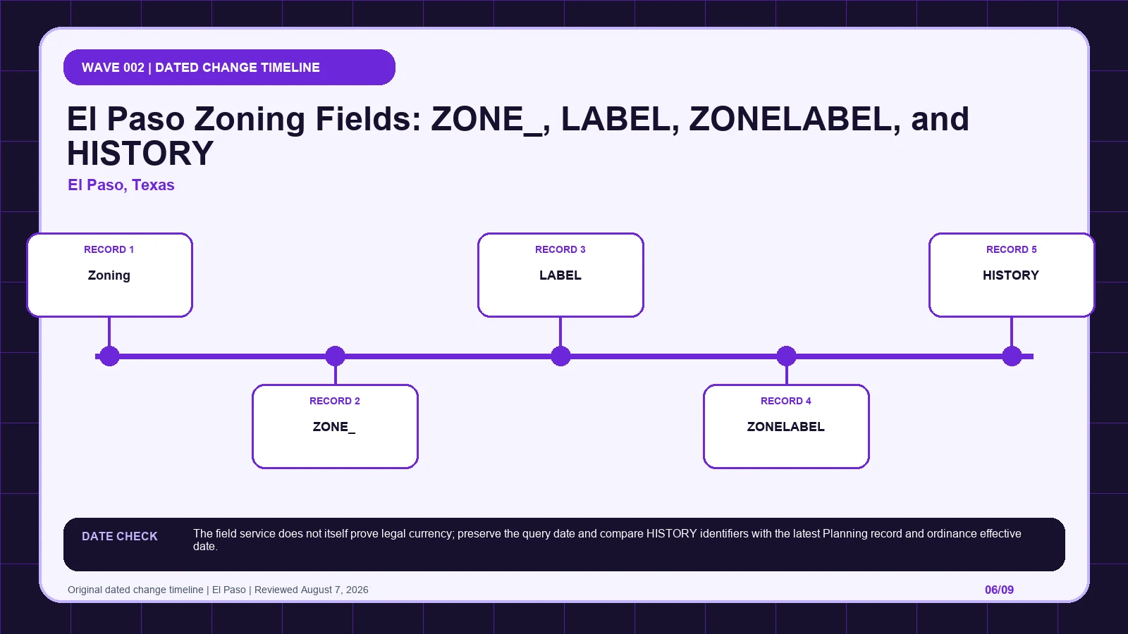
El Paso Zoning Fields: ZONE_, LABEL, ZONELABEL, and HISTORY
August 6, 2026 by Zoning Lookup Guide
El Paso zoning layer diagram separating Zoning (layer 0), ZONE_, LABEL, ZONELABEL, HISTORY before code verification

Preserve El Paso’s ZONE_, LABEL, ZONELABEL, HISTORY, and SC suffix separately, then trace the history identifier to the governing action.
Categories City Guides

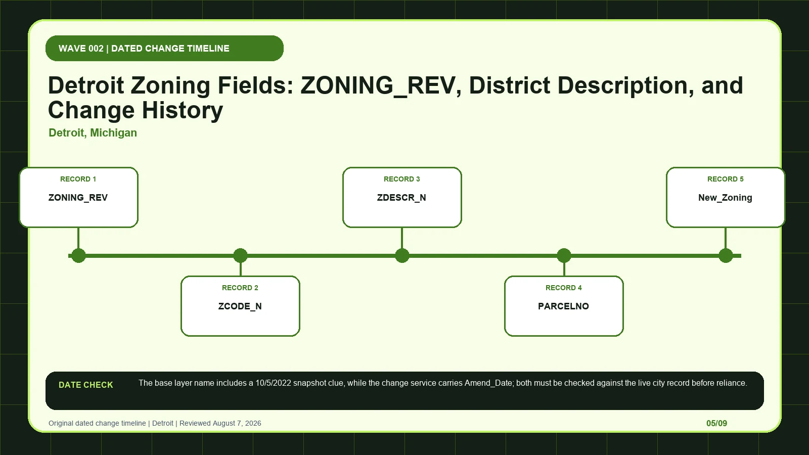
Detroit Zoning Fields: ZONING_REV, District Description, and Change History

August 6, 2026 by Zoning Lookup Guide
Detroit zoning layer diagram separating ZONING_REV, ZCODE_N, ZDESCR_N, PARCELNO, New_Zoning before code verification

Join Detroit’s base zoning row to the Zoning Changes service, parcel number, amendment date, and ordinance before reporting the current district.
Categories City Guides

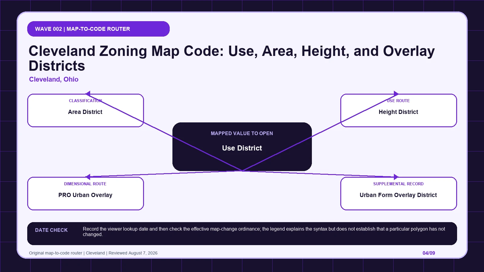
Cleveland Zoning Map Code: Use, Area, Height, and Overlay Districts

August 6, 2026 by Zoning Lookup Guide
Cleveland zoning layer diagram separating Use District, Area District, Height District, PRO Urban Overlay, Urban Form Overlay District before code verification

Split Cleveland’s compact map symbol into use, area, height, and overlay records, then confirm the selected polygon through the effective ordinance.
Categories City Guides

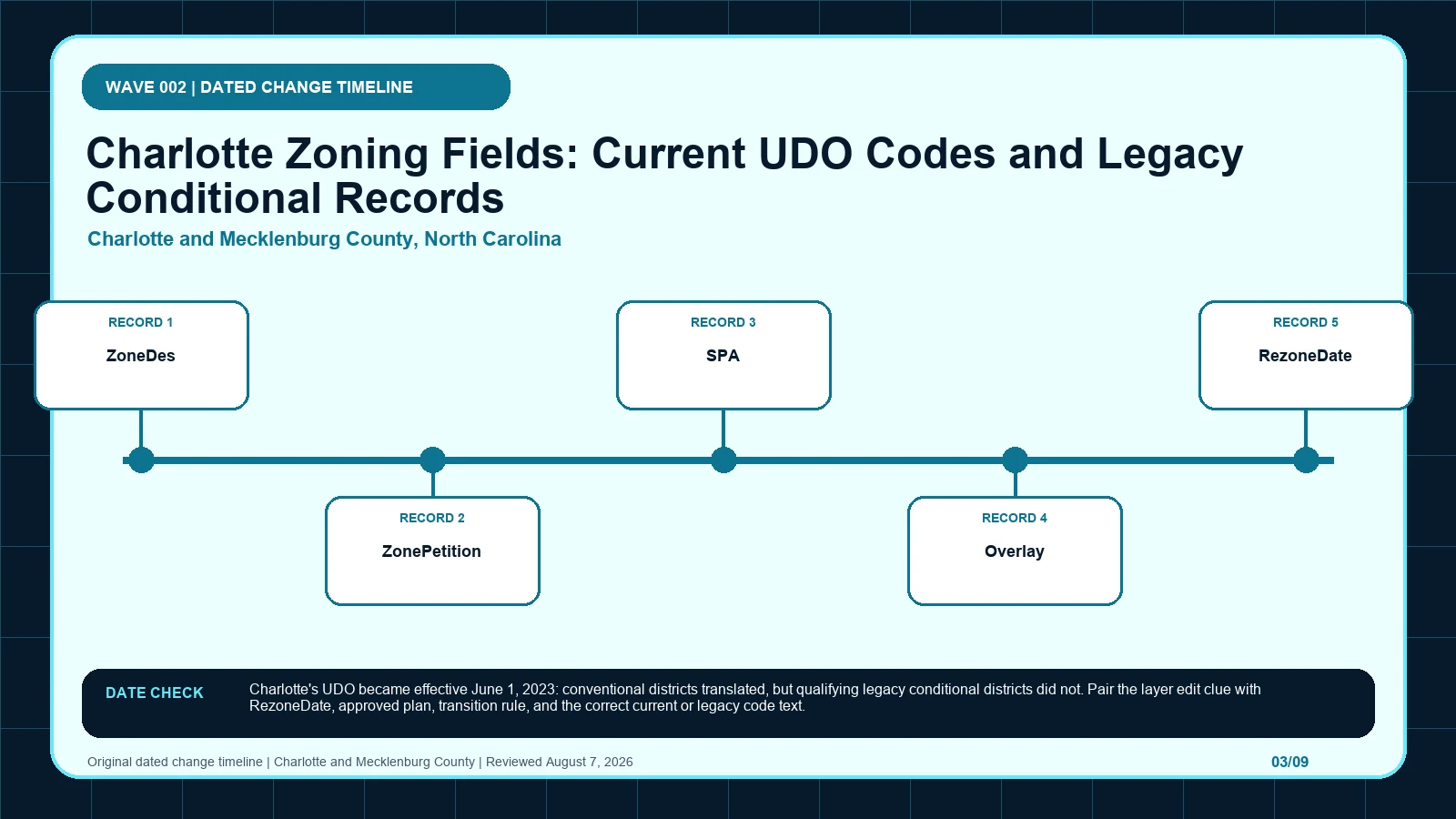
Charlotte Zoning Fields: Current UDO Codes and Legacy Conditional Records

August 6, 2026 by Zoning Lookup Guide
Charlotte and Mecklenburg County zoning layer diagram separating ZoneDes, ZonePetition, SPA, Overlay, RezoneDate before code verification

Read Charlotte’s POLARIS fields through the June 2023 UDO transition, preserving legacy petitions and approved plans before choosing the current code.
Categories City Guides

Boston Zoning Viewer Records: Parcel ID, Subdistrict, PDA, and Overlays

August 6, 2026 by Zoning Lookup Guide
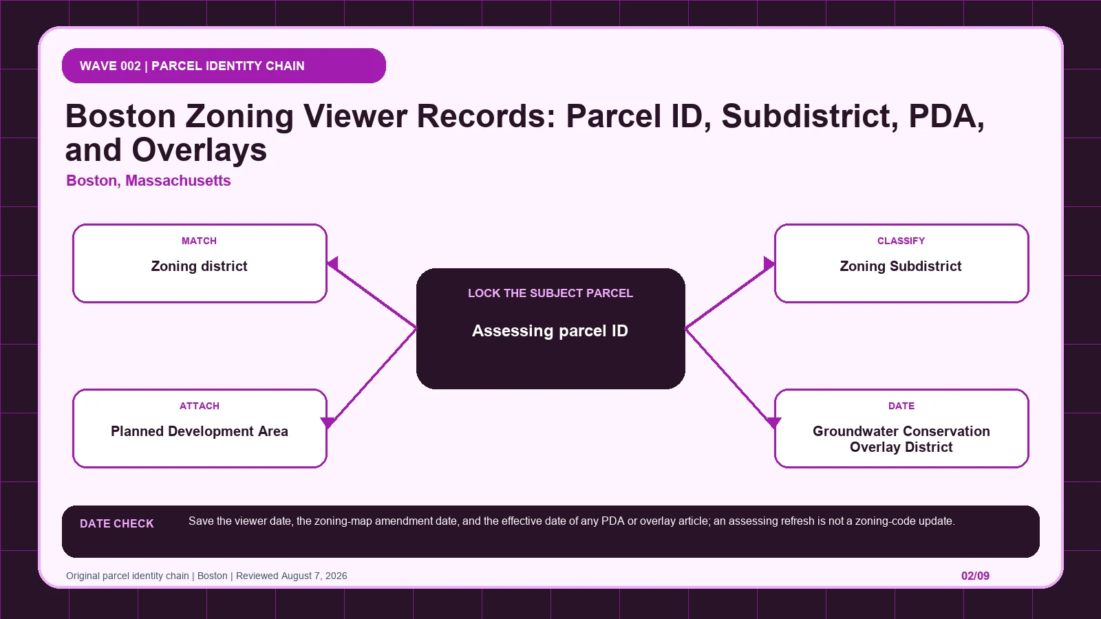
Boston zoning layer diagram separating Assessing parcel ID, Zoning district, Zoning Subdistrict, Planned Development Area (PDA), Groundwater Conservation Overlay District (GCOD) before code verification

Match the Boston Zoning Viewer result to the assessing parcel, then open the subdistrict, PDA, GCOD, or CFROD article returned for that land.
Categories City Guides

Atlanta Land Use Planning Layers: District, Overlay, Inclusionary Zoning, and Map Index

August 6, 2026 by Zoning Lookup Guide
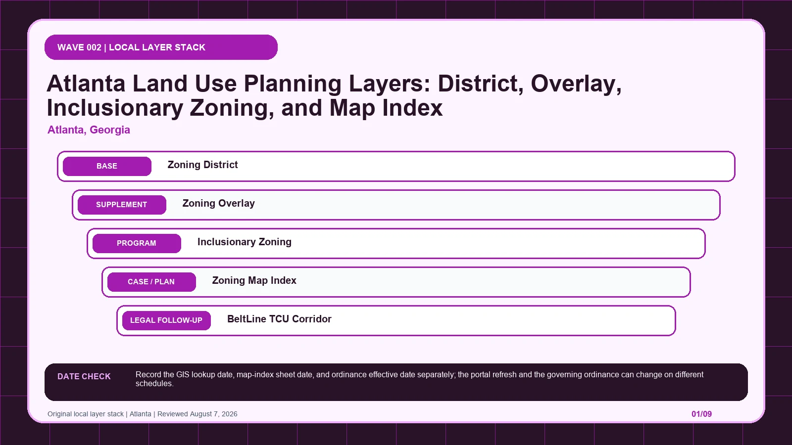
Atlanta zoning layer diagram separating Zoning District (layer 0), Zoning Overlay (layer 1), Inclusionary Zoning (layer 2), Zoning Map Index (layer 3), BeltLine TCU Corridor (layer 4) before code verification

Use Atlanta’s LandUsePlanning stack to separate the base district, overlays, map sheet, and rezoning history before opening the controlling ordinance.
Categories City Guides

Washington DC Zoning Map Fields: Zone, Overlay, Cases, and Pending Layers

August 6, 2026 by Zoning Lookup Guide
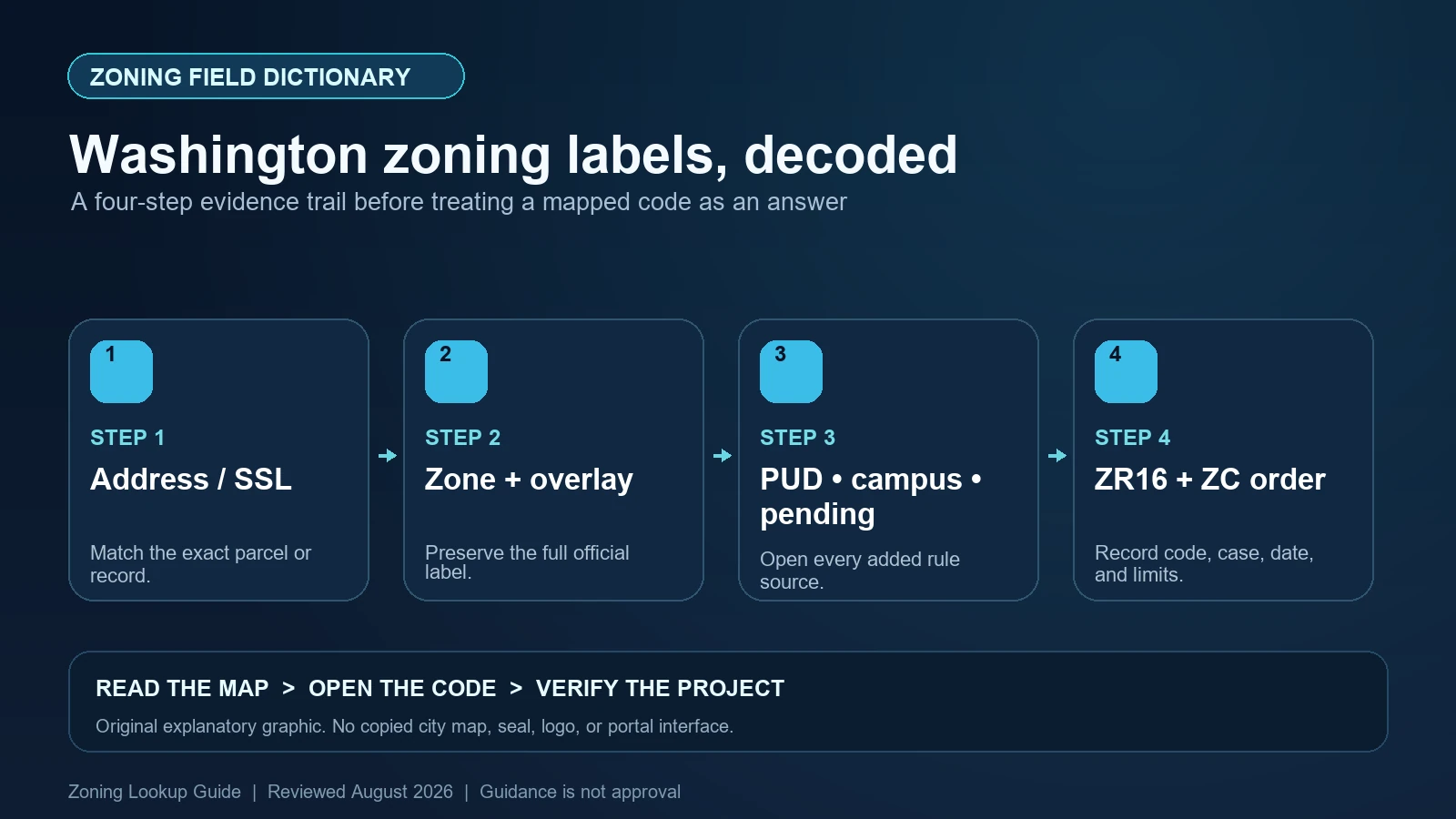
Washington DC zoning diagram linking Square-Suffix-Lot identity to zone and overlay notation, PUD and pending layers, and ZR16 text

Read Washington DC’s zone and overlay notation under ZR16, preserve Square-Suffix-Lot identity, and separate active PUDs, pending zones, campus plans, and map amendments.
Categories City Guides

San Diego Zoning Map Fields: Decode the Base Zone and Overlay Stack

August 6, 2026 by Zoning Lookup Guide
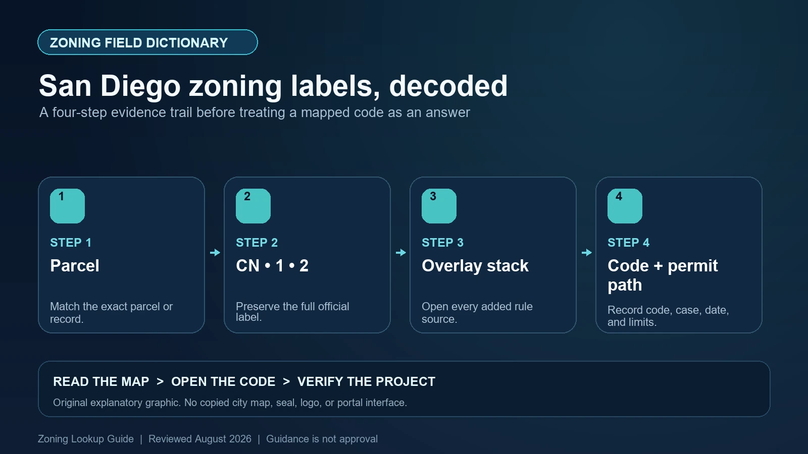
San Diego zoning diagram breaking CN-1-2 into zone type, category, use package, and development package before adding overlays

Decode San Diego base-zone designators such as CN-1-2, preserve ZONE_NAME, and check every coastal, airport, parking, transit, and community-plan overlay separately.
Categories City Guides

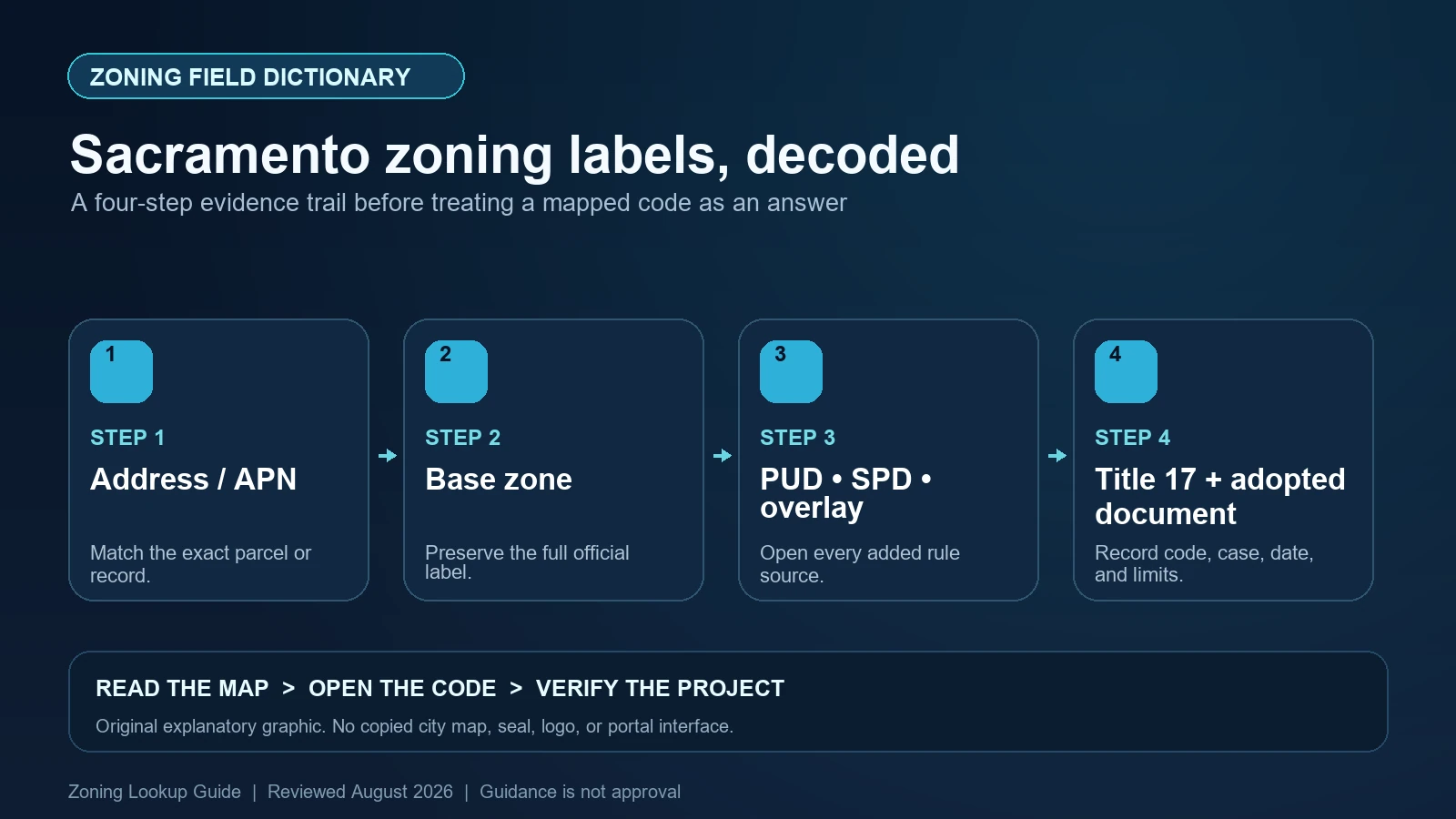
Sacramento Zoning Map Fields: Base Zone, PUD, SPD, and Overlay Codes

August 6, 2026 by Zoning Lookup Guide
Sacramento LILA diagram separating base zone, PUD or SPD suffix, General Plan designation, and design review fields

Read Sacramento LILA zoning strings, separate PUD, SPD, and overlay suffixes from the base zone, and keep General Plan and design-review fields in their proper roles.
Categories City Guides

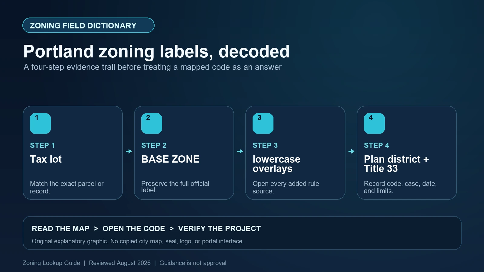
Portland Zoning Map Symbols: Base Zones, Lowercase Overlays, and Plan Districts

August 6, 2026 by Zoning Lookup Guide
Portland zoning symbol diagram separating capital-letter base zones, lowercase overlays, parenthetical plan designations, and plan districts

Decode Portland map symbols such as R5s, distinguish zoning from a parenthetical Comprehensive Plan designation, and add every plan or historic district.

Categories City Guides
Older posts
Newer posts
← Previous Page1 … Page3 Page4 Page5 … Page11 Next →

Recent Posts

  • What Zoning Allows RV Living?
  • What Zoning Allows Manufactured or Mobile Homes?
  • Raleigh iMAPS Zoning Records: Base District, Frontage, Height, Overlay, and Parcel
  • Fairfax County Zoning Fields: Zone Code, Proffer, Type, Public Land, Jurisdiction, and Cluster
  • Colorado Springs Zoning Lookup Records: Address, Tax Schedule, Zone District, Use, and Dimensional Standards

Recent Comments

No comments to show.
© 2026 Zoning Lookup Guide • Built with GeneratePress