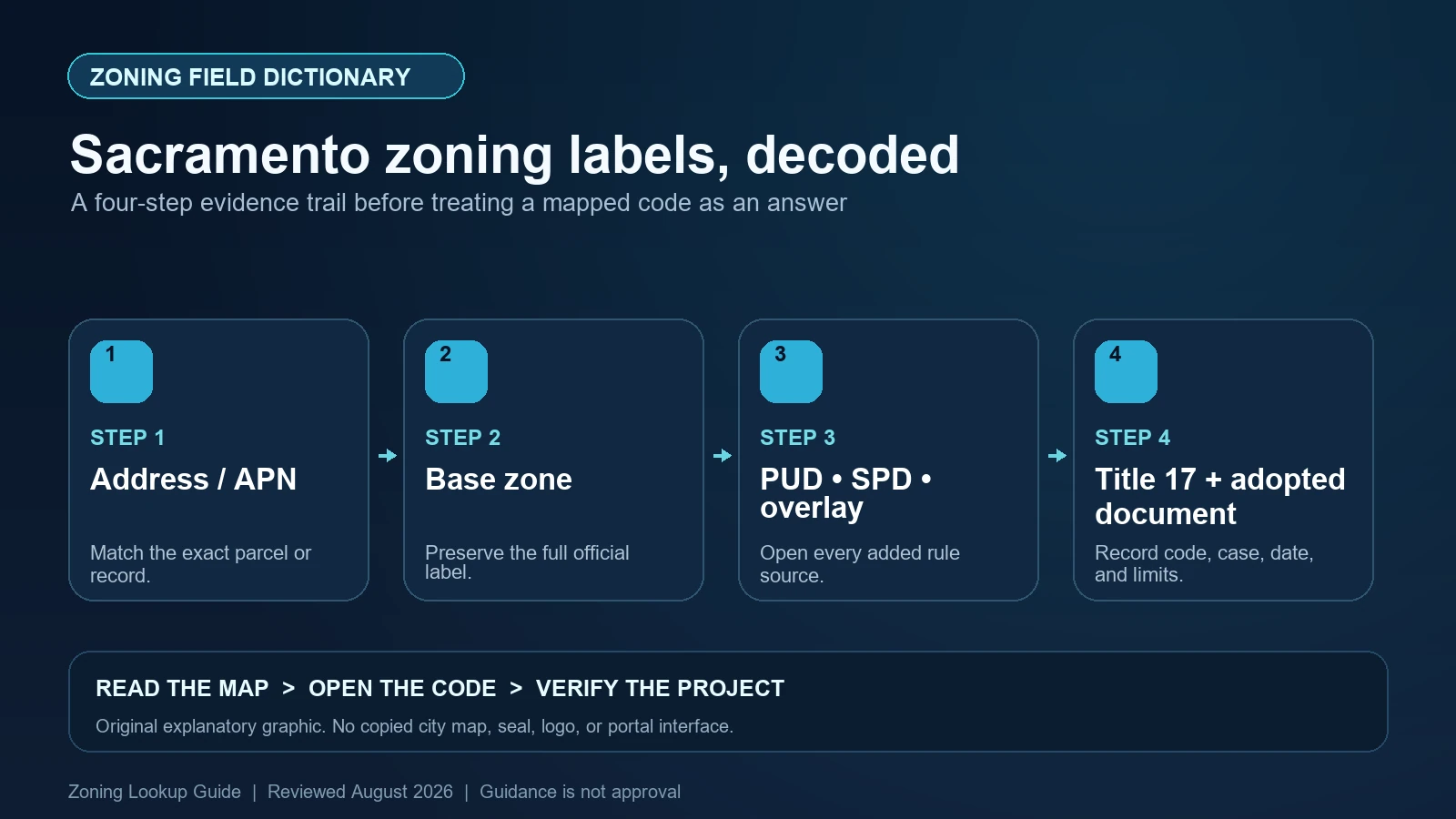
Sacramento’s Land Information Lookup Application (LILA) can return a zoning designation in which a base zone is followed by an added acronym. The City gives examples such as C-2-PUD, C-2-SPD, and C-2-TO. Read C-2 as the base zone and preserve PUD, SPD, or TO as a separate control that requires its own guideline, ordinance, or overlay provision. Do not cut the result at the first hyphen.
Last checked: August 7, 2026.
LILA also reports planning context such as the General Plan designation, Design Review Area, Council District, and historic-district information. Those fields help locate additional standards or responsible reviewers, but they are not alternate names for current zoning. The City’s GIS tools page says LILA can search by address or assessor’s parcel number and connect users to site-specific regulations and documents. Use those links before interpreting the acronym stack.
Use the APN to confirm the Sacramento parcel
Search the street address, then repeat or confirm with the assessor’s parcel number (APN). Save the selected polygon, City limit, APN, normalized address, and every parcel in the project area. A mailing address can point to the wrong jurisdiction or to only one part of a multi-parcel development. Sacramento County and the City of Sacramento maintain different land-use authorities, so a City postal label is not enough.
If the parcel appears split between designations or an overlay follows an irregular boundary, zoom in and preserve the map evidence. Do not estimate a legal line from the screen. Use a survey or legal description and ask the Planning Division which part of the project is subject to which rule. The GIS result is a research index, not a boundary survey or zoning verification letter.
Parse the base zone before opening added controls
The base portion routes the reader to Title 17, Division II, where Sacramento organizes zoning districts and land-use regulations. Preserve every letter, number, decimal, and hyphen. A residential, commercial, employment, industrial, public, or other district name provides orientation, but the code’s use tables, development standards, definitions, and exceptions determine how a precise proposal is reviewed.
The City’s zoning page explains that property location and proposed use determine the applicable standards and links both the Planning and Development Code and LILA. Write the proposed activity in code-relevant facts—dwelling count, business operations, floor area, height, setbacks, parking, access, and construction—before deciding that the base-zone description answers it.
| LILA result | What it means for research | What it does not prove |
|---|---|---|
| Address / APN | The property key and polygon selected for the lookup | A surveyed boundary or City jurisdiction by itself |
| Base zoning code | The Title 17 district to research first | Permission for the exact use, design, or occupancy |
| -PUD | A Planned Unit Development guideline or approval package may add controls | That every base standard remains unchanged |
| -SPD | A Special Planning District ordinance and subarea may apply | A generic citywide overlay with one standard |
| -TO or other overlay | A named overlay provision supplements the base zone | That the acronym’s effect can be guessed from its name |
| General Plan designation | Long-range policy and density or FAR framework | A second current zoning district |
| Design Review Area / Historic District | An added design or preservation review path | Approval of the proposed exterior work |
PUD guidelines are property or area records, not a generic suffix definition
A PUD suffix points to Planned Unit Development materials that may contain development guidelines, schematic plans, permitted-use variations, setbacks, circulation rules, or design requirements tailored to the project area. Record the PUD name, parcel coverage, adopting action, guideline version, exhibits, and amendments. A PUD on a neighboring tract does not control the subject parcel merely because the names are similar.
Compare the PUD document with current Title 17 and the specific proposal. Determine which provisions supplement or modify the base zone and which Citywide rules still apply. If LILA identifies a PUD but does not provide a complete document trail, contact Planning with the APN and PUD name. Do not assume the base-zone table is complete, and do not assume a decades-old plan authorizes a modern use not evaluated in the approval.
SPD and overlay fields require the named district text
A Special Planning District is an area with regulations adopted for its particular conditions. The added SPD acronym is a prompt to find the district name, subarea, ordinance chapter, maps, and amendments. Two SPDs can use entirely different standards. Report ‘SPD applies’ only as an intermediate fact; the useful conclusion identifies the relevant section and what part of the proposed use or form it changes.
Other overlay acronyms require the same discipline. Sacramento materials describe overlays as supplementary controls that address specific geographic, environmental, economic, or social conditions. The Transit Overlay is not interchangeable with an airport, flood, review, or other overlay. Keep each named layer, boundary, and code source in its own row and determine whether several layers overlap the project.
General Plan, design review, and historic fields answer different questions
LILA can show a General Plan designation and, according to City guidance, information such as minimum residential density and maximum floor-area ratio. That designation guides long-range land-use policy and zoning consistency, but it is not the parcel’s current zoning code. Save its map and policy references separately. A future consistency update or amendment also remains separate until legally adopted and effective.
Design Review Area and historic-district results identify other review paths. The City’s zoning FAQ notes that LILA can show whether a property is in a historic district, while individual historic landmarks may require checking the preservation register rather than relying only on the GIS map. A design or historic hit does not prohibit all work, and a blank layer does not prove the absence of every listed resource. Confirm the current designation and the scope of the proposed exterior change.
| Finding | Document to retrieve | Decision still required |
|---|---|---|
| Base zone only | Title 17 district, use table, and development standards | Whether the detailed proposal complies |
| PUD suffix | PUD guidelines, adopting action, exhibits, amendments, parcel coverage | Which customized provisions remain applicable |
| SPD suffix | Named SPD chapter, subarea map, and later amendments | How district-specific rules alter the base zone |
| Overlay suffix | Overlay code section and mapped boundary | Which supplemental standard or review is triggered |
| General Plan designation | 2040 General Plan map and policy provisions | Whether a zoning change will occur or be approved |
| Design / historic result | Applicable guidelines, designation, and review process | Whether the proposed work receives approval |
Read the current use and development rules after the field stack is complete
Once every code and boundary is captured, classify the proposed use under Title 17. Check whether the use is permitted, conditionally permitted, prohibited, or subject to special operational standards. Continue through density, floor-area ratio, height, setbacks, lot coverage, parking, loading, landscaping, signage, and design review. Apply PUD, SPD, and overlay modifications only from the adopted text that covers the parcel.
Existing buildings, assessor descriptions, and nearby activities are not substitutes for that analysis. A site can contain a lawful nonconforming use, prior entitlement, variance, or condition not visible in the zoning string. Search Planning records and AgencyCounter for relevant cases, then compare the approved plans and conditions with the current proposal. A change in operator, use, floor area, or site layout can matter.
Escalate incomplete Sacramento map results
The City’s zoning FAQ directs property-specific questions involving an SPD, Overlay Zone, or PUD to Planning. Use that route when the added document is unavailable, the parcel lies on a boundary, the City and County jurisdiction is unclear, or map and code dates do not align. Give staff the APN, exact LILA fields, proposed use, and missing record so the question is narrow and reproducible.
Do not describe a GIS lookup as a permit or entitlement. For a transaction, lease, lender, or formal filing, request the appropriate City confirmation or qualified local review. Sacramento states that its Planning Division can provide a letter confirming current zoning and General Plan designations, but the scope of a letter should still be checked against the decision that depends on it.
- Stop if the address is being treated as proof that the parcel lies in City rather than County jurisdiction.
- Stop if PUD, SPD, or an overlay suffix appears but the named adopted document and mapped subarea are missing.
- Stop if a General Plan designation is being presented as a second current zoning district.
- Stop if an existing use, historic structure, or old entitlement is assumed transferable without its case file and conditions.
Maintain a Sacramento parcel control sheet
The sheet should list the address, APN, City jurisdiction, selected polygon, complete zoning string, isolated base zone, PUD/SPD/overlay name and document, General Plan designation, design-review and historic fields, planning cases, Title 17 sections, effective dates, and project facts. Distinguish LILA evidence, adopted law, approval records, and your interpretation. That prevents a convenient map summary from becoming an unsupported legal conclusion.
Use the site’s Sacramento LILA lookup guide for parcel selection, the zoning code versus map guide for Title 17, and the PUD, SPD, and overlay worksheet for added controls. Sacramento’s Planning Division and adopted records remain authoritative.
Official Sacramento records used for this field dictionary
The working evidence set for this Sacramento field dictionary is the Sacramento official planning and zoning guidance (1), Sacramento official planning and zoning guidance (2), Sacramento official lookup guidance (3), and Sacramento official lookup guidance (4). Each source answers a different part of the lookup. The Sacramento map locates the record, the municipal layer or dataset exposes fields, and the applicable code or agency guidance controls interpretation. Save each Sacramento URL and the date checked instead of treating a search-result snippet as the source.
Questions to resolve before relying on the zoning label
What does C-2-SPD mean in Sacramento?
C-2 is the base zone and SPD signals a Special Planning District. Identify the specific SPD, subarea, adopted chapter, and amendments before deciding how it changes the base rules.
Is a General Plan designation another zoning district?
No. Preserve it as a separate long-range planning field. Current zoning changes only through the applicable legal process.
Why should I search by APN?
The APN ties the lookup to the parcel polygon and helps avoid relying on an address point or a similarly named location. Multi-parcel projects still require checking every APN.
Can LILA confirm that my Sacramento project is approved?
No. It routes users to applicable designations and documents. The project still needs code analysis and any required planning, design, historic, building, or other approval.
Sacramento’s LILA fields, Title 17, PUD guidelines, SPD chapters, overlays, and General Plan materials may change on separate schedules. Reopen every named document and confirm parcel coverage before reliance. This guide was reviewed August 7, 2026.