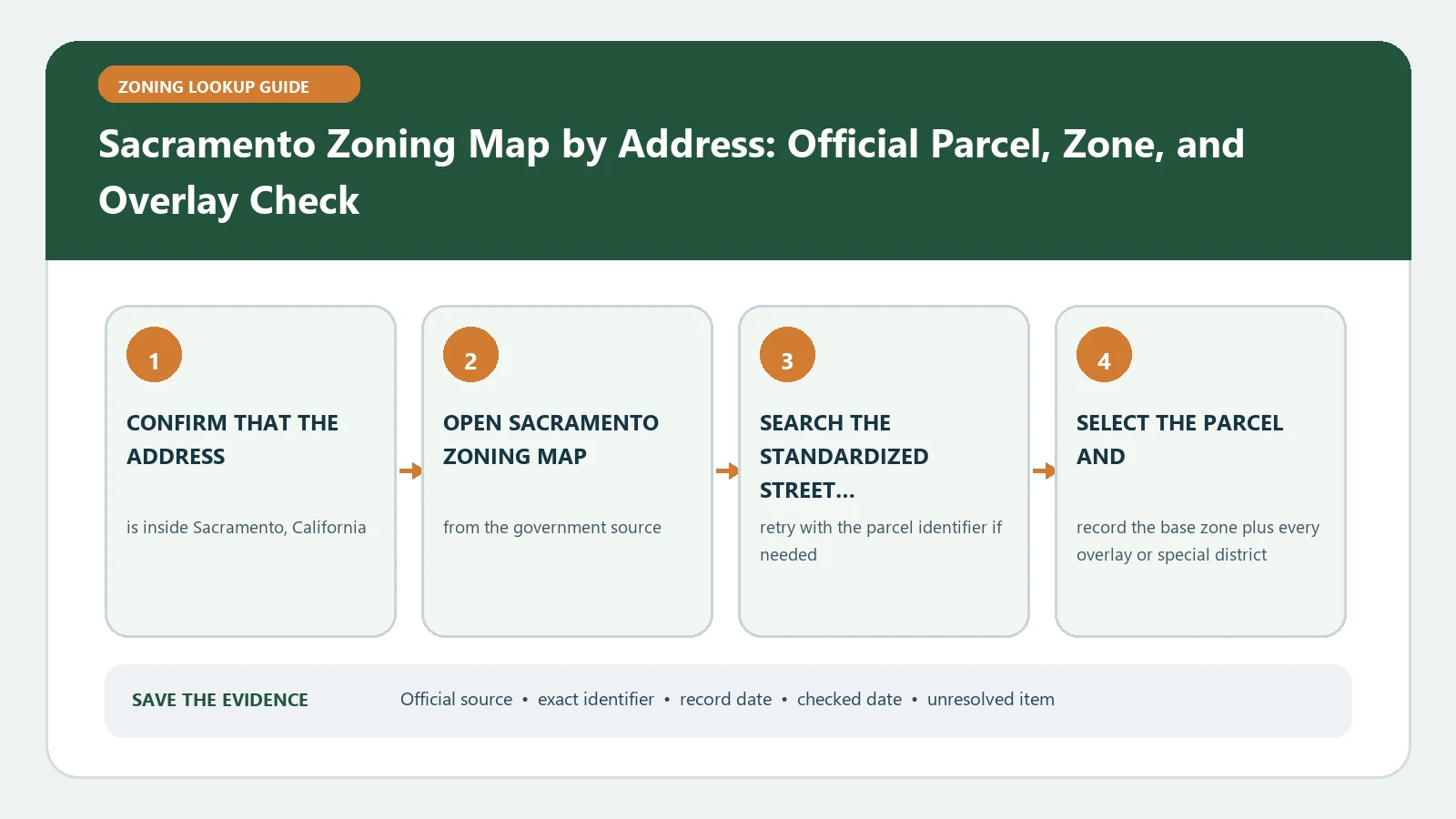
For a Sacramento zoning map check, first verify that the parcel is inside the City of Sacramento, then search the address or assessor parcel number in the City GIS Land Information Lookup Application route. Save the returned zoning and document links, and use the Planning Division zoning page to follow the applicable code and entitlement path. A lookup is research evidence, not a planning approval.
Sacramento presents an easy jurisdiction trap because a Sacramento mailing address may belong to the unincorporated County or another city. LILA is designed for City land information and accepts an address or APN. Establishing that boundary before reading a zone prevents a perfectly valid County record from being attached to a City permit question, or the reverse.
Choose the City branch before entering an APN
Start with the site address and APN from a current property document. Confirm that the map identifies the property within the City boundary and that the highlighted parcel shape matches the lot under review. When a project covers adjoining parcels, enter each APN and keep separate result rows. A shared street address, ownership name, or development name does not merge the zoning histories of those parcels.
If the location is outside the City, stop this workflow and use the authority named for that parcel. Do not borrow a nearby City zoning label simply because its map polygon is visually close. Keep a note of the jurisdiction finding; it explains why the next source changed and protects later reviewers from returning to the wrong portal.
Use LILA as a document router, not just a color map
The City describes LILA as a way to look up land-use regulations by address or APN and connect to specific regulations and documents for site research. After selecting the parcel, capture the exact zoning designation, planning area or special context shown, and every document link that appears relevant. Open those links in the same session so a short field label is not mistaken for the full rule.
- Save the query, matched APN, normalized site address, and selected parcel outline.
- Transcribe the zone code without expanding abbreviations from memory.
- Open linked regulations, plans, or site-area documents and preserve their titles and dates.
- Note any layer that appears to add review beyond the base zoning district.
- Write down the map access date and the date of each controlling document separately.
Translate the zoning result into one proposed activity
A district code becomes useful only after it is paired with a defined proposal. Describe what will occupy the site, whether the work changes a building or only its use, the number of units or tenants, outdoor activity, operating characteristics, parking demand, and any subdivision. Then consult the City zoning materials for the specific use and standards. This avoids an overbroad statement such as commercial zoning allows any business.
The LILA result does not prove entitlement, code compliance, or permit readiness for a Sacramento project. It identifies a parcel and routes the researcher to regulations and documents; Planning review and other official records may still control the actual proposal.
Separate three possible outcomes in your notes: the use appears allowed by the base code, the use requires discretionary or conditional review, or the classification remains unresolved. Even the first outcome can leave design review, setbacks, height, parking, preservation, environmental, or building-permit questions. The map should route those checks, not erase them.
Make a source-to-decision worksheet
| Question | Official evidence to keep | Decision boundary |
|---|---|---|
| Which property? | Address, APN, City boundary, and selected geometry | A nearby parcel cannot substitute |
| Which district? | Exact zoning code and LILA access date | The code is not a project approval |
| Which added rules? | Linked plan, overlay, special area, or entitlement record | Read the document instead of relying on its label |
| Which activity? | Plain description plus the City use classification consulted | A different operation needs a new screen |
| Which next review? | Named application, staff route, or unresolved question | Research does not create vested rights |
Check site documents before treating the base zone as final
A parcel can be affected by an adopted plan, prior entitlement, design review condition, or project record that is not apparent from the broad zone name. Follow the site-specific links exposed by LILA and compare the legal description or APN. If a document covers a larger area, locate the subject parcel within its map or exhibit. If it covers only part of the site, mark the boundary instead of extending its rule to the whole tract.
Also keep current zoning distinct from the General Plan designation. They answer related but different questions. A long-range land-use category does not silently replace the parcel zoning, and an apparent policy inconsistency does not resolve itself through a map note. Record both only when the proposal actually requires both checks.
When the City map has a missing or stale-looking result
For an empty address search, retry with the APN. For an empty APN search, verify digits against a current assessor document and browse to the parcel. New subdivisions, annexations, and recent address assignments can create timing gaps. Save the failed input, selected location, and date. If the map identifies another jurisdiction, treat that as a routing result rather than a failure.
If a linked document and the displayed zone conflict, preserve both sources and their effective dates. Ask Sacramento Planning which adopted action controls the parcel and whether LILA has incorporated it. Do not edit the zone code in your worksheet to make the records agree; the discrepancy is the item that needs an official answer.
Close the lookup with a dated evidence bundle
Name the folder with the property and checked date. Include the City-boundary finding, address and APN, map capture, zoning value, linked documents, project description, and unanswered question. Reopen the source near any purchase, design milestone, or application. A clean bundle lets the next reviewer reproduce the search without being forced to trust a conclusion written before the project details were settled.
The Sacramento field dictionary helps interpret local map labels. Use the overlay and special-district check when LILA exposes an added layer, and consult the code and map comparison when two official records appear to serve different roles.
Sacramento source paths were reviewed August 26, 2026. Recheck LILA, linked documents, and the Planning Division page before acting because parcel data, entitlements, and zoning regulations can be revised.