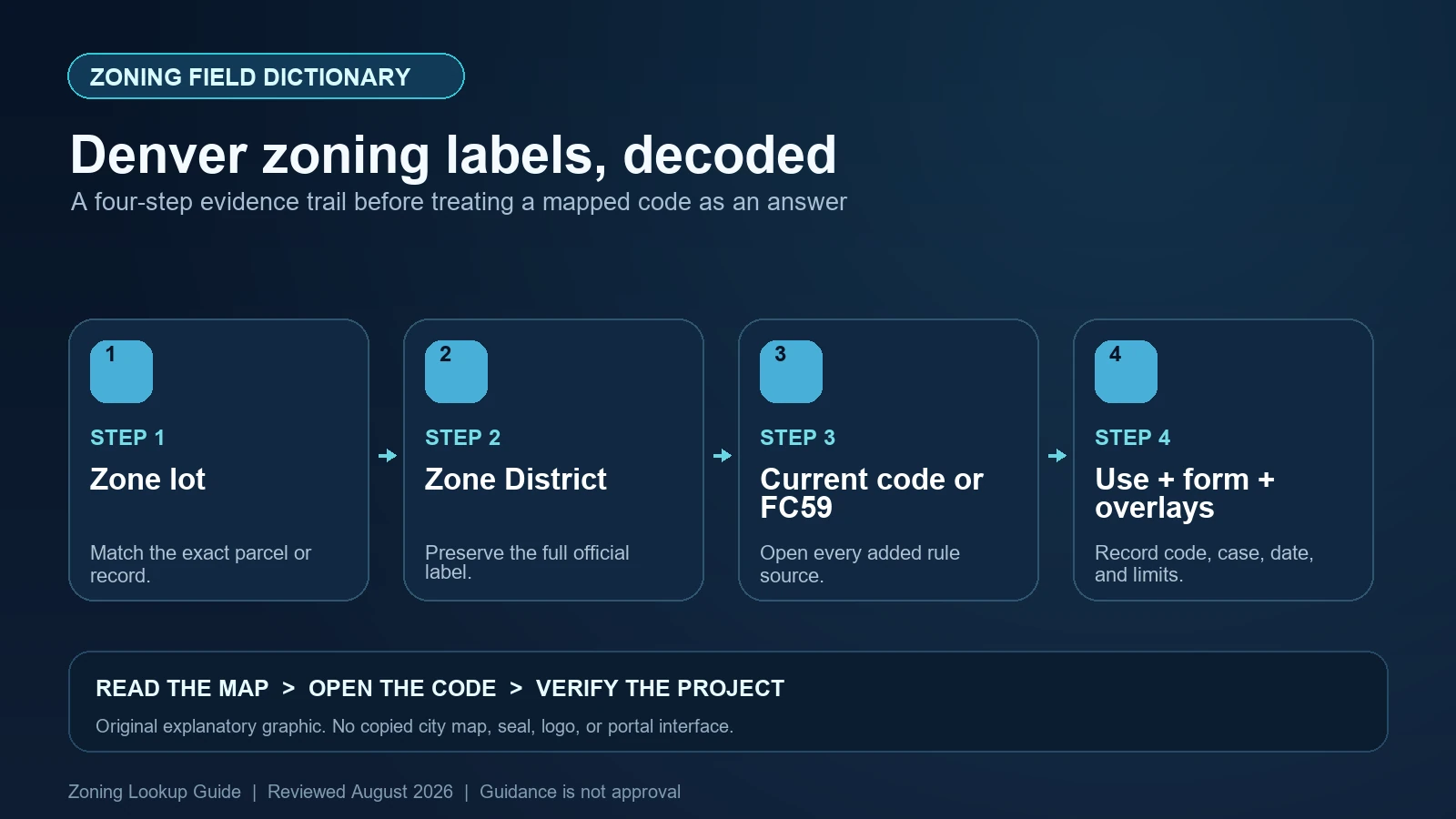
A Denver map result must answer two questions before it can guide code research: what is the complete Zone District, and is the property governed by the Denver Zoning Code or a district retained from Former Chapter 59? For a current-code district, also record the displayed Neighborhood Context and every overlay or special notation. For a Former Chapter 59 property, use the old district text and property-specific records rather than translating the label into a modern district that merely looks similar.
Last checked: August 7, 2026.
Start with Denver’s official zoning map. City instructions for map-based code research tell users to note Zone District, expand the result, note Neighborhood Context, and follow the link either to the Denver Zoning Code or Former Chapter 59. The map identifies the regulatory route. It does not decide a zone-lot boundary dispute, classify an unusual use, approve a structure, or replace a zoning permit.
Confirm the zone lot as well as the assessor parcel
Denver uses the term zone lot for the land designated as the site for a structure or use under its zoning codes. The City’s code resources caution that a zone lot may differ from a subdivision lot and block or an assessor’s tax parcel. That distinction can affect setbacks, building form, coverage, and other measurements. A tax parcel search is therefore a navigation aid, not automatic proof of the regulatory lot being evaluated.
Select the property, preserve the address and parcel data shown, and look for records establishing the zone lot when the project depends on lot lines or dimensions. If several tax parcels operate as one site—or one tax parcel contains more than one zoning polygon—do not force the map into a single-row answer. Document each area and request the applicable zoning research or determination before design money is committed.
Read a current Denver zone code by components, not by resemblance
Many Denver Zoning Code districts encode a neighborhood context, a building-form or use family, and an intensity component. Familiar examples include forms such as U-SU-C, G-MU-3, or C-MS-5, but not every special district follows one simple grammar. Record the exact hyphens, letters, numbers, plus signs, and overlay suffixes. Then use the Neighborhood Context field and the City’s link to open the correct code article.
The context helps route the reader: suburban, urban edge, urban, general urban, urban center, downtown, and special contexts are organized in different articles. The middle and trailing components must be interpreted from that article’s district description, building-form standards, and use tables. A trailing number often relates to an intensity such as maximum stories in the relevant family, but it should never be decoded from memory when the live code is available. Special-purpose and campus districts need their own definitions.
| Displayed item | What to preserve | Next source |
|---|---|---|
| Zone District | The complete code with all punctuation and modifiers | The linked Denver Zoning Code article or Former Chapter 59 text |
| Neighborhood Context | The context named in the expanded result | The article containing that context’s district and form standards |
| Code-family link | Whether the map routes to current code or Former Chapter 59 | Do not substitute the other code family |
| Overlay district | Exact overlay name/code and mapped boundary | Denver Zoning Code Article 9 and any adopted rules |
| Zone-lot evidence | Regulatory lot boundary and supporting records | Zoning records rather than assessor geometry alone |
| Map amendment or PUD | Case, ordinance, plans, conditions, and effective date | Property-specific approved materials |
Former Chapter 59 is a different code path, not a warning badge
Denver adopted a new zoning code in 2010, but not every property was remapped. The City’s regulations and code page explains that properties with site-specific zoning, PUDs, waivers, conditions, or planned building groups remained under Former Chapter 59. A result such as an older R, B, C-MU, or PUD designation must be researched in that retained system and its associated documents.
Do not convert an old R-1 or B-8-G label to a modern district because the names or land uses seem comparable. The official Former Chapter 59 district regulations enumerate the older districts and adopt the official map for them. Later City legislation can also apply selected current-code requirements to retained land. Read the current municipal cross-references and ask CPD when the interaction is unclear.
An overlay can modify the district but may depend on the underlying code
Denver’s overlay districts add location-specific standards. Save the overlay code and open Article 9 plus any adopted rules or design standards. Do not treat the overlay as decorative context. At the same time, do not assume it operates identically over every underlying district. The code can specify how an overlay applies to current-code land and whether a retained Former Chapter 59 property must first be rezoned for a particular provision to take effect.
Design-review areas, landmark districts, view planes, parkway setbacks, and site-development plans may also matter without appearing as part of the basic Zone District string. The City’s general regulations page explicitly describes several of these independent systems. Inspect the project location against the relevant map and keep each authority in a separate row. A modern base zone that appears to allow the building envelope does not waive landmark review, a view-plane limit, or a recorded site plan.
Move from district name to the exact use and building form
Describe the proposed operation with enough detail to select the zoning-defined use: primary and accessory activities, indoor and outdoor areas, hours, alcohol or food service, vehicle activity, floor area, dwelling count, and any change of use. Then read the use table in the article identified by the map. A business license label or everyday term can span several zoning use categories, each with different review or separation requirements.
For construction, identify the permitted building forms and the standards for the chosen form. Check primary and side-street setbacks, height, story rules, bulk planes, transparency or entrance rules where applicable, parking, vehicle access, and accessory structures. A district code does not promise that every form is available, and an allowed use does not guarantee the proposed building form fits. Former Chapter 59 parcels may also depend on waivers, conditions, PBGs, or PUD plans not summarized by the map label.
| Situation | Controlling research path | Do not conclude |
|---|---|---|
| Current-code district | Mapped code, Neighborhood Context article, use table, building-form standards | The code alone is a permit |
| Former Chapter 59 district | Former district text plus waivers, conditions, PUD/PBG or other site record | A similar modern district applies |
| Overlay over current code | Underlying district plus Article 9 overlay and adopted rules | Only the more visible map label matters |
| Overlay over retained district | Overlay applicability clause and CPD confirmation | Every overlay provision applies in exactly the same way |
| Unclear zone lot | Zoning records, survey/legal documents, and City determination | The assessor parcel is necessarily the zone lot |
| Pending map amendment | Case file, City Council ordinance, effective date, and updated map | The requested district is current |
Watch for a map update that outruns—or trails—the legal record
A rezoning case passes through application, review, hearings, ordinance adoption, effectiveness, and map maintenance. Those dates are not interchangeable. If a case page shows a proposed change, keep it separate from current zoning until the adopted action is effective and the responsible City source confirms the result. If the official map and enacted ordinance appear inconsistent, save both and ask CPD which record controls the immediate decision.
The same caution applies to old-code properties. A long-standing label can conceal site-specific attachments that are not obvious in the public map. Search the property and case history, not only the district index. For a purchase, lease, lender condition, entitlement strategy, or major design decision, request zoning research or qualified local review. The public map is excellent routing evidence but cannot promise that a particular proposal will receive a permit.
- Stop when a tax parcel is being used as the zone lot without supporting zoning records.
- Stop when a Former Chapter 59 label has been translated into a current Denver Zoning Code district by analogy.
- Stop when an overlay, PUD, waiver, condition, or site-development plan is visible but its adopted document has not been opened.
- Stop when a pending map amendment or map timestamp is being treated as the legal effective date.
Build a Denver code-routing record
Save the full address, assessor parcel, zone-lot evidence, complete Zone District, Neighborhood Context, code-family link, overlay fields, amendment or PUD number, ordinances, plans, waivers, conditions, effective dates, and proposed-use and building-form facts. Label each source as map data, adopted law, property-specific approval, or interpretation. That division makes it possible for a second reviewer to repeat the path without assuming that the map popup contained the whole answer.
The site’s Denver address guide handles the initial search. Use the map and code comparison to keep the current text tied to the correct district, and the overlay guide to document added controls. Denver CPD remains the source for project-specific confirmation.
Official Denver records used for this field dictionary
The working evidence set for this Denver field dictionary is the Denver official interactive zoning map (1), Denver official code or technical guidance (2), Denver official code or technical guidance (3), and Denver official code or technical guidance (4). Each source answers a different part of the lookup. The Denver map locates the record, the municipal layer or dataset exposes fields, and the applicable code or agency guidance controls interpretation. Save each Denver URL and the date checked instead of treating a search-result snippet as the source.
Questions to resolve before relying on the zoning label
What does Neighborhood Context add to a Denver zoning result?
It routes a current-code district to the article containing the applicable district, use, and building-form framework. Record it exactly rather than decoding the zone from a generic chart.
Is Former Chapter 59 obsolete?
No. Denver identifies retained properties that remain governed by that older zoning system, often with site-specific PUDs, waivers, conditions, or planned building groups. Use the old text and current cross-references.
Is a Denver tax parcel always the zone lot?
No. The City says a zone lot may differ from the assessor parcel and subdivision lot. Confirm the regulatory lot when boundaries or dimensions affect the project.
Does a map amendment application change the zone immediately?
No. Preserve the request and case status separately. Confirm an adopted, effective ordinance and the current official map before reporting the new district.
Denver’s map, current zoning code, Former Chapter 59 materials, overlays, and property-specific plans can change or be maintained separately. Reopen the map’s code-family link and every adopted record before reliance. This guide was reviewed August 7, 2026.