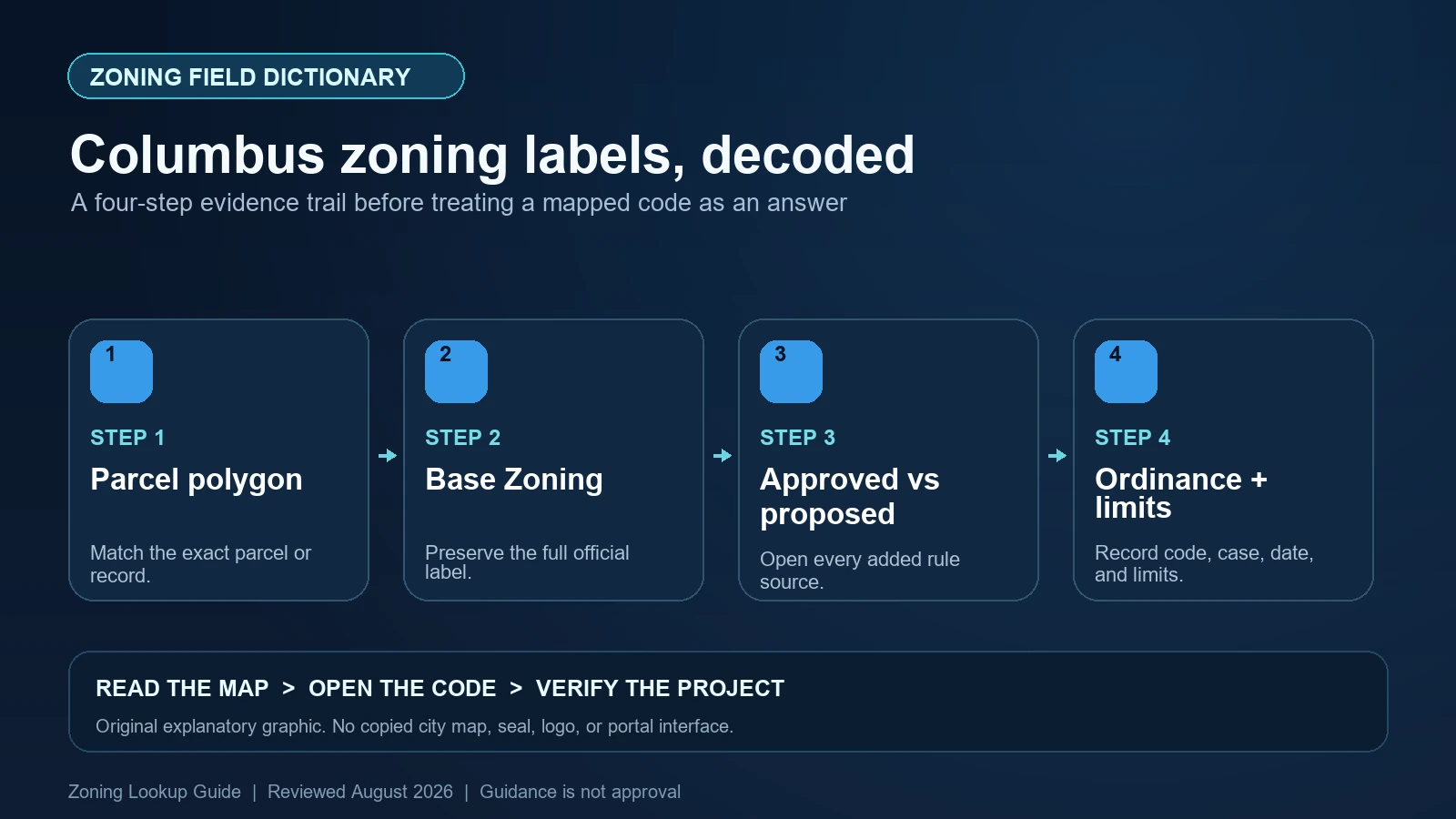
A Columbus zoning report is complete only when the base district is read beside approved variances and clearly separated from proposed cases. In the City’s Base Zoning layer, preserve CASE_NUMBER, EFFECTIVE_DATE, CLASSIFICATION, GENERAL_ZONING_CATEGORY, HEIGHT_DISTRICT, ZONING_STATUS, ORD_NO, and WEB_LINK. Then check the separate Council Variance, BZA Variance, commercial overlay, planning overlay, historic, and proposed-application layers that intersect the parcel.
Last checked: August 7, 2026.
The City provides a particularly useful zoning map instruction and layer-definition guide. It says an address search returns data intersecting the address point, while a parcel search returns information intersecting the parcel polygon. It also calls Base Zoning the official zoning layer but tells users to consult zoning staff before making binding decisions. Those two cautions determine how every field below should be read.
Choose parcel search when the whole site matters
The Online Zoning Map accepts an address, parcel ID, or owner name, but the geometry behind each search differs. An address result follows a point. A parcel result tests the polygon. If a long parcel reaches another district, variance, or overlay beyond the address point, a point-based report can miss it. Search the address to navigate, then repeat the lookup by parcel and click through every pop-up returned by the active layers.
Do not confuse the map’s courtesy reference layers with legal identity. The City notes that parcel data comes from the Franklin County Auditor and that an address shown in the zoning map is not a certified address for building purposes. Save the parcel identifier, selected outline, City corporate boundary, and project limits. When a project spans several parcels, create one row per parcel instead of averaging their results into a single zoning label.
The Base Zoning layer carries a case history, not just a color
The official Base Zoning feature layer uses CASE_NUMBER as its display field. Its label expression combines case number, effective date, classification, and height district. That is why a screenshot of fill color loses valuable evidence. Open the feature details and record the attributes, including the ordinance number and web link when available.
CLASSIFICATION is the district code. GENERAL_ZONING_CATEGORY is a broad renderer category such as Residential, Commercial, Mixed-Use, Manufacturing, or Neighborhood Center; it is not a substitute for the classification. HEIGHT_DISTRICT can carry an additional mapped component. ZONING_STATUS distinguishes values such as passed and proposed in the schema, but the map also publishes dedicated proposed layers. Confirm status, enacted ordinance, effective date, and the active layer before describing a case as current zoning.
| Official field | What it contributes | What still needs checking |
|---|---|---|
| CASE_NUMBER | The rezoning or mapped case identifier | Whether later actions amended the same property |
| EFFECTIVE_DATE | The date associated with the mapped action | The ordinance text and any conditions |
| CLASSIFICATION | The detailed zoning classification | The applicable use and development standards |
| GENERAL_ZONING_CATEGORY | A broad map-rendering family | The exact district; broad category is not enough |
| HEIGHT_DISTRICT | An additional height-district component where populated | How the current code and ordinance apply it |
| ORD_NO / WEB_LINK | The ordinance identifier and document route | Completeness, amendments, exhibits, and legal description |
Council Variance is a second polygon with a narrower legal job
A Council Variance is not a replacement name for the base district. Columbus describes it as a City Council-approved variance that may address use, yard, height, or parking requirements. In the related GIS service, fields include CASE_NUMBER, LIMITATION_TEXT, EFFECTIVE_DATE, and CLASSIFICATION. Record the variance case and its boundary, then open the ordinance through the pop-up’s More Info route or Legistar.
Read the ordinance for the exact relief, site plan, limitations, property description, and effective action. A use variance for one operation does not erase unrelated base-zone standards. A yard or height variance does not authorize a different use. Nor does the existence of an approved polygon show that all conditions have been satisfied. Tie each conclusion to the particular provision being tested and keep the base classification visible beside it.
Approved, proposed, BZA, and graphics layers must not be merged
The Columbus map exposes Proposed Graphics Variance, Proposed BZA Variance, Proposed Council Variance, and Proposed Base Zoning separately from the approved Graphics Variance, BZA Variance, Council Variance, and Base Zoning layers. The distinction is substantive. A pending application can show what someone requested; it does not change the current district or prove that the requested relief will be granted.
The decision-maker and scope also vary. The Board of Zoning Adjustment handles variances from zoning provisions other than use variances assigned to City Council, while graphics matters have their own commission. The City’s guide says the readily mapped approved variance series generally reaches back to about 2005 and directs older-record requests to the records office. A clean map after that date threshold is not proof that an older variance never existed.
Commercial, planning, historic, parking, and airport layers add separate questions
The map’s content list includes Commercial Overlays, Planning Overlays, Special Parking Areas, Historic and Design Review Areas, Historic Districts, Historic Properties, Flood Zones, and Airport Noise Levels. These layers are not all zoning overlays in the same legal sense. Use the exact layer name, selected feature, custodian, and linked rule. A planning-area boundary may guide review, while a historic designation or parking area may trigger a more concrete approval or design requirement.
Turn on only the layers relevant to the proposed work, then cycle through every pop-up for the parcel. Overlapping features can hide behind the first result. Preserve a null result only after the layer was visible at the correct scale and the parcel polygon—not merely its address point—was selected. If an apparent overlay has no linked text, use the City’s zoning or records contact rather than explaining its effect from a legend title.
| Layer finding | Evidence to collect | Unsafe shortcut |
|---|---|---|
| Base Zoning | Classification, case, effective date, height district, ordinance | Using General Zoning Category as the district |
| Council Variance | Case, exact relief, limitations, plan, boundary, ordinance | Assuming every base-zone requirement was waived |
| BZA or Graphics Variance | Correct decision body, case record, scope, and conditions | Calling all variance layers Council Variances |
| Proposed case | Request, filing status, hearing path, and final action if later adopted | Reporting the proposed classification as current |
| Commercial or Planning Overlay | Feature name, mapped extent, and controlling text | Inferring legal effect from the layer title |
| Historic / Design Review Area | Designation, commission route, and proposed exterior work | Treating base zoning as historic approval |
Follow More Info into the ordinance and read the classification table
The City’s instructions tell users to keep Base Zoning and Council Variance layers on, click the parcel, move through the pop-ups, and use More Info to reach ordinance text in Legistar. Follow that route for both records. If the map has no link, retrieve the ordinance by case or ordinance number from City records. Save the document itself, not only the browser result page.
Once the legal record is identified, define the proposed use under the Columbus Zoning Code and check the exact classification column. Continue through density, lot, yard, height, parking, loading, landscaping, signage, and use-specific provisions. Apply only the variance terms that actually modify those rules. Existing structures or nearby activities may predate current standards or rely on separate approvals, so they are evidence of conditions on the ground, not automatic evidence of a transferable right.
Flag Columbus results that need staff or records review
Escalate when the address point and parcel report differ, the parcel crosses a district boundary, a case lacks an ordinance link, the status conflicts across layers, or a project depends on a pre-2005 variance. Also stop when an overlay name is visible but its rule or boundary cannot be matched. Document the missing item precisely—case number, date range, layer, and parcel—so the records request can be answered without redoing the entire search.
The City’s Zoning Maps page says users can turn on desired layers, identify a point, and generate a report, while directing questions to Building and Zoning Services. Use that agency route before a binding purchase, lease, permit design, or business decision. A public GIS report remains research evidence; it is not a certified address, zoning clearance, permit, or promise of variance compliance.
- Do not rely on an address-point report when the parcel polygon reaches another district or case layer.
- Do not combine approved and proposed layers in one unlabeled zoning conclusion.
- Do not treat a Council Variance polygon as permission beyond the relief and conditions in its ordinance.
- Do not infer that no variance exists merely because the mapped series begins around 2005.
Assemble a Columbus evidence sheet before making the decision
For each parcel, save the search method, parcel ID, selected outline, corporate boundary, Base Zoning fields, every approved and proposed case, overlays, ordinance links, checked date, and proposed-use facts. Add a column for ‘displayed by City’ and another for ‘interpretation.’ This makes a later reviewer able to see whether a conclusion came from an official attribute, adopted ordinance, code table, or your own reading.
Use the site’s Columbus parcel lookup guide for the initial map workflow, the code-versus-map guide to move from classification to text, and the special-layer guide to keep variances and overlays separate. None replaces the Columbus ordinance or a staff determination.
Official Columbus records used for this field dictionary
The working evidence set for this Columbus field dictionary is the Columbus official planning and zoning guidance (1), Columbus official code or technical guidance (2), Columbus official GIS layer or field schema (3), and Columbus official interactive zoning map (4). Each source answers a different part of the lookup. The Columbus map locates the record, the municipal layer or dataset exposes fields, and the applicable code or agency guidance controls interpretation. Save each Columbus URL and the date checked instead of treating a search-result snippet as the source.
Questions to resolve before relying on the zoning label
Why should I search a Columbus parcel instead of only its address?
The City’s guide says an address search returns layers intersecting the address point, while a parcel search returns features intersecting the polygon. A point can miss zoning or variance coverage elsewhere on the lot.
Does Council Variance mean the property was rezoned?
No. Keep the base classification and the variance as separate records. The ordinance defines the specific use, yard, height, parking, or other relief and its conditions.
What does ZONING_STATUS prove?
It is a useful schema field, but status should be confirmed against the active layer, enacted ordinance, effective date, and later actions. A proposed layer is not current zoning.
Why might an older variance be absent from the map?
The City’s layer guide says the mapped variance records generally date from about 2005 and provides a records-office route for older cases. Request the historical file when past relief matters.
Columbus updates GIS layers, case links, and ordinances on different schedules. Reopen the live parcel report, ordinance, and status layer before relying on any classification or variance. This field dictionary was reviewed August 7, 2026.