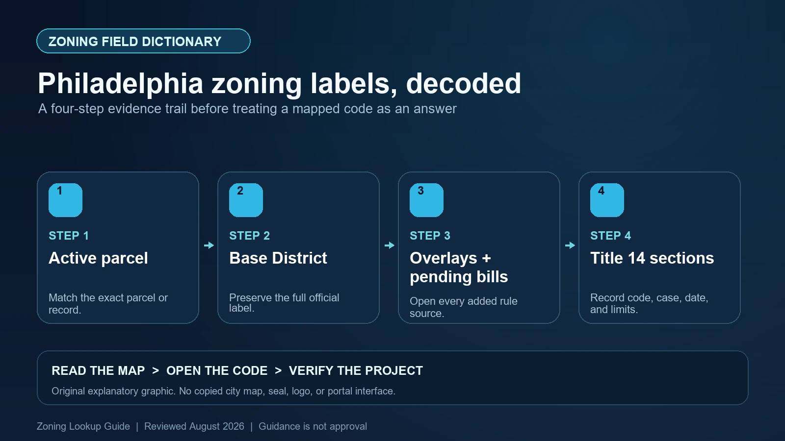
Philadelphia Atlas divides a parcel’s zoning result into a Base District, zero or more Overlays, and a separate Pending Bills area. Preserve those categories separately. In the City’s underlying overlay layer, save OVERLAY_NAME, the overlay symbol, CODE_SECTION, CODE_LINK, regulation type, and any SUNSET_DATE. A pending bill is not current zoning, and an overlay can alter the base rule without replacing the base district record.
Last checked: August 7, 2026.
The official Philadelphia Atlas accepts an address, intersection, OPA account, or Department of Records registry number. Its zoning tab also links a fuller Zoning Summary Generator. Use Atlas to establish parcel identity and map fields, then use the Philadelphia City Planning Commission’s Title 14 resources for the current rule. Neither tool is a variance, permit, certificate, or legal opinion.
Confirm the active parcel and search key before reading zoning
An address can return more than one parcel record, especially for condominiums, consolidated properties, or historical identifiers. Atlas shows the number of active parcels and lets the reader select a parcel key. Save the OPA account or Department of Records registry number, selected polygon, normalized address, and active status. If the project includes adjacent lots, open each rather than assuming one parcel’s district continues across the site.
Atlas also contains deeds, assessments, permits, licenses, inspections, and other records. Those tabs are useful cross-checks but do not redefine the zoning field. An assessment description of property use is not a zoning use classification, and a permit history does not by itself establish an ongoing right. Keep parcel identity, current mapped zoning, past approvals, and present project facts in separate columns.
Base District is the starting code family
Philadelphia base districts use codes such as RSA-5, RM-1, CMX-2, I-2, or SP-INS. The City’s ArcGIS service contains Base Zoning District layers and uses fields including CODE and LONG_CODE; the renderer uses the long code to pair the symbol with a descriptive district name. Capture both where available. The broad residential, commercial mixed-use, industrial, or special-purpose family is orientation, not a complete use decision.
Open Title 14’s base-district chapter and then the use and development-standard chapters referenced by the district. The City’s Zoning Code Base Districts Quick Guide is designed as a general guide and says it is not a substitute for adopted ordinances or codes. Use it to understand the district shape, then verify every material standard in the current code.
| Field or panel | What to preserve | Why it is not the final answer |
|---|---|---|
| Active parcel / OPA account | The exact selected property record and polygon | An address label can cover several parcels |
| Base District / CODE | The current mapped district symbol | It does not include every overlay or approval |
| LONG_CODE | The district code paired with its descriptive name | The description does not replace Title 14 |
| Overlays | Every overlay row returned for the parcel | A zero count must be tied to the correct active parcel |
| Pending Bills | Bill type, current zoning, proposed designation, and status | Introduction or pendency does not amend the map |
| RCO coverage | Organizations and boundaries displayed for notice context | RCO coverage is not a zoning district or approval |
Overlay rows carry their own code links and dates
The City’s Zoning Overlay Districts layer documents key attributes: Overlay Name, Overlay Symbol, Code Section, Code Link, Regulation Type, and Sunset Date. Save them as displayed. Overlay boundaries can overlap and are not required to coincide with one another, so a parcel can have several rows. Do not collapse them into one generic ‘overlay applies’ note or discard a narrow subarea after seeing the first result.
The overlay description says its regulations apply together with the underlying base district. Philadelphia’s quick-guide materials explain that overlay provisions govern when they conflict with otherwise applicable provisions, and that the stricter overlay provision generally governs a conflict between overlays unless the code says otherwise. That is a direction to read each cited section—not a license to guess which rule is stricter without comparing the same use or dimensional standard.
Pending Bills belong in a watch column, not the current-zoning cell
Atlas exposes pending zoning legislation because it matters to due diligence. Record the bill number or type, current zoning, pending designation, introduction and action status, and the date checked. Keep the adopted Base District unchanged in your current-zoning field until the legislation has been enacted, becomes effective, and is reflected or confirmed through the responsible City source.
A pending bill can be amended, held, defeated, or enacted with different boundaries. The map polygon shown during that process may also differ from the final legal description. Open the Council bill and amendments, follow the legislative status, and compare the enacted map change with the subject parcel. For a closing or permit design during an active remapping, ask the City how the timing affects the planned submission rather than predicting the outcome.
Use CODE_SECTION and CODE_LINK to test the actual proposal
Start with a precise project description: the principal and accessory uses, number of dwelling units, floor area, height, lot dimensions, parking and loading, signs, outdoor activity, and any change of occupancy. Use the Base District to locate Chapter 14-400, the overlay rows to locate Chapter 14-500 provisions, and then read the use regulations in Chapter 14-600 and development standards in Chapter 14-700. Definitions and administrative procedures may change the result.
Do not stop when a use seems listed. Check whether it is permitted, prohibited, subject to a special exception, or requires a variance; read all table notes and use-specific standards. Prior zoning permits or appeals may authorize a condition or lawful nonconforming situation that the current base table does not explain. Conversely, a historic permit does not automatically authorize today’s changed operation or enlarged building.
| Atlas finding | Official follow-through | Claim that remains unproven |
|---|---|---|
| Base district | Title 14 base, use, and development chapters | That the exact proposed use and design comply |
| One overlay | Named CODE_SECTION and linked current text | That the base rule controls a conflict |
| Several overlays | Compare each provision and any stated conflict rule | That the visually largest overlay is controlling |
| Sunset date | Confirm current code and whether the provision expired or changed | That an old GIS date alone settles present applicability |
| Pending bill | Council record, amendments, enacted action, effective date, final boundary | That proposed zoning is current |
| Past appeal or permit | Decision, plans, conditions, scope, and present validity | That the approval transfers to every new project |
The Zoning Summary Generator is a reading aid with its own dates
Atlas may route a parcel to the City’s Zoning Summary Generator, which combines base and overlay material into a property-oriented view. Read the dates displayed for the zoning map and code text, because they may not be the same. The tool states that its information is not legally binding and does not represent an official opinion of the City or its departments, boards, or commissions. Preserve that scope note with any exported summary.
A generated summary can make a complex stack easier to navigate, but it cannot know every project fact, prior approval, nonconforming status, or pending record. Use its code citations to open the live adopted text. If Atlas, the summary, and the current code show different dates or fields, save all three and ask the Department of Planning and Development or Licenses and Inspections for the project-appropriate answer.
Pause when parcel, overlay, or legislation evidence does not align
Common failures include choosing an inactive parcel, reading only the base district, ignoring an overlay with a narrow subarea, treating an RCO boundary as zoning, or reporting a pending bill as enacted. Another is relying on map color when the overlay table lists a field not visually obvious. Resolve each by returning to the selected active parcel and recording the literal table rows, code sections, and checked dates.
A zoning result also does not prove building-code compliance, historic approval, lawful occupancy, title condition, or permit issuance. When a transaction or filing depends on the answer, obtain the appropriate City certification, permit review, or qualified local opinion. State exactly what the source confirms and what remains open; that is more useful than a broad assertion that the property is ‘properly zoned.’
- Stop if Atlas returns multiple active or related parcels and the project boundary has not been matched to the selected record.
- Stop if one or more overlay rows lack an opened CODE_SECTION or the overlay subarea is uncertain.
- Stop if a pending bill is described as current zoning before final enactment, effectiveness, and boundary confirmation.
- Stop if the summary generator’s map date and code-text date are being treated as one freshness date.
Save a Philadelphia parcel-and-code worksheet
Your worksheet should include the address, OPA or registry number, active parcel, Base District code and description, every overlay’s name, symbol, code section, code link, regulation type and sunset date, pending bills, zoning appeals or permits, checked dates, and the proposed-use and building facts. Separate the current map, pending legislation, historical approvals, and interpretation into different columns.
Use the site’s Philadelphia Atlas lookup guide to reach the correct parcel, the zoning code versus map guide to trace Title 14, and the overlay worksheet when several rows intersect. The official City sources and project review control the result.
Official Philadelphia records used for this field dictionary
The working evidence set for this Philadelphia field dictionary is the Philadelphia official interactive zoning map (1), Philadelphia official GIS layer or field schema (2), Philadelphia official planning and zoning guidance (3), and Philadelphia official code or technical guidance (4). Each source answers a different part of the lookup. The Philadelphia map locates the record, the municipal layer or dataset exposes fields, and the applicable code or agency guidance controls interpretation. Save each Philadelphia URL and the date checked instead of treating a search-result snippet as the source.
Questions to resolve before relying on the zoning label
Does Philadelphia Atlas show current zoning or proposed zoning?
It shows the Base District and overlays while also providing a separate Pending Bills area. Keep proposed legislation separate until an enacted, effective change is confirmed.
What should I save from an overlay row?
Preserve the name, symbol, code section, code link, regulation type, and any sunset date. Open the cited section and identify the subarea that covers the parcel.
Does an overlay replace the Philadelphia base district?
No. Keep both. Overlay standards apply with the underlying base district and can control conflicts as specified by Title 14.
Is the Zoning Summary Generator a legal zoning opinion?
No. The City describes it as an aid and displays a nonbinding disclaimer. Use its citations to research the current code and obtain the appropriate formal review when reliance matters.
Philadelphia Atlas, the overlay service, pending legislation, the Zoning Summary Generator, and Title 14 can carry different update dates. Reopen each live source and save its specific date before reliance. This guide was reviewed August 7, 2026.