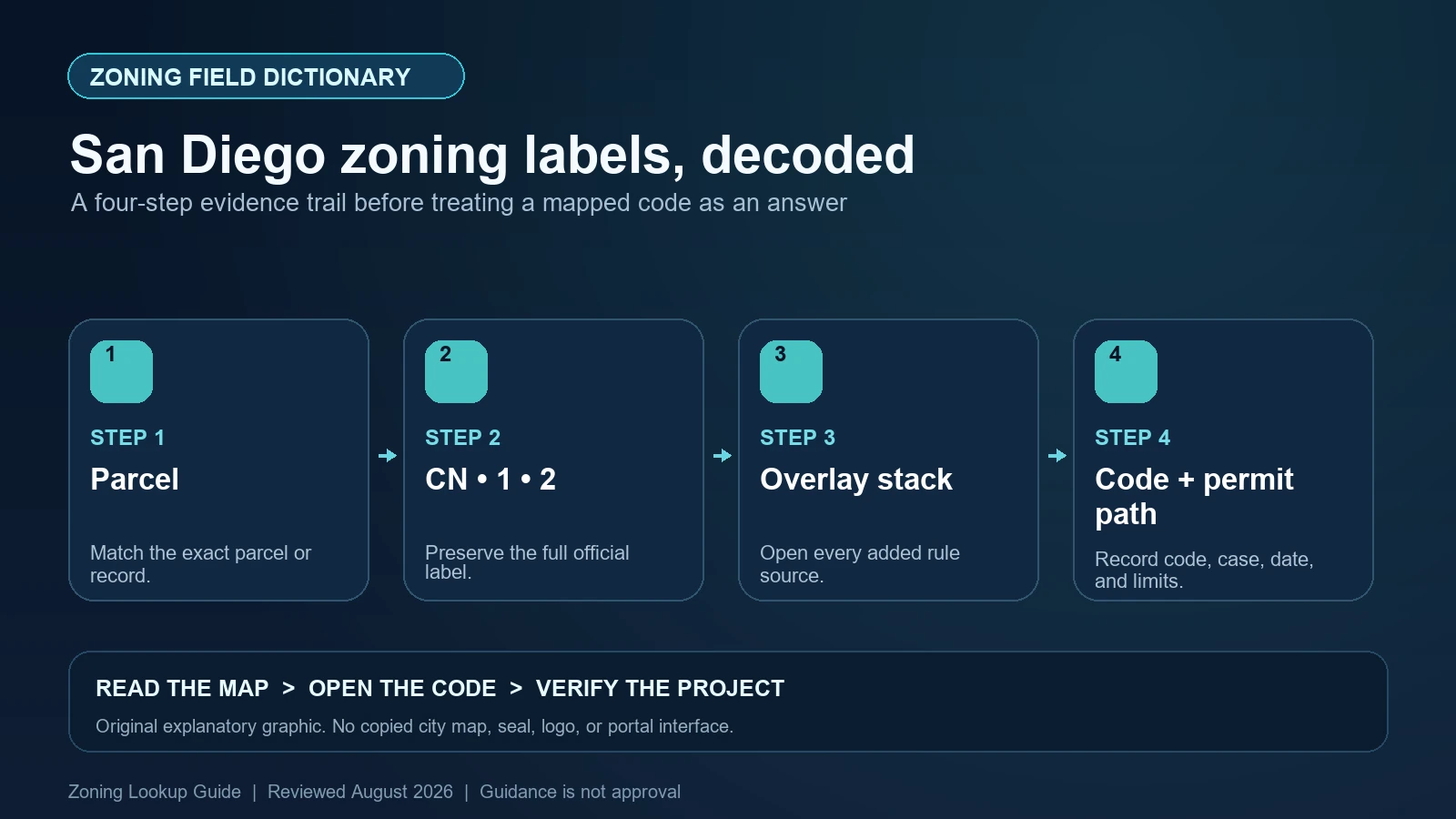
A standard San Diego base zone such as CN-1-2 has four designators: C identifies the commercial type, N identifies the neighborhood-commercial category, the first number identifies a use package, and the second number identifies a development-regulations package. Preserve the full value in the map’s ZONE_NAME field. Then record every overlay and other site criterion separately. CN-1-2 and CN-1-3 are not interchangeable simply because they share the same letters.
Last checked: August 7, 2026.
Use the City Development Services zoning page and Zoning and Permit Portal (ZAPP) for the property lookup. The City also publishes a weekly base-zoning open dataset. That dataset depicts current base-zone designations and boundaries; it is not the complete overlay stack. A map result supports research and self-certification steps but does not guarantee a permit, coastal approval, entitlement, or project compliance.
Verify City jurisdiction and the selected property geometry
San Diego County contains many cities and unincorporated areas with their own zoning. Confirm that the parcel is inside the City of San Diego and that ZAPP selected the intended property rather than a nearby address point. Save the assessor parcel number or legal description available to the project, the selected polygon, community planning area, and all parcels included in the work.
If a base-zone or overlay boundary crosses the site, do not settle it by reading the color beneath the address marker. Compare the official zoning-map geometry, the project survey, and the legal description. The City’s base-zone data is intended to show mapped designations, not to certify a disputed boundary. Ask Development Services for the appropriate project-specific review when the exact line changes the proposal.
Break the base zone into its four designators
The first letter identifies a broad zone type: agriculture, open space, residential, commercial, or industrial in the City’s standard grammar. The second letter narrows the category—for example, M in RM for multiple-unit residential or N in CN for neighborhood commercial. Together, those letters route the reader to the correct division of Chapter 13, Article 1.
The first number is the use package, while the second number is the development-regulations package. Use and form must therefore be researched separately. One numerical component can change which uses are permitted or limited; the other can change standards such as lot area, density, setbacks, height, or floor area. Copy both numbers and every hyphen. Planned District Ordinance zones and certain legacy codes can use a different pattern, so do not force them into the four-designator explanation.
| Component | Official role | Research consequence |
|---|---|---|
| C | Commercial zone type | Open the commercial base-zone division rather than a residential table |
| N | Neighborhood-commercial category | Use the CN category definitions and standards |
| 1 (first number) | Use package | Check the precise use category, permissions, limitations, and permits |
| 2 (second number) | Development-regulations package | Check height, yards, lot, floor area, and other development standards |
| ZONE_NAME | The complete mapped base-zone value | Preserve the whole string; do not report only CN |
| Planned district code | A separate district ordinance may define the grammar | Open that ordinance rather than decoding it as a standard citywide zone |
The open dataset is a base-zone source, not an overlay clearance
The City’s open-data description says its zoning layer depicts current base-zone designations and boundaries and is updated as rezone actions change them. The related official GIS layer uses ZONE_NAME as its display and rendering field. This makes it useful for downloading or reproducing the base-zone geography. Save the dataset update date and the selected feature value when using it as evidence.
Do not infer that a parcel with one base-zone polygon has no overlays. The open dataset is explicitly described as base zoning. Return to ZAPP and the relevant official maps for coastal, airport, parking, transit, community-plan implementation, height, mobilehome, and other overlays or site criteria. A downloaded GeoJSON or CSV row cannot answer a layer it does not contain.
Build the overlay stack from Chapter 13, Article 2
San Diego Municipal Code Section 132.0102 lists overlay designations. They include AAOZ for Airport Approach, AEOZ for Airport Environs, COZ for Coastal, CHLOZ for Coastal Height Limit, SCOZ for Sensitive Coastal, MHPOZ for Mobilehome Park, PIOZ for Parking Impact, RTPOZ for Residential Tandem Parking, TAOZ for Transit Area, UVOZ for Urban Village, MTDD for Mission Trails Design District, CMHLOZ for Clairemont Mesa Height Limit, CPIOZ for Community Plan Implementation, ALUCOZ for Airport Land Use Compatibility, and CEOZ for Community Enhancement.
The code states that overlays apply with a base zone and modify or add regulations for their geographic area. Record the exact acronym, mapped subarea, and division. Some overlays have categories—coastal appealability or a community-plan subarea, for example—that affect process or standards. Also read effective-date and Coastal Commission certification notes where the City identifies them; the newest municipal amendment may not operate identically inside the Coastal Overlay Zone until the required certification step occurs.
Keep overlays separate from other site criteria
The City’s zoning page groups ‘Overlay Zones and Other Site Criteria’ for practical research, but the phrase does not make every displayed layer an Article 2 overlay. Environmentally sensitive lands, community plans, specific plans, transit priority areas, fire-hazard information, airport agency maps, and historic resources can have different authorities and review effects. Save the official layer name and controlling source rather than labeling all of them COZ or CPIOZ.
This is especially important for permit planning. A Coastal Overlay hit may create a Coastal Development Permit question; environmentally sensitive land may require additional studies and a Site Development Permit or Neighborhood Development Permit; a planned district can replace portions of the citywide base-zone framework. The map identifies questions to test. Only the applicable code, plan, and agency review determine the actual submission path.
| Mapped result | Source to open | What remains undecided |
|---|---|---|
| Standard base zone | Chapter 13 Article 1 division, use and development tables | Whether the precise use and design comply |
| Planned district zone | Named Planned District Ordinance and maps | Which citywide standards are replaced or supplemented |
| COZ / CHLOZ / SCOZ | Each named Article 2 division and mapped category | Permit need, appeal path, and project compliance |
| AEOZ / AAOZ / ALUCOZ | City overlay division plus applicable airport-agency criteria | Whether the proposed height or use receives clearance |
| CPIOZ or specific plan | Community-plan implementation division, subarea, and plan | Which supplemental development process applies |
| Environmental or other site criterion | Named map, code section, and responsible review group | That it is legally the same as an overlay zone |
Translate the use package before testing the development package
Define the proposed activity under the Land Development Code’s use categories and subcategories. Include primary and accessory uses, dwelling count, floor area, outdoor areas, hours, alcohol or food service, vehicle activity, and change of occupancy. Then read the use package associated with the first number and every footnote or separately regulated use. A business name does not select the code category.
After use, apply the second number’s development package and added overlay standards. Check density, lot dimensions, yards, structure height, floor-area ratio, parking, access, and any community-plan or coastal modification. A permitted use can still fail the physical standards, and a compliant envelope can still require a discretionary permit. Existing development may rely on older approvals or lawful nonconforming status that does not transfer to the new scope.
Pause when map layers or effective dates conflict
Stop when ZAPP and the downloaded base layer show different zone values, a rezone ordinance appears newer than the dataset, the parcel crosses an overlay edge, or a coastal amendment carries a certification caveat. Save the map, dataset update, ordinance, effective language, and project location. Ask Development Services which record and version governs the immediate application rather than choosing the source with the newest web timestamp.
Formal reliance may require a City review, preliminary review, zoning use clearance, discretionary permit, or professional analysis. A self-certification workflow still requires the applicant to use the correct zone and code; it does not turn a guide into City approval. State the map field, code section, and remaining review separately so a reader can see where certainty ends.
- Stop if ZONE_NAME has been shortened and one of the use or development-package numbers is missing.
- Stop if a base-zone download is being cited as proof that no overlay or other site criterion applies.
- Stop if coastal, airport, community-plan, and environmental layers have been merged into one generic overlay conclusion.
- Stop if a rezone proposal, ordinance date, dataset refresh, and effective or certification date are being treated as the same event.
Save a San Diego field-and-layer packet
Record the address, parcel identifier, City jurisdiction, selected geometry, complete ZONE_NAME, decoded four designators or planned-district route, every overlay acronym and subarea, other site criteria, community plan, rezone or permit cases, code divisions, effective dates, and proposed-use and design facts. Separate the base dataset’s evidence from ZAPP layers and from your interpretation.
Use the site’s San Diego ZAPP lookup guide for parcel selection, the code-versus-map guide for Chapter 13, and the overlay worksheet to keep the full stack visible. City Development Services and the adopted Land Development Code control project decisions.
Official San Diego records used for this field dictionary
The working evidence set for this San Diego field dictionary is the San Diego official planning and zoning guidance (1), San Diego official open-data record (2), San Diego official code or technical guidance (3), and San Diego official GIS layer or field schema (4). Each source answers a different part of the lookup. The San Diego map locates the record, the municipal layer or dataset exposes fields, and the applicable code or agency guidance controls interpretation. Save each San Diego URL and the date checked instead of treating a search-result snippet as the source.
Questions to resolve before relying on the zoning label
What does the last number in CN-1-2 mean?
It identifies the development-regulations package. Read the applicable commercial-zone table for the physical standards rather than treating it as part of the use package.
Does San Diego’s open zoning dataset include every overlay?
No. The City describes it as a current base-zone layer. Use ZAPP and the official overlay and site-criteria sources for the complete location review.
Are all values after the base zone the same kind of overlay?
No. Article 2 contains named overlay zones, while ZAPP can also show plans and site criteria governed by other authorities. Preserve each official layer name and source.
Does a ZAPP result approve a San Diego business or project?
No. It helps identify the rules. The proposal still must satisfy use and development regulations and obtain every required zoning, coastal, environmental, building, and other approval.
San Diego’s ZAPP, weekly base-zone dataset, Land Development Code, overlay maps, and Coastal Commission-related effective notes can update separately. Reopen every source and confirm the applicable version before reliance. This guide was reviewed August 7, 2026.