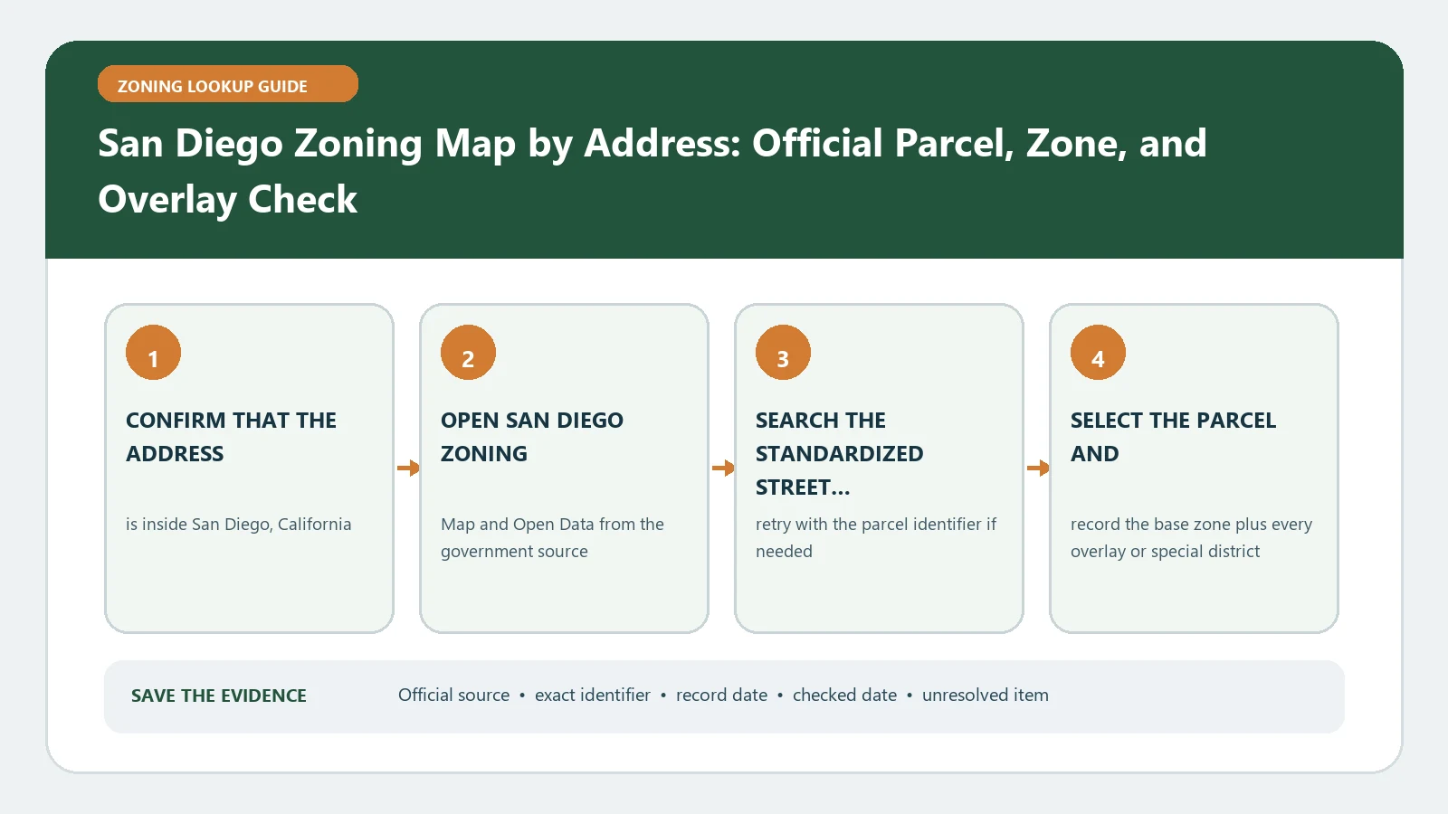
For a San Diego zoning map lookup, match the address to a parcel inside the City of San Diego, inspect the municipal zone in the City zoning dataset, and use the Development Services Department zoning page to reach the governing code and related map tools. Record the base zone and every applicable overlay separately. A mapped zone is not a development permit.
San Diego addresses can be confused with County territory or another incorporated city, and the region contains many coastal, historic, airport, community-plan, and other place-based constraints. The right sequence is parcel, jurisdiction, base zone, additional layers, then project interpretation. Skipping the first two steps produces a confident answer about the wrong authority.
Match the site to a City of San Diego parcel
Start with the complete address and a current assessor parcel number when available. Select the lot and compare its shape with streets, adjoining parcels, and the project boundary. A single address can serve a complex with several parcels, while one parcel can have more than one site address. Build one evidence row for each tract touched by the proposed work.
Confirm that the municipal layer and Development Services sources cover the selected land. If the parcel falls outside City limits, stop and follow the authority shown for that location. The City dataset is not a regional permission map, and a nearby City polygon cannot stand in for a County or neighboring-city record.
Use the zoning dataset to capture, not to guess
The official open-data route provides City zoning boundaries that can be viewed or downloaded. Save the selected zoning value exactly, the parcel identifier used to match it, the dataset page, and the access date. If you work with downloaded GIS data, also preserve the layer name and edition or update information. Those details make the result reproducible when symbology or a portal interface changes.
| Evidence pair | What belongs in the file | What remains unresolved |
|---|---|---|
| Parcel match | Address, APN, City boundary, and selected lot | Whether a multi-parcel proposal needs separate review |
| Base zone | Exact municipal zone and source date | The full list of permitted or conditional uses |
| Code route | Development Services page and linked regulation | How the proposed activity is classified |
| Additional layer | Overlay or special-area name and boundary | Which extra standard or permit path applies |
| Project facts | Use, building work, scale, parking, and outdoor component | Whether staff interpretation or an application is required |
Read the municipal code for the proposed activity
Write a short project description before opening the code. Name the use, existing and proposed occupancy, structural work, dwelling or tenant count, outdoor operations, parking effect, and any lot split. Then use the mapped zone to find the district regulations and use categories. Do not substitute a business label for the code-defined activity; a cafe, bar, food production use, and retail shop can follow different standards.
After screening the use, continue to development standards that affect the proposal. Height, setbacks, floor area, parking, loading, signs, landscaping, and design review may remain even when a use is allowed. Conditional or limited-use language should be carried into the decision note verbatim enough to preserve the limitation, followed by the official route for confirmation.
Inventory overlays before drawing a conclusion
A base zone cannot show every rule attached to a San Diego location. Check the official tools for mapped overlays and special contexts relevant to the parcel, including any coastal, airport, historic, community, or other plan area exposed by the City. Record the exact layer name and whether it covers the whole parcel or only a portion. Then follow the responsible City source for its legal effect.
The municipal zone and overlay inventory do not prove legality, approval, or exemption from further review for a San Diego use. They define the official map starting point, while permits, past decisions, and project-specific findings may answer the remaining questions.
Avoid writing a universal statement that every parcel needs all of those reviews. The layer inventory is evidence-driven. A named overlay belongs in the file only when the official map connects it to the selected land or the City directs the project to that review. A nearby boundary should be measured or confirmed instead of inferred from screen color.
Separate zoning history from today’s project
A prior permit, variance, neighborhood plan, or discretionary approval can explain the site without authorizing a new proposal. Capture any parcel-specific record that the City tools expose and compare the legal description, conditions, and effective date. State which parts of the new project match the record and which parts differ. If the earlier approval is important, ask whether it remains active and transferable to the current scope.
- Map fact: the City layer displayed a named zone for a selected parcel on a recorded date.
- Code finding: the cited provision treats the described use in a particular way.
- Parcel record: a prior action may add conditions or explain a mapped change.
- Project decision: City review may still be needed before work, occupancy, or investment proceeds.
Repair a missing address or boundary mismatch
When the address search is empty, retry with the APN, remove a unit, and browse to the known block. When the parcel appears but the zoning layer is blank, confirm City jurisdiction, layer visibility, scale, and dataset date. At a municipal boundary, record the authority on each side. At a zoning boundary, save the parcel geometry and avoid assigning a label by the map pin alone.
If the open-data layer and another City page disagree, retain both URLs and dates. Determine whether one is a general-information map, an adopted record, or a dataset pending refresh. Send Development Services the address, APN, captures, and exact discrepancy. A resolved City answer is stronger than silently choosing the newer interface.
Prepare the evidence pair for a pre-application question
The minimum useful pair is a dated parcel-and-zone capture plus the exact code route used for the project screen. Add the overlay inventory, site-specific actions, and one-page project description. Ask which use category applies, which additional review is triggered, and whether the mapped district is current for every parcel. Keep the response with the same project version.
Use the San Diego zoning field dictionary to decode map fields, the code and map guide to separate source roles, and the overlay guide to organize multiple rule areas. The City of San Diego remains the source for parcel classifications.
The San Diego Open Data and Development Services zoning routes were reviewed August 26, 2026. Refresh the parcel, zoning layer, and code links before a transaction or application because map data and regulations may be updated.