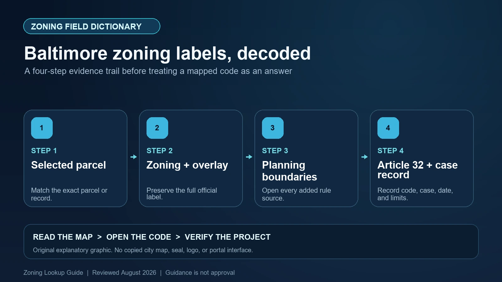
Baltimore’s primary zoning polygon layer exposes separate Zoning, overlay, Label, and URL fields. Copy all four where they are populated. The map renderer uses Label, so a visible value such as R-3/D-MU/HR can carry more information than a hurried note of the first district. After that first layer, inspect the City’s separate CHAP District, National Register Historic District, PUD Boundary, and Urban Renewal Plan layers. Those boundaries provide context or additional controls; they are not interchangeable with the base zoning field.
Last checked: August 7, 2026.
The authoritative text is Baltimore City Code Article 32, Zoning, which states that the enacted zoning map is part of the code. The City’s Existing Zoning Districts service is the reproducible map source used here. A GIS value routes the reader to law and records; it is not a permit, Board decision, historic approval, or guarantee that a proposed use can occupy the site.
Select the Baltimore parcel before decoding the district label
A search marker, centerline, building footprint, and parcel polygon can occupy slightly different positions. Select the parcel or zoning polygon itself and compare its outline with streets and the project’s legal description. If several lots form one project, test every lot. Baltimore’s zoning service is a polygon layer, so the meaningful question is which polygon covers the work area, not which color sits closest to the address pin.
Keep jurisdiction separate too. A Baltimore mailing address may be in Baltimore County rather than Baltimore City, and the two governments use different zoning systems. The City service identifies itself as representing City of Baltimore zoning districts. Confirm the City boundary and responsible agency before recording any code. When a polygon edge cuts through or closely follows the property, do not estimate from screen pixels; preserve the map evidence and ask the Zoning Administrator or Planning staff for a boundary determination appropriate to the decision.
Read Zoning, overlay, Label, and URL as distinct fields
The ArcGIS layer’s display field is Zoning, while its unique-value renderer is keyed to Label. The schema also includes overlay and URL, along with created_date and last_edited_date. That architecture matters: the symbol on the screen may be based on a composed label, while the component fields and linked page provide the better audit trail. Export or transcribe the attributes rather than trying to reverse-engineer the fill pattern.
Slash notation deserves special care. The service legend includes labels such as C-1-E/W-1, C-5-DC/AU, R-3/D-MU/HR, and TOD-4/W-2. Do not assume every slash component is a generic overlay with the same effect. Keep the exact value, identify each component in Article 32, and check whether the linked URL or another ordinance supplies a mapped subdistrict rule. A composite label can alter use, bulk, waterfront, urban-renewal, or other questions depending on its actual code provision.
| Service field | Evidence to preserve | Interpretive limit |
|---|---|---|
| Zoning | The district value returned by the selected feature | It may not preserve the complete rendered composite by itself |
| overlay | Any separate overlay token populated for the polygon | A blank value does not clear separate planning-boundary layers |
| Label | The exact value used by the map renderer | Colors and slash notation still require Article 32 research |
| URL | The linked official record or code route | A link’s presence does not establish current project approval |
| created_date | When the GIS feature was created | The effective date of the underlying ordinance |
| last_edited_date | When the feature was last edited | That no later legal action is pending or omitted |
Keep the planning-boundary service beside, not inside, the zoning result
Baltimore publishes a separate Planning Boundaries service. Under its Planning Administrative group are CHAP District, National Register Historic District, PUD Boundary, Urban Renewal Plan, Floodplain, Critical Area, and Transform Baltimore layers. These are separate feature classes with their own geometry and attributes. Turn on each relevant layer and save its feature name instead of folding every boundary into a homemade ‘overlay’ field.
This separation prevents category errors. A CHAP local historic district can carry City preservation review consequences, while a National Register district is a different designation. A PUD boundary points toward an approved development framework. An Urban Renewal Plan boundary requires the reader to locate the plan and determine which provisions remain operative. Floodplain and Critical Area layers concern additional regulatory systems. None should be reported as the base zoning district, and none should be ignored merely because the zoning polygon’s overlay field is blank.
Use Article 32 to translate the map into rules
Article 32 organizes Baltimore’s districts, maps, use tables, bulk and yard regulations, procedures, and specialized controls. Once the exact label is saved, find the district title and then classify the proposed activity under the code’s use terminology. The zoning tables distinguish permitted uses from conditional uses decided by the Board of Municipal and Zoning Appeals or by ordinance. A business description on a lease or website is not necessarily the code’s use category.
Continue beyond the use row. Read every referenced standard, table note, dimensional rule, parking or loading requirement, sign provision, and special district section. If the label includes a waterfront or other subdistrict component, open that title directly. A building that exists today may be lawful nonconforming, authorized by a variance, or subject to a prior condition; its physical presence is not proof that a new applicant can reproduce or expand it. Permit and Board records must be matched to the same property and scope.
CHAP, National Register, PUD, and Urban Renewal Plan are four different checks
For a CHAP hit, record the district or landmark name and use the Commission for Historical and Architectural Preservation process applicable to the proposed exterior work. For a National Register hit, identify the federal listing context without describing it as a Baltimore local approval. If both layers cover the site, report both. Their boundaries can overlap, but the legal pathways and review triggers are not the same.
For a PUD or Urban Renewal Plan hit, capture the feature name, boundary, adopted document, amendments, and any parcel-specific plan or condition. Do not assume an old plan is irrelevant, and do not assume every sentence in a planning document operates as a zoning standard. The research question is narrower: which adopted provision applies to this parcel and proposal today? When the answer is not apparent from the GIS attribute, route the issue to Planning rather than inventing a hierarchy from map color.
| Mapped layer | Record to retrieve | Claim to avoid |
|---|---|---|
| Existing Zoning Districts | Full Label, component fields, URL, Article 32 district provisions | The district alone approves the project |
| CHAP District | Local designation and current CHAP review requirements | Every historic-looking property is locally designated |
| National Register Historic District | Listing name, boundary, and relevant federal/state context | National Register status equals a City zoning approval |
| PUD Boundary | PUD name, adopting action, plans, conditions, and amendments | The base-district table is the complete rule set |
| Urban Renewal Plan | Plan name, adopted text, amendments, and current Planning confirmation | Every plan statement is an enforceable parcel restriction |
| Transform Baltimore or pending record | Case status, enacted ordinance, and effective map change | A proposal is already current zoning |
Know when timestamps and map colors are insufficient
A last_edited_date describes the GIS feature, not necessarily the date the Mayor and City Council enacted the controlling ordinance. Conversely, a newly enacted legal change may need time to appear in every viewer. Save the ordinance date, effective date, service edit date, and research date as four different values. If the label, linked record, and Article 32 text point in different directions, report the conflict and seek a City answer rather than choosing the newest-looking timestamp.
Colors are even weaker evidence. Renderer categories help distinguish polygons, but printing, transparency, scale, and overlapping layers can change what appears visible. A diagonal fill may signal a component in the legend, yet the feature attributes and code control the research. Use the map legend to find the layer, then rely on the selected attributes and adopted records. This practice also avoids missing a narrow boundary that vanishes at a small scale.
- Stop when the selected feature is a street, building, or address point rather than the zoning polygon covering the project area.
- Stop when a slash label is shortened and one of its mapped components has not been traced into Article 32.
- Stop when CHAP, National Register, PUD, or Urban Renewal Plan boundaries are merged into one generic historic or overlay conclusion.
- Stop when a proposed case, service edit date, or nearby existing use is being treated as proof of an adopted and effective right.
Create a Baltimore record that survives a second review
Save the complete address, City jurisdiction, parcel or legal description, selected polygon, Zoning, overlay, Label, URL, created and edited dates, Article 32 sections, and every intersecting administrative boundary. Add the proposed-use facts, building dimensions, relevant permit or Board numbers, and the date each source was opened. Keep interpretation in a separate column so another reviewer can distinguish City data from your conclusion.
The site’s Baltimore address lookup guide covers the initial parcel search. Use the map-versus-code guide when a district label must be tied to Article 32, and the special-district worksheet when several administrative boundaries intersect. They are research aids, not Baltimore City determinations.
Official Baltimore records used for this field dictionary
The working evidence set for this Baltimore field dictionary is the Baltimore official GIS layer or field schema (1), Baltimore official GIS layer or field schema (2), Baltimore official interactive zoning map (3), and Baltimore official code or technical guidance (4). Each source answers a different part of the lookup. The Baltimore map locates the record, the municipal layer or dataset exposes fields, and the applicable code or agency guidance controls interpretation. Save each Baltimore URL and the date checked instead of treating a search-result snippet as the source.
Questions to resolve before relying on the zoning label
Why does Baltimore’s Label field matter if Zoning is present?
The service renderer uses Label, and composite labels can include slash components not captured by a hurried note of the base district. Preserve Zoning, overlay, Label, and URL together.
Is a National Register district the same as a CHAP district?
No. Baltimore publishes them as separate layers. A property can be in one, both, or neither, and the applicable review path depends on the actual designation.
Does an Urban Renewal Plan boundary automatically change the base zoning?
No. It flags a separate adopted-plan research task. Retrieve the plan and amendments and determine with Planning which current provisions apply to the parcel and proposal.
Can last_edited_date prove the zoning became effective that day?
No. It is a GIS edit timestamp. Preserve the enacted ordinance and legal effective date separately from the service’s maintenance dates.
Baltimore’s ArcGIS services, Article 32, PUD and Urban Renewal Plan records, and historic boundaries can be revised independently. Open the live attributes and adopted documents again before relying on a result. This field dictionary was reviewed August 7, 2026.