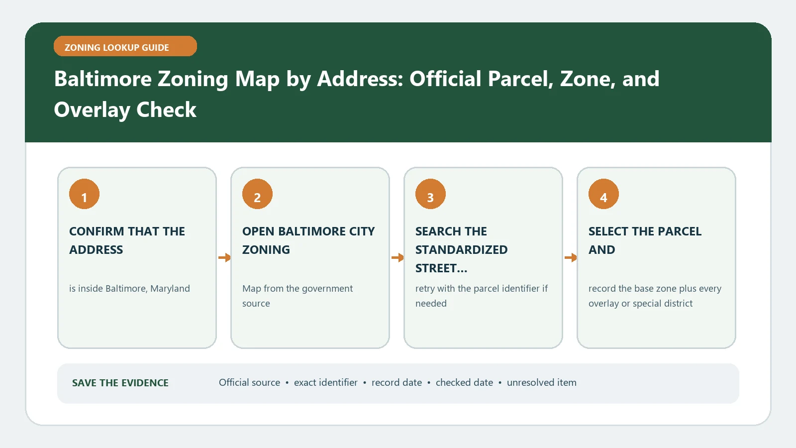
For a Baltimore zoning check, first establish that the parcel is inside Baltimore City rather than Baltimore County. Then use the City planning map route, select the intended parcel, and preserve the exact zoning district plus any overlay or context layer. If a district line touches or crosses the lot, stop reading the screen as a precise survey and apply the boundary rules in Baltimore City Code Article 32.
Official route checked August 26, 2026: Baltimore City official code publisher. Recheck the current Baltimore City map service, certified map route, boundary rule, and code text whenever a parcel edge controls the conclusion.
Baltimore is unusually clear about the relationship between the zoning map and the written law. The map is incorporated into the Code, while Title 6 supplies rules for locating district boundaries and handling a lot divided by a zoning line. That makes parcel selection and boundary evidence central to a trustworthy answer.
Confirm Baltimore City before opening the zoning layer
Baltimore City and Baltimore County are separate jurisdictions with different official systems. A postal address or a search result containing Baltimore does not settle which one controls. Check the government named on the parcel or property record and make sure the map comes from Baltimore City.
Start from the Baltimore City Department of Planning Maps and Data page. An official department landing page is safer than an old bookmark because interactive applications and viewer URLs can change. Record the viewer name and access date before searching.
If the property falls outside the City, stop. Do not carry a City district label or City Code section into a County parcel. For a general jurisdiction workflow, follow the address zoning lookup guide.
Preserve the parcel label and district returned by the City service
Search the full address, choose the exact parcel, and compare the highlighted shape with the street frontage and adjacent lots. Save the parcel identifier or label shown by the viewer. If the building spans several lots or the project includes parking on another parcel, repeat the lookup for each parcel.
The official CityView Zoning New map service exposes the City zoning layer through Baltimore’s geographic service. Treat the returned district as a field tied to the selected geometry. Preserve its exact lettering and numbering rather than translating it into a general land-use description.
Use the Baltimore zoning field guide to organize the display fields, but return to the City Code for legal meaning. A label can direct research; it does not answer whether a particular occupancy, alteration, or development satisfies every standard.
Screen pixels do not decide a disputed zoning boundary
When a zoning color changes near a property edge, the apparent line thickness and zoom level can create false certainty. Baltimore City Code provides actual rules for boundary-line determination. Under Article 32 Title 6, a line shown along a street, alley, way, extension, or non-navigable stream generally follows the center line. A line shown along a lot line follows that lot line. A designated distance controls when the map states one, and the Code also addresses railroad rights-of-way, navigable water, and other unresolved locations.
Those rules mean that the visual center of a thick digital line is not always the legal answer. Identify what physical or legal feature the adopted map uses, then compare it with the relevant parcel or survey information. If the boundary is material to the project, ask the City how to obtain an official determination.
A lot divided by a district line needs a two-part reading
Baltimore City Code Title 6 expressly addresses property divided by a zoning district line. For purposes other than density, each part must comply with the regulations applicable to its zoning classification. The density provision follows a separate lot-area rule described in the same section.
Do not choose the district covering the building entrance, mailing address point, largest colored area, or tax record label and apply it to the whole lot. Mark where the proposed use, structure, parking, access, or other work sits in relation to the district line. Then read both district sections and the City rule for divided property.
A split lot can affect site design even when the proposed building lies entirely on one side. Parking, loading, accessory activity, or an addition may extend into the other district. This is a point for project-specific City review rather than a shortcut based on the dominant color.
Keep overlays and context layers in separate columns
The City viewer may display zoning together with overlays, flood-related geography, historic information, planning areas, or other context. Record each layer under its own official name and ask what legal source it points to.
- Base zoning district: Which Article 32 district rules apply to this part of the parcel
- Floodplain or environmental overlay: Which mapped profile, overlay rule, or additional review applies
- Historic or design geography: Whether a separate commission, standard, or approval path is involved
- Planned development or case: Which final ordinance, plan, or decision controls
- Planning or neighborhood boundary: Whether it is context only or carries a separate adopted rule
The overlays and special districts guide provides a general method for keeping base and added layers separate. On this page, Baltimore City sources control every final entry.
Baltimore makes the zoning map part of the Code
Section 6-301 of Article 32 states that the zoning map, floodplain overlay maps, and flood profiles adopted under the Code are incorporated into it. The section also authorizes conversion and maintenance in digital format under the conditions stated there.
This does not mean that any third-party rendering or any screen capture is the legal map. It means the adopted and properly maintained City map has a defined place in the Code. A reliable lookup therefore pairs the official map with the current text and any ordinance that changed the parcel.
If a case or amendment appears, retrieve the final enacted or signed record. A pending application, staff note, or proposed layer should remain labeled as such until a final action is found.
Use a boundary worksheet when the result is close
For a parcel near a district line, record:
- City parcel identifier and full address
- Viewer and zoning-service URL
- Exact district on each visible side of the line
- Physical feature the line appears to follow
- Relevant Title 6 boundary rule
- Whether the lot is divided by the line
- Location of the proposed use, building, parking, access, and other work
- Survey, plat, map sheet, ordinance, or case still needed
- Screenshot scale and access date
- Question submitted to the City
The worksheet prevents a later reviewer from mistaking a zoomed image for a legal conclusion. It also lets City staff answer the disputed point without reconstructing the entire search.
Escalate the uncertainty, not a guessed answer
If the parcel is missing, confirm the City jurisdiction and search by parcel identifier. If the viewer and code appear inconsistent, refresh the official sources, check effective dates, and look for a later ordinance. If the line crosses the lot or its legal location remains unclear, send the City the worksheet and ask which adopted district applies to the exact project area.
The public map cannot grant occupancy, approve alterations, certify a survey, or clear every permit. The defensible result is a dated record of the City parcel, map layer, Code rule, final case documents, and any official determination obtained for the unresolved boundary.