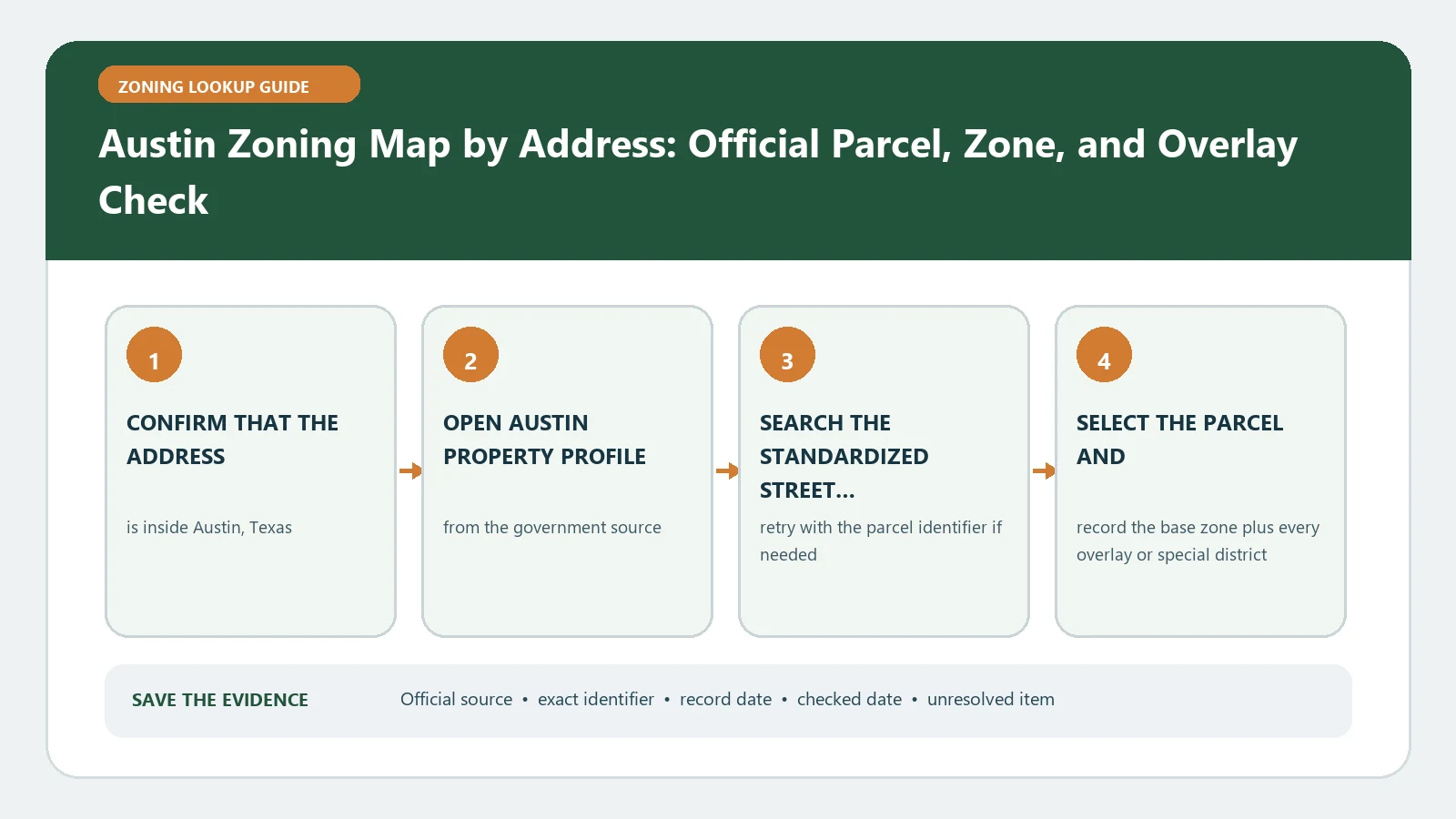
To check Austin zoning by address, select the exact lot in the City Property Profile, record the complete base and combining-district string, and then follow the linked code and case history. An address result is an informational starting point, not a final determination that a proposed use or project is permitted. A signed zoning-verification letter is a different City service.
Reviewed August 25, 2026 against current City of Austin property and zoning-verification routes.
Confirm that Austin controls the parcel
Do not infer jurisdiction from the postal city. Austin-area addresses can fall inside Austin, another municipality, or an extraterritorial area with a different development framework. In the property result, record the jurisdiction layer and parcel identifiers before reading a zoning color. If the selected feature is outside City zoning authority, stop and identify the government that maintains the applicable land-use record.
The Austin zoning-verification page directs users who do not need a signed letter to Property Profile and explains separate formal letter options. That distinction matters when the result will be used for financing, licensing, a lease, or another decision that asks for City-issued confirmation.
Use Property Profile to select the lot, not the pin
- Enter the full address and compare every suggested result with the street, unit, and visible parcel boundary.
- Select the parcel and record its property ID or appraisal identifier, legal description, and jurisdiction.
- Open the zoning layers and capture the entire displayed district string rather than one familiar code.
- Save related zoning ordinance or case references and the date of the lookup.
- Repeat the search by parcel identifier when the address lands on a road, shared site, or neighboring tract.
The official Austin Zoning By Address dataset can help identify source ownership and corroborate an address result. It should not be used to skip the parcel check or the current code.
Read the base district and combining districts as one record
Austin labels can join a base district with conditional, mixed-use, neighborhood-plan, historic, or other combining districts. Each component can point to a separate rule or adopted ordinance. Splitting the string too early can hide the condition that matters to the proposed activity. Use the Austin zoning field dictionary to organize the components without treating its explanation as City confirmation.
| Property Profile evidence | Question it answers | Next record |
|---|---|---|
| Jurisdiction and parcel | Did the search select the intended Austin lot? | Appraisal and legal-description details |
| Base district | Which main zoning family starts the review? | Current Land Development Code district rules |
| Combining districts | Which extra standards or limitations may apply? | Definitions, overlays and adopted ordinances |
| Zoning case or ordinance | Was the parcel changed or conditioned? | Case file, ordinance text and exhibits |
| Map date | When was this evidence captured? | Recheck before a binding decision |
Follow the district into the code and property history
Describe the proposed use in operational terms: residential units, floor area, customers, employees, hours, outdoor activity, alcohol, parking, construction, or change of occupancy. Find the definition and use table for the base district, then follow cross-references for every combining district. Review site plans, restrictive zoning ordinances, conditional overlays, and active cases tied to the parcel. A district that generally allows a use can still carry parcel-specific limits.
Keep public zoning separate from private deed restrictions. A City permit path does not erase a covenant, easement, or property-owner agreement. Likewise, the map does not establish building-code compliance or confirm that an existing use was lawfully established.
Separate zoning from the status of the existing building
The property profile may show a use, structure, or permit clue that predates the current district. Do not treat physical presence as proof of lawful establishment. Search available permit, certificate-of-occupancy, site-plan, and enforcement records for the specific building and suite. An older nonconforming use, a conditional approval, and a current permitted use can produce very different options after vacancy, damage, expansion, or a change of operator.
Business licensing and state licensing can also ask for zoning confirmation without deciding the land-use question themselves. Identify the exact statement the licensing body needs, then choose the City verification route that addresses it. Sending a broad request without the proposed use, suite, and parcel can yield an answer that is too narrow for the decision.
When an Austin map result is missing or disagrees
A broker sheet, appraisal record, older zoning map, and Property Profile may show different labels because they use different dates or purposes. Compare parcel IDs first. Then save each source, update date, ordinance or case number, and the exact conflict. Do not average the results or choose the label that best fits the project. Recent annexation, rezoning, a split parcel, or a pending case needs a direct City question.
- Retry the official search with the appraisal identifier and confirm the selected geometry.
- Open every ordinance or case reference attached to the zoning result.
- Check whether the proposed use depends on a site plan, conditional overlay, or separate license.
- Ask staff which record and effective date control the parcel today.
Choose the right level of Austin confirmation
For early research, keep a dated Property Profile capture, the full zoning string, code sections, and open questions. For a transaction or formal reliance, review the City options for a Zoning Verification Letter or Development Compliance Letter and match the request to the decision. A letter may confirm a defined scope; it does not guarantee permit approval or resolve private restrictions. Before sending the request, use the overlay and special-district check to ensure the question includes every mapped layer.
Attach only evidence tied to the selected parcel: the map selection, appraisal identifier, full zoning string, relevant ordinances, case numbers, and a one-paragraph proposal. Keep pending cases in a separate column so a reviewer can distinguish current zoning from a possible future change.
Before relying on the answer, verify the office, date, parcel, and proposal described in it. If the project facts change, identify which part of the earlier response no longer matches and request a focused update instead of treating the old answer as transferable.
Keep the original response beside the revised facts so the change in scope remains visible to the next reviewer.