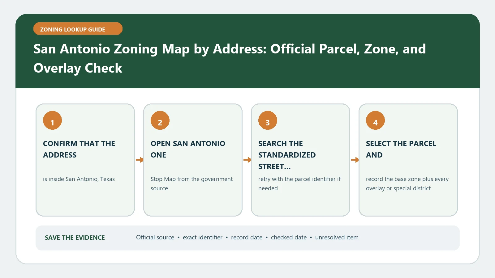
The San Antonio zoning map answer is the set of visible One Stop layers attached to the selected CoSA or BCAD parcel, not merely the code printed nearest the address pin. Use One Stop Map, accept its GIS limitation, select the suggested address, and identify the parcel after zooming close enough for parcel-dependent layers to appear.
Reviewed August 26, 2026 against San Antonio One Stop, its user guide, and Development Services zoning resources.
Use the address page first and the field guide second
| Your task | Use this page |
|---|---|
| Find the parcel and the zoning layers for an address | Stay on this address lookup guide |
| Interpret NCD, overlay, case, ordinance, and parcel fields | Open the San Antonio field guide |
| Decide whether a use is allowed | Open the current code and confirm with Development Services when the decision matters |
Make the parcel appear before asking the layers to answer
Type a complete civic address such as the One Stop example format, then choose a suggestion from the City address index. The map can zoom to a location before every parcel layer is visible. Continue to parcel scale, turn on the relevant One Stop group, and click inside the parcel. If the address is missing, use Advanced Search with the CoSA or BCAD parcel layer.
| Available key | Where to use it | Identity check |
|---|---|---|
| CoSA address | Main search bar | Suggested address and selected parcel agree |
| Parcel key | Advanced Search | Returned CoSA parcel is the intended tract |
| Plat number or situs | CoSA/BCAD parcel query | Legal description or situs matches the source record |
| BCAD legal description | BCAD layer search | County appraisal parcel and City map refer to the same land |
Treat Identify Results as a layer inventory
The One Stop user guide separates address search, identify, and advanced layer queries. In Identify Results, open each returned layer rather than reading only the first summary line. Record the base zoning detail, zoning overlay label, neighborhood conservation or historic layer, approved master development plan, case, and parcel identity that actually appeared.
- Base zoning answers which district record to open next.
- An overlay label adds a rule layer; it does not replace the base district.
- A planned-development or case result points to adopted documents that may contain site-specific conditions.
- A layer absent at one scale is not proof that it does not cover the parcel; check visibility and zoom range first.
Build a four-row San Antonio property card
| Row | Record | Completion test |
|---|---|---|
| Identity | Address, parcel key, BCAD reference | All identifiers describe the same polygon |
| Base | Zoning Detail | Exact district text copied from the selected parcel |
| Additional control | Zoning Overlay plus named special layers | Each visible layer has a source or document link |
| History/document | Case, ordinance, MDP or approved plan | Status and adoption/effective information are recorded |
Use the San Antonio One Stop field guide to decode the returned field names. This address page remains responsible for locating the parcel and collecting the layer stack; the companion page owns detailed field semantics.
Follow documents only from the layer that produced them
If Identify Results lists an approved MDP, planned development, zoning case, or overlay, open the document from that result or the Development Services route. Match the parcel, case number, and adoption status. A proposed case and an adopted ordinance belong in different rows. A nearby development document is not a substitute for the one returned for the subject parcel.
Troubleshoot the map in the order the failure occurred
- No address suggestion: remove unit text, standardize direction and suffix, then try parcel search.
- No parcel attributes: zoom farther in and confirm the CoSA or BCAD parcel layer is visible.
- Only one zoning line appears: expand the layer group and run Identify again for visible overlay and document layers.
- County and City parcel references diverge: retain both identifiers and ask Development Services to resolve the parcel match.
- A use decision depends on the result: request current department confirmation because One Stop states that GIS output is not a legal representation.
Close with an address result, not a citywide generalization
Record the exact search term, selected suggestion, parcel key, zoom/date, returned zoning and overlays, and every linked case or plan. Consult Development Services zoning resources for the controlling district and document route. For general follow-up, use Zoning Overlays and Special Districts or Parcel Number Zoning Lookup. The defensible conclusion is the layer stack observed for one matched parcel, with any legal or current-use question left for the department.
Turn the One Stop pop-up into a scale-aware case file
One Stop does not expose every parcel-dependent layer at every zoom. Record the scale or visible parcel boundary when the Identify result was taken, then save the result tabs that matter to the decision. If the same click produces several records, name the layer that supplied each value rather than copying the first code into every field.
| One Stop observation | Case-file entry | Follow-through |
|---|---|---|
| Suggested address selected | Exact returned site address | Compare with the subject deed, lease, survey, or application |
| CoSA parcel result | Parcel key, situs, legal-description clue | Use the selected City polygon for the layer review |
| BCAD parcel result | Account/parcel identifier and matching address | Resolve a CoSA/BCAD mismatch before interpreting zoning |
| Zoning Detail | Base district, overlay, case or ordinance fields | Open the named rule or case document |
| Layer appears only after zoom | Layer name and scale observation | Repeat the Identify step at parcel scale |
The advanced parcel route is useful when an address candidate is missing or when several lots share one mailing address. Search by the strongest available parcel key, plat, situs, or legal-description element, then compare the returned geometry. A successful attribute query does not prove that every result row belongs to the development site; select and document each affected parcel.
For a staff question, send the parcel key, returned address, base district, all overlay and case fields, checked date, and one proposed use or dimensional issue. That packet lets Development Services answer the discrepancy without reconstructing an undocumented map click.