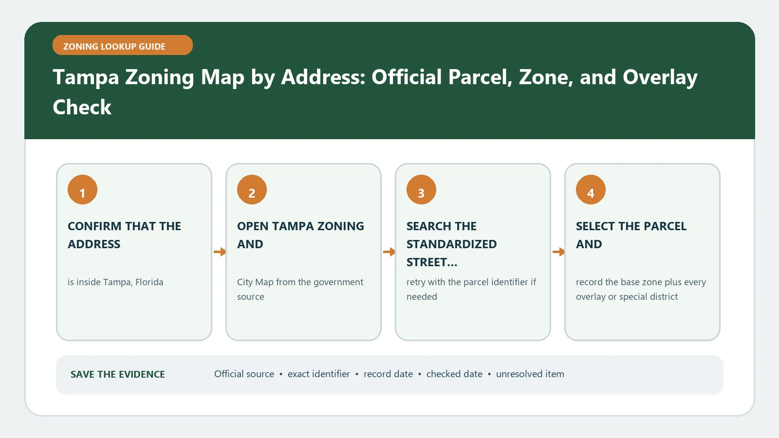
For a Tampa zoning map lookup, first confirm that the property is inside the City of Tampa, then select the exact parcel by address or tax folio in the City map. Record the zoning district, parcel identity, historic or overlay fields, and lookup date before opening Chapter 27 for the proposed use. A map label is a research starting point, not a permit decision.
Checked August 25, 2026 against the City of Tampa zoning-map and city-limits routes.
Confirm Tampa city limits before opening the zoning layer
A postal address that says Tampa may be in unincorporated Hillsborough County or another municipality. The City of Tampa city-limits page warns about that distinction and provides a boundary lookup. Save the jurisdiction result with the parcel record. If the point falls outside incorporated Tampa, use the planning map and land-development code maintained by the government shown for that parcel instead of applying City Chapter 27.
Jurisdiction is the first decision owner. The county property appraiser may supply a folio or ownership clue, but ownership data does not decide which zoning ordinance controls. For land near a boundary, compare the selected parcel polygon with the municipal boundary rather than relying on the mailing city alone.
Search the City map by folio when the address is ambiguous
The City zoning maps page supports address and property-tax folio searches. An address-point search can return a road or building point, while the folio route is better for tying the result to a tax parcel. Select the parcel shape and compare its site address, folio, and owner clue. A campus, corner tract, vacant lot, or multi-parcel project should be recorded one parcel at a time.
- Copy the normalized site address and folio shown for the selected parcel.
- Confirm that the highlighted boundary contains the proposed structure, parking, access, and outdoor activity.
- Save the zoning district exactly, including any letters, numbers, or site-plan-controlled designation.
- Record historic district and overlay results as separate fields rather than folding them into the base zone.
- Add the map access date and a screenshot or printable result that preserves parcel context.
Read the three Tampa result panels as separate evidence
| City map result | What to preserve | What remains unanswered |
|---|---|---|
| Parcel panel | Site address, folio, selected boundary, owner clue | Whether one address covers several legal parcels |
| Historic or overlay panel | Named district, overlay, or blank result | Which additional standards and review route apply |
| Zoning panel | Full district designation and any linked code route | Whether the proposed use and physical plan comply |
| City-limits layer | Inside or outside incorporated Tampa | Which agency owns zoning when the boundary is uncertain |
Keep the panel names because they prevent a common error: treating every field as part of one zone code. The parcel-number zoning lookup guide explains how to preserve the parcel key when an address search returns several candidates.
Turn the district into a Chapter 27 use question
Write the proposed activity in operational terms before reading the code: dwelling type and unit count, retail or service function, customers, employees, hours, deliveries, outdoor work, signs, parking, building area, height, and new construction. Then use the district schedule, definitions, use conditions, dimensional standards, and procedural provisions linked from the City source. Do not infer permission from a district name such as residential, commercial, or planned development.
The zoning code versus map guide helps keep these roles separate. The map identifies the district placed on the parcel. Chapter 27 explains the rules attached to that district. A rezoning ordinance, approved site plan, variance, special use, or other property record may add a third layer.
Historic districts and overlays need their own document trail
When the map reports a local historic district or overlay, record the exact name and open the City material for that boundary. Identify whether the extra layer changes design review, demolition, signs, setbacks, height, use, or application steps. If a planned or site-plan-controlled district appears, locate the ordinance, approved plan, conditions, and amendments tied to the same folio. The overlay and special-district workflow provides a way to keep base and supplemental rules distinct.
Future land use and current zoning also answer different questions. A comprehensive-plan category may guide later decisions without changing the district currently mapped on the lot. Store each label under its own source and date.
Existing permits deserve a separate column as well. A permit can show that defined work was reviewed, but it may not explain the current use, a later alteration, or every zoning condition. Match the permit address and folio, read its approved scope and final status, and check whether a certificate or site plan is attached. When an older record uses a former district name, retain that label and locate the map or ordinance that explains the transition.
If the folio result is missing or outside Tampa
Retry the search with the street suffix removed, the folio entered without punctuation, and direct parcel selection. Check for a recent split, combination, annexation, or address assignment. If the City-limits layer, parcel panel, and another agency disagree, keep all results with dates and ask which government and effective map control. Never choose the record that best supports the project while ignoring the identity conflict.
For a new or changed parcel, provide the legal description or survey reference available to you. For a multi-parcel site, mark where each proposed element will sit. That lets staff answer whether one district, several districts, or a boundary interpretation matters.
Send Development Coordination one bounded project question
A useful handoff contains the address, folio, City-limits result, district, historic or overlay fields, parcel image, cited Chapter 27 sections, proposed activity, and the exact uncertainty. Ask who owns the next determination and whether a property-specific case or site plan must be retrieved. Preserve the office, date, documents supplied, response, and stated limits.
The City map does not establish lawful existing use, building-code compliance, title condition, survey accuracy, or approval of a design. Recheck the live map, code, and property actions before purchase, lease, license, or permit filing because map data and adopted rules can change.