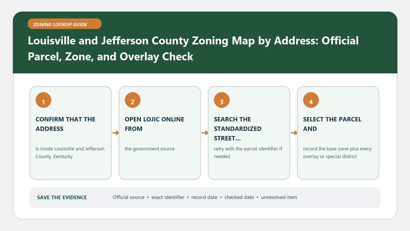
A Jefferson County address needs a jurisdiction answer and a two-part land-use result: zoning district plus form district. Start from the Louisville Metro maps route and open the relevant LOJIC property application. Confirm whether Louisville Metro or one of the smaller incorporated cities administers zoning, then capture both mapped designations. A zoning code without its form district can omit standards that shape development and design.
Official route checked August 26, 2026: Louisville Metro Office of Planning. Recheck the responsible jurisdiction, current Land Development Code edition, LOJIC returns, and any parcel-specific case before relying on the result.
Resolve the zoning authority before opening a code book
The official Land Development Code page explains the Metro code route and notes that multiple small cities in Jefferson County maintain their own zoning authority and land-development rules. A Louisville mailing address is therefore insufficient evidence that Louisville Metro administers the parcel. Record the municipality or unincorporated area returned by the property record. If authority remains uncertain, stop before interpreting a district abbreviation and ask which planning body owns the map, code, case file, and confirmation process for that parcel.
| Jurisdiction finding | Code path | Evidence to save |
|---|---|---|
| Louisville Metro authority | Current Metro Land Development Code | Parcel, jurisdiction, code edition, and amendment date |
| Independent small-city authority | That city’s adopted zoning and development rules | Municipality, official code source, and local contact |
| Boundary or authority unclear | No interpretation yet | Conflicting returns, parcel key, map capture, and question sent |
Retrieve the parcel in LOJIC and preserve the identity
Open LOJIC Online through the official route, search the full address, and confirm the selected parcel polygon. Record the parcel identifier, jurisdiction, zoning district, form district, and any linked land-development report. If the address marker and polygon do not align, retry by parcel number and inspect neighboring boundaries. For a project assembled from several lots, repeat the process for each parcel. Save the application name and lookup time because LOJIC offers more than one public map and report product with different displayed fields.
- Normalize the address and obtain the official parcel identifier.
- Confirm the responsible zoning jurisdiction returned for the parcel.
- Copy the zoning district and form district as separate values.
- Open the land-development or parcel report and retain its source date.
- Check overlays, historic or design review, cases, and mapped boundaries relevant to the proposal.
- Save every code page and official record used to interpret the pair.
Read zoning and form district as a paired result
The zoning district organizes permitted, conditional, or prohibited uses and related standards. The form district addresses the intended physical pattern and can affect site, building, frontage, landscaping, access, and design expectations. Keep both values at the top of the worksheet. Then identify the proposed use and development facts that each part of the code tests. A use that fits the zoning table can still face form-district or design standards, while a compatible building form does not authorize a use absent from the applicable zoning route.
| Record | Question it answers | Common mistake |
|---|---|---|
| Zoning district | Which use and district standards begin the review | Treating the code as the full development answer |
| Form district | Which physical-development pattern and design rules apply | Ignoring it because the zoning code looks familiar |
| Overlay or design review | Which supplemental process or standard applies | Assuming the base pair displaces every special review |
| Parcel-specific case | Which approval, condition, or plan may affect the site | Applying a nearby case without proving the parcel connection |
Match the code edition to the decision date
Save the Land Development Code version or amendment date used, the LOJIC lookup time, and the effective date of any parcel-specific approval. A current code can govern a new application even when an older project was approved under earlier text. Conversely, an approved plan or condition may remain relevant to an existing site. Do not collapse those clocks. State whether the research concerns a new use, an alteration, continuation of an existing use, or verification of a historical approval, and ask the responsible jurisdiction which rule set applies when the dates matter.
Put the dates in a short chronology rather than a narrative guess. List the map lookup, current code edition, original approval, every later amendment found, and the date of the proposed decision. For each entry, name the issuing government and the parcel or case it covers. This format reveals whether a record is merely older, actually superseded, or still controlling through a saved approval. When the chain has a gap, label it unresolved and request the missing ordinance, plan, or staff interpretation.
Build a two-axis feasibility worksheet
Create one axis for use and zoning standards and another for physical form and site standards. Add separate rows for overlays, design review, parking, access, signs, landscaping, flood information, and any case or plan discovered. The Louisville field dictionary helps retain LOJIC labels. The special-district workflow keeps supplemental rules from disappearing behind the base pair. Record a blank as not returned in the checked application, not as a legal conclusion.
Repair jurisdiction, address, and report failures
If the address fails, remove unit details, confirm the street suffix, and search by parcel identifier. If two LOJIC products display different labels, capture both product names, layer names, parcel keys, and dates. If the zoning authority differs from the mailing city, follow the authority returned by the official parcel and planning records. When a land-development report is blank or unavailable, retain the zoning and form-district values and request the missing record from the responsible jurisdiction. Never substitute a third-party parcel page for the official code or case file.
For this parcel, which government administers zoning, what are the current zoning and form districts, which code edition applies to the proposed activity, and is any overlay, case, or design review also controlling?
Keep approval questions outside the map result
A saved LOJIC result identifies public records to investigate and is not a substitute for an official parcel determination or application review. It does not approve a use, establish a survey boundary, resolve title or private restrictions, certify an existing lawful occupancy, or issue a building permit. Submit the parcel identifier, both district values, proposed-use facts, code sections, and unresolved record conflicts to the correct planning authority. Keep the response with the map capture and code edition so the evidence remains auditable after a map or ordinance update.