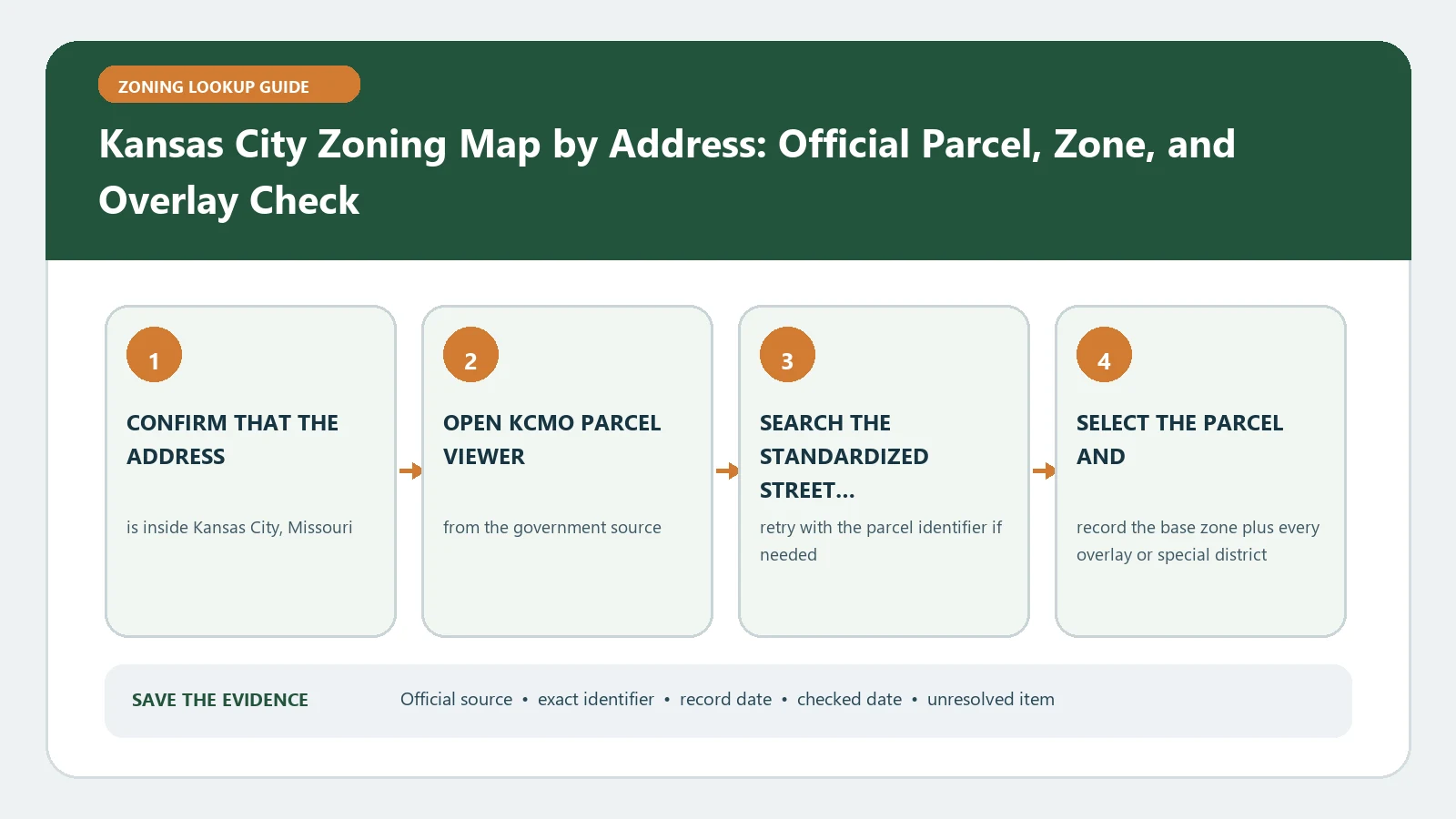
A Kansas City, Missouri zoning lookup has two branches: ordinary district research, or a plan-controlled route for parcels marked UR or MPD. Find the property in the KCMO Parcel Viewer, open Parcel Data, and copy the zoning value. If the district is UR or MPD, do not stop at the code letters; the approved development plan becomes essential evidence for what the parcel was authorized to contain.
Official route checked August 26, 2026: City of Kansas City, Missouri City Planning and Development. Recheck the KCMO development guide, Parcel Viewer plan link, current code, and written-confirmation procedure before financial or construction reliance.
Read the Parcel Data panel before turning on map color
The official KCMO development guide directs users to search an address or navigate to the property, then read zoning in the Parcel Data area. Record the exact street address, parcel identifier, selected polygon, zoning label, and lookup time. The Layers menu can display Zoning for visual context, but color should confirm the selected parcel rather than replace its data record. If the site contains several parcels, make a row for each one. A project footprint can encounter different districts or plan records even when a mailing address suggests one property.
- Search the address and verify the selected parcel boundary.
- Copy the zoning entry from Parcel Data without shortening it.
- Turn on the Zoning layer and compare the parcel fill with nearby boundaries.
- Open the Plans link or related record when the parcel provides one.
- Save the parcel key, result panel, plan or case number, and lookup date.
Route the district family to the right evidence
Common KCMO district prefixes identify broad residential, business, office, downtown, manufacturing, or related families, but the complete code remains necessary. Use the exact district string to open the current zoning and development code, then test the proposed activity and dimensional facts. Treat UR and MPD as a separate branch: those planned-development districts rely on an approved development plan, so a general use-table reading cannot substitute for the parcel plan. The plan may contain site layout, use, height, access, or conditions that are not visible in the short district label.
| Parcel result | Evidence route | Stop condition |
|---|---|---|
| Standard district family | Current district text plus applicable use and development standards | Full suffix, overlay, or parcel boundary is unclear |
| UR | Approved UR development plan plus current code and later case history | Plan document or governing case cannot be located |
| MPD | Approved master planned development plan and its conditions | Map label is present but plan scope is unverified |
| Several parcel values | Separate worksheet and rule path for every parcel | Project boundary has been reduced to one mailing address |
Open the plan as a controlling parcel record
When Parcel Viewer exposes a Plans link, retain the plan name, case number, approval date, sheets relevant to the site, and later amendments. Confirm that the selected parcel is inside the approved plan boundary. Read conditions and graphics together: a note may limit a use, and a drawing may locate an approved building envelope or access point. If several plans appear, arrange them chronologically and identify which action amended or replaced the earlier approval. Never infer that a neighboring UR or MPD plan governs the selected parcel merely because the map colors look continuous.
Choose the city document that matches the business question
KCMO distinguishes routine zoning research from official documents used for particular purposes. The development guide identifies a Zoning Clearance for Business License route and a formal Zoning Compliance Letter route. Use the business-license clearance when that named process applies to a licensing step. Use a compliance letter when a lender, purchaser, tenant, or other relying party needs the city to address the parcel record in writing. Neither document is automatically a certificate of occupancy, and zoning approval alone does not authorize occupation of a space that lacks required building or occupancy approvals.
| Need | Most relevant route | What to include |
|---|---|---|
| Preliminary feasibility | Parcel Viewer plus code and plan research | Parcel, full district, proposed activity, and unresolved question |
| Business licensing | Zoning Clearance for Business License | Business activity, suite, parcel, and licensing context |
| Formal reliance on zoning status | Zoning Compliance Letter | Exact parcel, requested findings, supporting records, and recipient |
| Permission to occupy | Separate occupancy and building review | Existing certificate, proposed occupancy, alterations, and applicable permits |
Turn a proposed use into a staff-checkable statement
Describe the activity with facts that distinguish code categories: primary and accessory uses, floor area, employees, customers, operating hours, alcohol or food service, outdoor storage, manufacturing, deliveries, parking demand, signs, and proposed construction. For UR or MPD, add the plan sheet and condition believed to address the activity. This prevents a broad label such as retail or office from hiding a more specific use or an operational feature that changes the review. Preserve any staff answer as limited to the facts submitted.
Use a local field ledger, not a screenshot alone
The Kansas City field dictionary can help retain local map labels. Pair it with the map-and-code comparison workflow and keep the parcel result, district text, plan record, case chronology, current code, and proposed-use facts in separate columns. A screenshot without the parcel key and layer name is hard to reproduce. A code excerpt without the mapped district and plan is equally incomplete.
Recover when Parcel Viewer or the plan link fails
If the address search fails, remove a suite number, check directional and street suffixes, then navigate from a nearby parcel and verify the parcel identifier. If Parcel Data and map color differ, capture both and ask which layer or update date controls. When UR or MPD appears but no plan opens, retain the district value and request the approved development plan by parcel and case rather than guessing from another property. If a plan is legible but the site boundary is uncertain, ask staff to confirm that the parcel is inside its legal approval area.
For this parcel, what is the complete current district, does an approved UR or MPD development plan control it, which plan and amendments are current, and which city confirmation is appropriate for the stated use?
Separate zoning evidence from occupancy authority
A complete KCMO packet contains the selected parcel, district value, any governing plan, code path, proposed-use facts, and the right city confirmation for the decision. It is not a substitute for a survey, title review, private-restriction check, environmental review, building-code approval, utility check, or lawful occupancy record. Keep the zoning result and occupancy record as distinct checks. That separation prevents a valid zoning district from being misread as permission to open, occupy, remodel, or construct immediately.