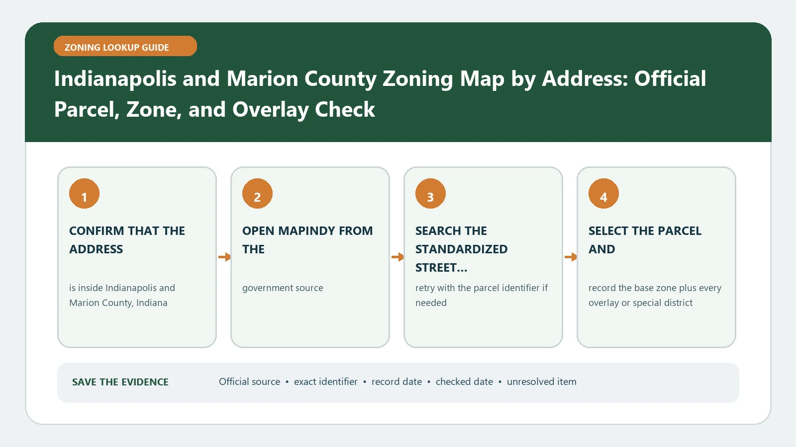
A Marion County address is not automatically governed by Indianapolis zoning. Before reading a district in MapIndy, check the selected parcel against the Excluded Cities and old legal-limits layers. Then record the zoning district separately from variances, rezoning, approvals, legal nonconforming use, historic, wellfield, land-use-plan, and transit-oriented-development layers.
Reviewed August 26, 2026 using MapIndy, its help system, and the current official Zoning map service.
Pass the government-boundary screen
Search the full address or parcel number, select the parcel, and open the jurisdiction-related layers before code interpretation. Marion County contains excluded cities and other boundary conditions. If the parcel is outside the consolidated City zoning authority, save the boundary result and move to the responsible municipality rather than applying an Indianapolis district by proximity.
| Boundary observation | Meaning for this lookup | Next action |
|---|---|---|
| Inside Indianapolis/Marion zoning coverage | Continue to district and rule layers | Record parcel and district |
| Inside an Excluded City | Indianapolis map context is not the final local zoning authority | Use that municipality’s official source |
| Boundary unclear or parcel split | Jurisdiction unresolved | Save the map and request a parcel-specific determination |
Use MapIndy as a layer ledger
The official MapIndy Zoning service lists distinct layers for Zoning, Zoning Variances, Legal Non-Conforming Use, Approvals, Rezoning, Flood Zones, Historically Significant Areas, Wellfield Protection, land-use planning, Transit-Oriented Development, airspace, and parcels. A blank result in one layer says nothing about another. Write one ledger row for every layer that could alter the proposed decision.
| Ledger group | Fields or observation | Time label |
|---|---|---|
| Identity | Address, parcel, Property Record Card link | Checked date |
| Current regulation | Zoning label/district | Current map observation |
| Decision history | Rezoning, variance, approval, nonconforming record | Case status and decision date |
| Additional geography | Historic, wellfield, flood, TOD, airspace | Layer/source date when shown |
| Policy context | Current land-use class, plan, plan overlay | Plan version |
Search once for location and once for identity
- Use the address search to reach the correct street location.
- Select the parcel polygon and compare the returned parcel number and address.
- Open the Property Record Card link when it helps verify the tax parcel.
- Repeat with the parcel number if the address point touches several polygons.
- Print or save the chosen layer set so another reader can reproduce what was visible.
The MapIndy help page documents address or parcel searches and the Property Record Card route. Those tools prove which parcel was selected; they do not establish that every map layer is legally complete or that a proposed use is approved.
Separate current zoning from decisions and plans
The Zoning layer is the district starting point. A variance, rezoning, or approval is a separate case record with its own scope and status. Legal nonconforming use is an evidence question about an established use, not another base district. Land Use Plan and plan-overlay layers are policy records, while flood, wellfield, historic, TOD, and airspace layers can trigger specialized review. Keep those roles visible in the ledger.
Recover from a silent or overloaded map
- No address candidate: simplify the address and search the parcel number.
- Zoning layer is blank: confirm layer visibility and scale, then verify the jurisdiction screen.
- Too many pop-up results: hide unrelated layers and repeat Identify for one ledger group at a time.
- A case appears without a final action: open the case record and record it as pending or unresolved.
- A proposed use depends on a historical right: collect permit, occupancy, and legal-nonconforming evidence instead of relying on the map label.
Issue a layer-complete finding
The finding should name the governing municipality, selected parcel, current district, relevant case/history rows, additional geographies, and plan context. Continue to Indianapolis MapIndy Layers for exact field interpretation, Legal Nonconforming Use Records for established-use proof, and Zoning Overlays and Special Districts for rule stacking. If jurisdiction or a required decision record is unresolved, say so explicitly rather than converting a partial MapIndy view into a final zoning answer.
Interpret MapIndy case layers as decisions, not decorations
A variance, approval, rezoning, or legal-nonconforming point or polygon has to be tied to a case record. Capture the case identifier, decision type, status, decision date, affected parcel, approved scope, conditions, and expiration or continuity information actually shown in the source. If the public map gives only an identifier, the result remains a document-retrieval task.
| Layer hit | Case question | Do not infer |
|---|---|---|
| Variance | Was relief approved, denied, pending, expired, or limited by condition? | That the whole zoning code was waived |
| Approval | What use or site plan was approved for which parcel? | That a later project inherits it automatically |
| Rezoning | Did the action become effective and match the current district? | That a filed case changed the map |
| Legal nonconforming use | What established activity and continuity evidence does the record cover? | That every existing activity is grandfathered |
Excluded-city routing deserves its own saved evidence. Record the municipality shown for the parcel, the boundary layer, and the official office chosen next. MapIndy can provide regional context, but that context does not prove Indianapolis is the governing zoning authority for an excluded-city parcel.
Before handing the file to a planner, turn off unrelated layers and print the selected parcel with a short legend of only the evidence used. Attach the Property Record Card identifier, current zoning observation, each case record, and any wellfield, historic, flood, TOD, or airspace trigger. This makes the question reproducible without treating the crowded map as one blended result.
Date every Indianapolis decision layer
For a variance, approval, or rezoning, keep the filing date, hearing or decision date, final status, and the date the public layer was checked. A proposed case and an effective action can occupy nearby map layers but have very different consequences. If the status vocabulary is unclear, quote it exactly and obtain the decision document.
When a later permit or Property Record Card appears inconsistent, compare identifiers and scopes before assuming the zoning layer is wrong. The permit may address construction rather than land use, or the case may cover only a stated condition.