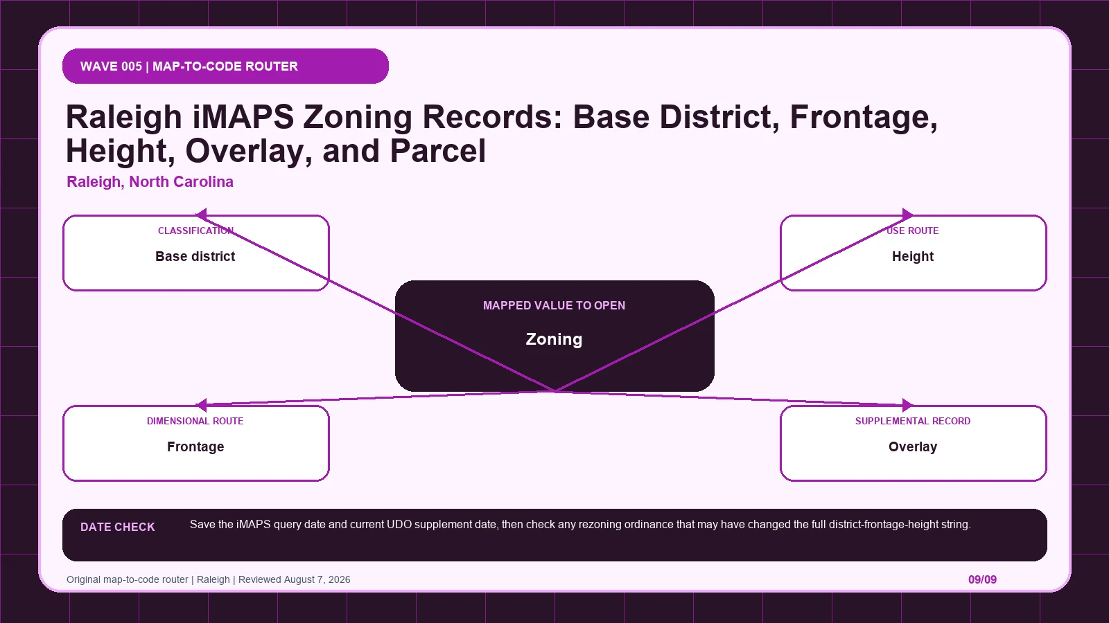
Raleigh iMAPS expresses zoning as a compact notation whose base district, height, frontage, and overlay pieces must survive transcription. Tie the full string to one parcel PIN, then use Find My Zoning and the UDO notation rules before checking a later rezoning ordinance. It is not an approval.
Last checked: August 7, 2026.
Begin the PIN-to-four-part-code route at Raleigh iMAPS, which supplies address, parcel, and map lookup. Cross-check the selected geometry through Raleigh Planning Zoning layer, the route used for base zoning map record. Before copying Zoning (layer 0), verify maps.raleighnc.gov official host and Planning/Zoning layer 0; those markers keep the Raleigh iMAPS notation tied to the intended jurisdiction and record period.
The full Raleigh district string combines base, height, frontage, and overlay
Raleigh's mixed-use zoning string should be treated as structured data rather than a short district label. Zoning layer 0 returns the mapped record. The base component identifies a family such as RX, OP, OX, NX, CX, DX, or IX. A numeric height component is mandatory for a mixed-use district and must stay attached to the family. A frontage component is optional, but when present it adds a named frontage standard that cannot be dropped. An overlay adds another supplemental rule path. The Parcel PIN stabilizes the selected property and guards against address or boundary mismatches. The complete reading order is PIN and polygon, full layer 0 string, base family, height, frontage if present, and every overlay. Reporting only CX or RX discards part of the official notation and can send the reader to incomplete dimensional and frontage rules.
Parcel PIN keeps every piece of the notation on the same geometry
| Returned local record | Record to compare | When to stop | Next decision |
|---|---|---|---|
| Zoning (layer 0) returns official Planning/Zoning layer 0 | Compare with Base district, which identifies the primary mixed-use family | Stop the PIN-to-four-part-code route if Base district is missing, dated differently, or points to another record. | Continue through the Raleigh iMAPS notation: Decode the full district string in the UDO. Then test whether Base district changes that route. |
| Base district returns RX, OP, OX, NX, CX, DX, or IX | Compare with Height, which states the mapped height tier in a mixed-use district string | Stop the PIN-to-four-part-code route if Height is missing, dated differently, or points to another record. | Continue through the Raleigh iMAPS notation: Preserve the complete district abbreviation before reading its use standards. Then test whether Height changes that route. |
| Height returns mandatory numeric height component | Compare with Frontage, which states an applied frontage standard | Stop the PIN-to-four-part-code route if Frontage is missing, dated differently, or points to another record. | Continue through the Raleigh iMAPS notation: Check the UDO height standards and transitions for that number. Then test whether Frontage changes that route. |
| Frontage returns optional frontage suffix | Compare with Overlay, which adds a supplemental district or protection standard | Stop the PIN-to-four-part-code route if Overlay is missing, dated differently, or points to another record. | Continue through the Raleigh iMAPS notation: Open the exact frontage section when the suffix is present; do not drop it. Then test whether Overlay changes that route. |
| Overlay returns overlay shown in iMAPS or zoning notation | Compare with Parcel PIN, which locks the property selected in iMAPS | Stop the PIN-to-four-part-code route if Parcel PIN is missing, dated differently, or points to another record. | Continue through the Raleigh iMAPS notation: Read it with, not instead of, base zoning. Then test whether Parcel PIN changes that route. |
| Parcel PIN returns parcel identification number returned by iMAPS | Compare with Zoning (layer 0), which returns the current mapped zoning | Stop the PIN-to-four-part-code route if Zoning (layer 0) is missing, dated differently, or points to another record. | Continue through the Raleigh iMAPS notation: Use it to prevent address and boundary mismatches. Then test whether Zoning (layer 0) changes that route. |
Break the iMAPS result into four code-facing components
The Raleigh iMAPS notation table keeps each returned label beside its displayed scope and the separate legal record still waiting to be opened. Its first checkpoint is Zoning (layer 0), which may appear as official Planning/Zoning layer 0; from there, Decode the full district string in the UDO. A blank in the PIN-to-four-part-code route stays visible so another reader can distinguish an empty official return from an unexamined field.
| Local field, layer, or record | What it does | Displayed value or scope | Next code or record check | Official page |
|---|---|---|---|---|
| Zoning (layer 0) layer | returns the current mapped zoning | official Planning/Zoning layer 0 | Decode the full district string in the UDO. | Open exact record |
| Base district code component | identifies the primary mixed-use family | RX, OP, OX, NX, CX, DX, or IX | Preserve the complete district abbreviation before reading its use standards. | Open exact record |
| Height mandatory code component | states the mapped height tier in a mixed-use district string | mandatory numeric height component | Check the UDO height standards and transitions for that number. | Open exact record |
| Frontage optional code component | states an applied frontage standard | optional frontage suffix | Open the exact frontage section when the suffix is present; do not drop it. | Open exact record |
| Overlay layer/code component | adds a supplemental district or protection standard | overlay shown in iMAPS or zoning notation | Read it with, not instead of, base zoning. | Open exact record |
| Parcel PIN record key | locks the property selected in iMAPS | parcel identification number returned by iMAPS | Use it to prevent address and boundary mismatches. | Open exact record |
Find My Zoning leads to the UDO only after the notation is preserved
- Open the Raleigh iMAPS notation; fix the parcel, boundary, jurisdiction, and official key before reading thematic records.
- Start the PIN-to-four-part-code route by copying Zoning (layer 0) exactly as returned, including official Planning/Zoning layer 0.
- Keep Base district in a second Raleigh iMAPS notation worksheet field because it identifies the primary mixed-use family.
- Test Height independently, then mark its value, service layer, or documented blank in the PIN-to-four-part-code route.
- Give Frontage and every later item a separate row; never compress history, plans, and overlays into the Raleigh iMAPS notation result.
- Attach the Raleigh iMAPS notation lookup time to Zoning (layer 0), while preserving this separate currency clue: Save the iMAPS query date and current UDO supplement date, then check any rezoning ordinance that may have changed the full district-frontage-height string.
- If Zoning (layer 0) and Base district conflict, send the PIN-to-four-part-code route to Raleigh iMAPS and ask whether any base, height, frontage, or overlay component was lost.
The Raleigh iMAPS notation worksheet is complete only when another reader can reproduce the PIN-to-four-part-code route from the same parcel key and official pages. Keep each source's legal role and effective date apart, then record whether any base, height, frontage, or overlay component was lost as unresolved instead of selecting the most convenient output. The local currency note remains part of that audit trail: Save the iMAPS query date and current UDO supplement date, then check any rezoning ordinance that may have changed the full district-frontage-height string.
A hypothetical Raleigh iMAPS selection returns one Parcel PIN and a mixed-use zoning string built from the CX family, a numeric height component, and a frontage suffix. An overlay also intersects the parcel. The reviewer would save the PIN and polygon, copy the entire string exactly, and decode each component on the official mixed-use UDO page. The height number would be researched under the height standards, the frontage suffix under its frontage provision, and the overlay under separate supplemental text. The note would never shorten the result to CX. This example is expressly hypothetical and supplies no real PIN, height value, frontage designation, overlay, or use outcome. It demonstrates the grammar of the official record and why a parcel near a boundary must be identified by PIN before a full zoning sentence is transcribed or interpreted.
iMAPS date, UDO supplement, and rezoning ordinance are three clocks
Raleigh, North Carolina date check: Save the iMAPS query date and current UDO supplement date, then check any rezoning ordinance that may have changed the full district-frontage-height string.
Raleigh's iMAPS query date, the current UDO supplement, and a rezoning ordinance can differ. A complete district-frontage-height string shown today may have arisen through an older rezoning, while a newer UDO amendment may change how one component is interpreted without changing the map label. Frontage is optional in the notation unless applied, so its absence should be reported as an absent component in the returned string rather than a citywide statement that no frontage rule can matter. Save the full layer 0 result and PIN with the query date, use the current official mixed-use district explanation, and check any relevant rezoning action. The Raleigh iMAPS syntax does not certify that the viewer contains every property condition or that a current code supplement retroactively describes the effective date of the mapped designation.
Correct a truncated or stale district string before code research
| Local situation | What went wrong | What to retain | How to resolve it |
|---|---|---|---|
| Scenario 1 | A Raleigh mixed-use code is shortened to CX or RX and loses its height or frontage component. | Preserve Height, the selected geometry, and both timestamps from the Raleigh iMAPS notation check. | Use Raleigh iMAPS to settle whether any base, height, frontage, or overlay component was lost; then Check the UDO height standards and transitions for that number. |
| Scenario 2 | A parcel near a boundary is selected by address but its PIN and polygon are never confirmed. | Preserve Frontage, the selected geometry, and both timestamps from the Raleigh iMAPS notation check. | Use Raleigh iMAPS to settle whether any base, height, frontage, or overlay component was lost; then Open the exact frontage section when the suffix is present; do not drop it. |
When a Raleigh result has been shortened to CX or RX, the missing height and possible frontage must be recovered before any standard is discussed. Re-select the parcel by PIN, confirm its polygon, and copy the full layer 0 string. Decode the family, mandatory height, optional frontage, and overlay one at a time using the official UDO sources. If the address point and parcel geometry disagree, preserve both captures rather than guessing at the boundary. Ask Raleigh Planning: 'For this Parcel PIN, what is the complete current zoning string, including its base family and height, is a frontage component applied, and which overlay or rezoning ordinance also controls the parcel?' That exact question lets staff correct a transcription or boundary error. It does not ask the map or the department to guarantee that a proposed use, height, or frontage design will be approved.
- Selected parcel key, geometry, and responsible jurisdiction
- Every returned value from the local field table
- Page titles, URLs, lookup times, and update clues
- Opened code, plan, case, ordinance, or metadata records
- Unresolved blanks, boundary splits, dates, and competing outputs
- Proposed activity stated in code-relevant facts
- Agency contact, narrow question, reply date, and limits
The Raleigh iMAPS notation does not decide title, survey boundaries, private restrictions, vested rights, building-code compliance, utilities, licensing, or permit issuance. Request a written response when the PIN-to-four-part-code route leaves competing official results or when substantial reliance is planned. A useful request to Raleigh iMAPS identifies the parcel, quotes Zoning (layer 0) and Base district, gives their source dates, and asks whether any base, height, frontage, or overlay component was lost.
Use iMAPS, Planning layer 0, and the UDO notation page by purpose
| Official page | What to check there | Local coverage shown |
|---|---|---|
| Raleigh iMAPS | address, parcel, and map lookup | City-owned application |
| Raleigh Planning Zoning layer | base zoning map record | City-owned maps.raleighnc.gov service |
| Raleigh Find My Zoning | UDO decoding and official guidance | Official city page |
| Raleigh UDO mixed-use district notation | exact district, height, and frontage syntax | Official City page defines RX/OP/OX/NX/CX/DX/IX, mandatory height, and optional frontage |
How should Zoning (layer 0) be checked in Raleigh, North Carolina?
Open the official Zoning (layer 0) record and capture the value inside the Raleigh iMAPS notation. That record shows how Zoning (layer 0) returns the current mapped zoning; one displayed form is official Planning/Zoning layer 0. Place the copied value in the PIN-to-four-part-code route, then follow its separate rule route: Decode the full district string in the UDO.
How should Base district be checked in Raleigh, North Carolina?
Open the official Base district record and capture the value inside the Raleigh iMAPS notation. That record shows how Base district identifies the primary mixed-use family; one displayed form is RX, OP, OX, NX, CX, DX, or IX. Place the copied value in the PIN-to-four-part-code route, then follow its separate rule route: Preserve the complete district abbreviation before reading its use standards.
How should Height be checked in Raleigh, North Carolina?
Open the official Height record and capture the value inside the Raleigh iMAPS notation. That record shows how Height states the mapped height tier in a mixed-use district string; one displayed form is mandatory numeric height component. Place the copied value in the PIN-to-four-part-code route, then follow its separate rule route: Check the UDO height standards and transitions for that number.
Use raleigh zoning map by address, zoning code vs zoning map, zoning overlays special districts only where those methods clarify the PIN-to-four-part-code route. The Raleigh iMAPS notation evidence linked for Zoning (layer 0) and Base district remains the local starting point.
Reviewed August 7, 2026. Recheck the Raleigh iMAPS notation, its cited ordinance, and the agency procedure before relying on the saved worksheet.