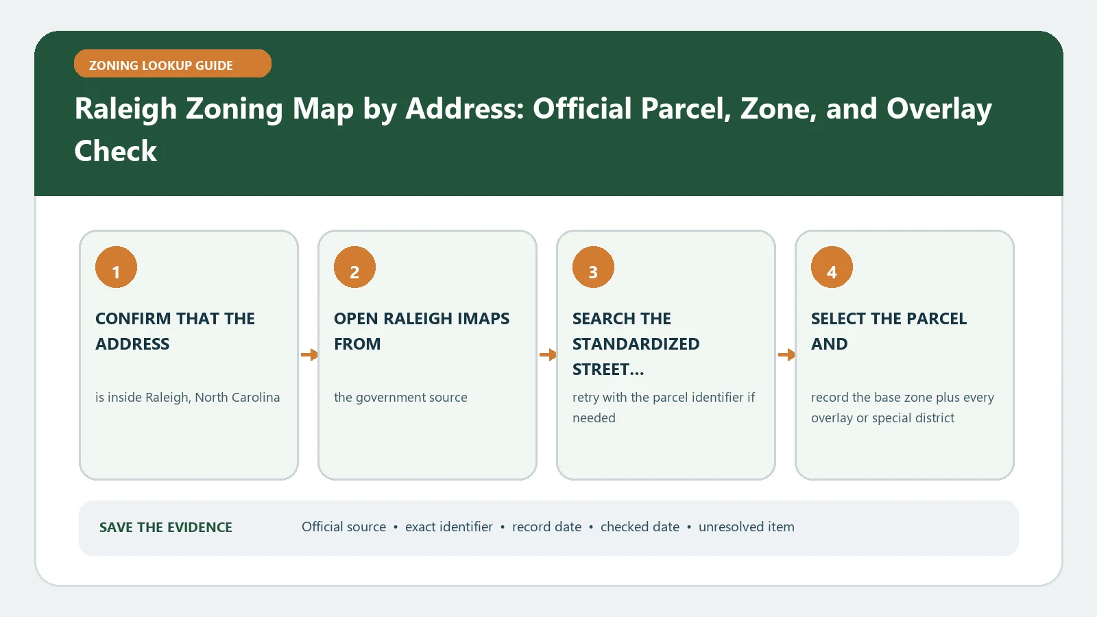
Use Raleigh’s Find My Zoning instructions to open iMAPS, enable the Raleigh zoning and overlay layers, search the address or parcel identifier, and run Identify on the selected property. Record the district, every overlay, and any Link to Conditions. The Official Zoning Map page explains the legal map role; the web result does not decide whether an existing use complies.
iMAPS is managed by Wake County but includes City of Raleigh regulatory and policy information. That relationship makes the first step a jurisdiction check. Confirm that the parcel is within Raleigh’s zoning jurisdiction before treating a popup as the City zoning answer. A Wake County tax record can help identify land without turning every county parcel into a Raleigh-regulated parcel.
Set the Raleigh layers before searching
Open the Layers control and keep the Property layer visible. Under Planning and Development, enable Raleigh Overlay Districts and Raleigh Zoning. Setting the layers first matters because an address can highlight correctly while the map is displaying only tax information or a different planning layer. Record the active layer names in the evidence note so another reader can reproduce the view.
The City describes three broad district families and explains that overlays add regulations connected to environmental, cultural, or infrastructure features. Preserve the district and overlay values separately. An overlay that crosses many base districts is not a replacement base zone, and a base district does not make an overlay optional.
Search with the strongest parcel identifier available
- Try the complete address and select the property result rather than a nearby point.
- Use the parcel identification number or real estate ID when the address is ambiguous.
- Treat owner-name search as a discovery route and confirm the parcel with a stable identifier.
- Run the Identify tool on the highlighted parcel and review each applicable popup tab.
- Save the returned parcel identity, district, overlays, and lookup date before interpreting them.
For multi-parcel sites, repeat Identify for each parcel. The City verification-letter process can address a limited group of contiguous parcels, which is another reason to know exactly which land is included. A campus name or single mailing address should never erase a different zoning condition on one component parcel.
Open Link to Conditions before reading the district generally
After identifying the property, move through the popup until the Raleigh Zoning layer appears. The City instructs users to scroll to Link to Conditions when conditions exist. Open that record and preserve the case, text, map, or decision reference. Conditions can narrow or qualify a district result for the parcel, so they belong beside the base zone rather than in a footnote added after a project conclusion.
| iMAPS action | Evidence produced | Reason it matters |
|---|---|---|
| Enable Raleigh Zoning | Current base district layer | Starts the UDO use and standard review |
| Enable Raleigh Overlay Districts | Every mapped overlay touching the parcel | Exposes added place-based regulations |
| Property search | Address, PIN, REID, or owner candidate | Finds the land but does not finish identity |
| Identify parcel | Selected geometry and popup fields | Binds the result to the intended tract |
| Open conditions | Case-specific condition link and record | Prevents the general district from hiding parcel restrictions |
Translate the map into a UDO research question
State the contemplated use and physical work: for example a new dwelling, business occupancy, addition, sign, subdivision, or outdoor activity. Use the mapped district to find the corresponding UDO provisions. Then read the overlay and parcel-condition records against that same description. Separate use permission from height, setbacks, frontage, parking, design, and other development standards.
A district name is not a certificate of compliance for what already exists. Current use history, permits, prior approvals, and legal nonconforming status may need another record. Keep the map lookup bounded to its actual job: identify the City zoning framework for the selected parcel and route the next official check.
Know what a Raleigh verification letter will and will not answer
Raleigh offers a Zoning Verification Letter that confirms district information and applicable zoning conditions for a parcel. The City also states that this letter does not determine whether existing land uses comply or fail to comply. Use the letter when an official confirmation of district and conditions is needed, but do not describe it as an inspection, code-compliance certificate, or approval of a proposed project.
Prepare the request with each contiguous parcel, the exact address, map capture, zone, overlay, condition link, and intended decision. If the issue is existing-use legality or a proposed use, ask which separate process or record addresses it. This keeps the letter request aligned with the service the City actually offers.
Fix a missing parcel, disabled layer, or map mismatch
If no address result appears, search by PIN or REID and inspect the map near the known location. If tax data appears without Raleigh zoning, confirm the jurisdiction and layer settings. If conditions are expected but no link appears, save the popup and ask whether the condition is recorded under another parcel or case. A missing screen element should remain an unresolved field, not become proof that no condition exists.
Where an adopted rezoning case and iMAPS disagree, compare effective dates and parcel numbers. Raleigh describes rezoning as the process that modifies the Official Zoning Map. Keep pending and finalized cases distinct, and request clarification before carrying either classification into plans, financing, or a contract.
Leave a reproducible Raleigh record
Close with the active layer list, search input, selected parcel, base zone, overlays, condition link, source dates, project description, and one next action. Recheck after a rezoning decision, parcel change, or map update and immediately before a time-sensitive filing. The record should show what the map said and what remains to be decided elsewhere.
Use the internal Raleigh iMAPS field guide for popup interpretation, the address lookup guide for failed searches, and the overlay guide for layered parcels. Raleigh Planning and Development remains the authority for the zoning result.
Raleigh’s current Find My Zoning and Official Zoning Map pages were reviewed August 26, 2026. Repeat the iMAPS steps before reliance because districts, conditions, and interface details can change.