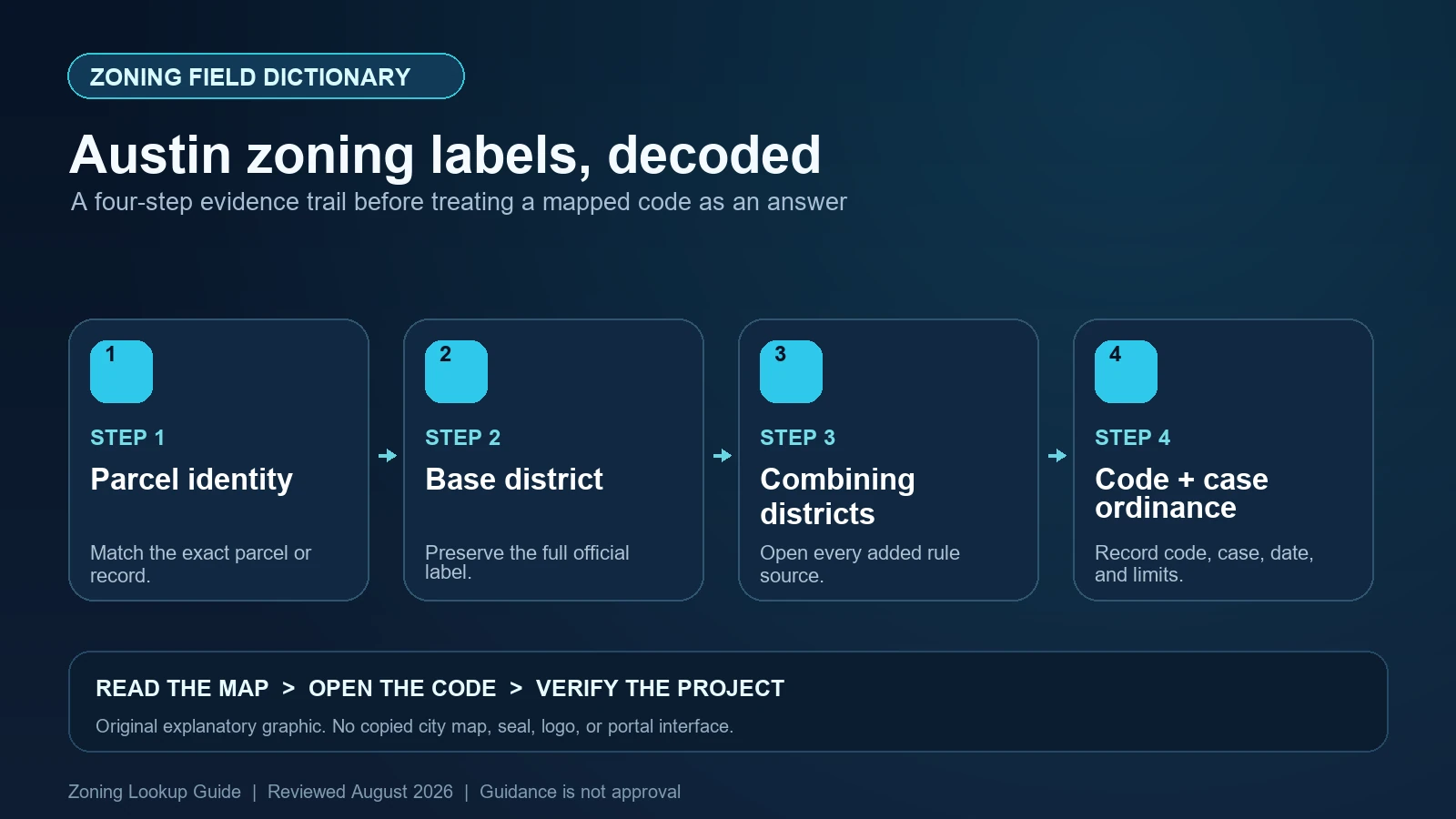
An Austin zoning label is a stack, not a single permission. In a string such as CS-V-CO-NP, CS is the base district, while V, CO, and NP point to additional rules for vertical mixed use, a conditional overlay, and a neighborhood plan. Record the whole string from the correct parcel, then read the base-district standards and every applicable combining-district or case ordinance. The label does not, by itself, approve a use, building, subdivision, or permit.
Last checked: August 7, 2026.
Use the City of Austin’s Property Profile for parcel-level research. The separate Zoning By Address dataset is useful for data work, but its own description warns that an address point can omit other zoning on the property, overlays, and later changes. That distinction is the most important field-level fact in this guide.
Begin with the parcel rather than the address row
Property Profile and Zoning By Address answer related but different questions. Property Profile lets a reader inspect the mapped parcel and other layers. The open dataset joins an address point to zoning and exposes eight columns: OBJECTID, FULL_STREET_NAME, ZONING_ZTYPE, BASE_ZONE, BASE_ZONE_CATEGORY, PARENT_PLACE_ID, PLACE_ID, and SEGMENT_ID. Those identifiers help reproduce a data lookup; they do not turn the address point into the property’s legal boundary.
A large tract can be split-zoned, and the structure’s address point may sit in only one of its polygons. Search the street address, select the parcel, zoom far enough to see every boundary, and compare the highlighted geometry with a survey or legal description when the decision matters. Also confirm that the land is inside Austin city limits. The dataset expressly limits its zoning coverage to City of Austin addresses, so a familiar Austin mailing address outside that jurisdiction is not enough.
Treat ZONING_ZTYPE as a sequence of regulatory parts
The dataset’s ZONING_ZTYPE is the full displayed zoning string, while BASE_ZONE isolates the underlying district and BASE_ZONE_CATEGORY supplies its description. For example, CS means General Commercial Services. The remaining tokens may identify combining districts that add an option, impose a restriction, connect the parcel to a neighborhood plan, or signal historic regulation. Preserve punctuation and order instead of shortening the result to the first two letters.
Austin’s zoning resources page lists the base districts and explains the combining districts. CO is a Conditional Overlay that can restrict uses or site-development standards otherwise available in the base district. NP identifies a Neighborhood Plan Combining District. H identifies a historic landmark and HD a historic area; NCCD identifies a Neighborhood Conservation Combining District. MU, V, PDA, WO, CVC, and other tokens have their own provisions. Their effect cannot be inferred from the acronym alone.
| Official field or token | What to record | What it does not establish |
|---|---|---|
| FULL_STREET_NAME | The normalized address attached to the data row | The complete legal parcel or all zoning polygons |
| ZONING_ZTYPE | The entire zoning string, including every suffix | That every suffix has been interpreted correctly |
| BASE_ZONE | The underlying district code, such as SF-3 or CS | Permission for a specific use or project |
| BASE_ZONE_CATEGORY | The City’s descriptive district name | The controlling use and site-development tables |
| PLACE_ID / PARENT_PLACE_ID | Stable address-layer identifiers for reproducing the join | A deed, tax parcel, or survey identifier |
| Parcel geometry in Property Profile | Every zoning polygon touching the project site | A certified boundary determination |
A conditional overlay must be traced to its case ordinance
CO is not a standard bundle with the same restrictions everywhere. It tells you that a property-specific zoning action restricted something the base district would otherwise allow. One CO might prohibit selected uses; another might reduce height, floor-area ratio, impervious cover, or other development standards. The map suffix therefore creates a research task: find the zoning case and adopted ordinance for this tract, read its exhibits and conditions, and note later amendments.
Do not reverse that logic. A conditional overlay generally restricts the base district; seeing CS-CO is not evidence that a use absent from CS became permitted. Nor should a neighbor’s CO ordinance be applied by analogy. Match the ordinance’s legal description and zoning-case number to the subject property. If Property Profile does not expose the document clearly, ask Austin Planning for the relevant case record or use the formal verification route rather than guessing from a similarly colored polygon.
NP, NCCD, H, and HD lead to different records
NP indicates a neighborhood-plan combining district, but the future land use map in a neighborhood plan is not a substitute for current zoning. A plan amendment and a rezoning can be related processes, yet they answer different questions. Record the adopted neighborhood plan, any applicable infill options or design tools, and the current zoning ordinance separately. The NP suffix is a signpost to those materials, not a promise that every plan recommendation is an enforceable parcel standard.
Historic tokens also require precision. H concerns an individually designated historic landmark, while HD concerns a historic area; NCCD uses tailored neighborhood regulations. A National Register context, an Austin historic designation, and a zoning combining district are not interchangeable labels. Exterior work may trigger a review process even when the underlying use is allowed. Capture the exact mapped token and then follow the City link for the commission, ordinance, district boundaries, and review requirements that actually apply.
Separate the map label from the code question you need answered
The full zoning string identifies the rule set to research; it does not classify the reader’s proposed activity. Describe that activity in operational terms before opening a use chart: principal and accessory uses, indoor or outdoor activity, floor area, dwelling count, alcohol service, hours, vehicle movements, construction, and any change of occupancy. Then locate the City’s definition and the base-district use rule. A colloquial label such as studio, shop, warehouse, or short-term rental may not match the code category.
Next, check dimensional and site rules such as setbacks, height, building coverage, impervious cover, floor-area ratio, parking, compatibility, and any additional overlay standard. Austin’s own zoning-layer materials note that some regulations, including compatibility standards, may not appear in the zoning string. The absence of a suffix is therefore not proof that no other land-development rule applies. Building, fire, environmental, subdivision, deed, and licensing requirements remain separate.
| Finding | Document to open next | Decision that remains unresolved |
|---|---|---|
| Base zone such as SF-3, MF-3, or CS | Chapter 25-2 district, use, and site-development provisions | Whether the precise proposed use and design comply |
| CO suffix | Property-specific zoning case ordinance and amendments | Which base rights were restricted on this tract |
| NP or NCCD | Adopted plan, combining-district text, and mapped subarea | Whether a particular option or tailored standard applies |
| H or HD | Designation ordinance, district record, and historic-review requirements | Whether the proposed exterior work receives approval |
| Recent rezoning case | Council action, signed ordinance, effective date, and updated map | Whether a pending or adopted action controls today |
| Split zoning or unclear boundary | Survey/legal description and Austin Planning confirmation | Which rule applies to the affected portion of the project |
Resolve stale, split, or contradictory Austin results
Three common conflicts deserve a stop rather than a confident answer. First, the address dataset may return one zone while the parcel crosses another. Second, a recently adopted ordinance may appear in council records before every public-facing layer is synchronized. Third, an address can be outside the City’s zoning jurisdiction even though the postal city says Austin. In each case, save both records, their checked dates, the selected geometry, and the ordinance or case identifier; do not silently choose the result that favors the project.
The Austin zoning-verification page distinguishes an informal Property Profile lookup from a signed Zoning Verification Letter. Use the letter route when a lender, closing, lease, legal opinion, or other reliance requires an official confirmation. Even that confirmation should be read for scope: verification of the mapped designation is not the same as a permit, plan review, vested-right decision, or approval of a particular business or building.
- Stop if the address point falls close to a district boundary or the project spans more than one tract.
- Stop if a CO, PUD, PDA, NCCD, or historic token appears but the controlling ordinance cannot be matched to the legal description.
- Stop if a proposed or recently enacted case is being reported as current zoning without an effective ordinance and map confirmation.
- Stop if the land is in the ETJ, limited-purpose area, or another jurisdiction and the City zoning layer is being treated as universal coverage.
Save an Austin zoning evidence packet another person can repeat
A useful research packet contains the complete address, parcel or legal description, Property Profile URL, selected parcel screenshot or exported map for internal documentation, full ZONING_ZTYPE, isolated BASE_ZONE, every combining token, the relevant zoning-case and ordinance numbers, effective dates, code sections, and the proposed-use facts being tested. Record the dataset update date separately from the ordinance date. That prevents a fresh web page from being mistaken for fresh law.
For adjacent tasks, use the site’s Austin address lookup guide to locate the right polygon, then compare the result with the zoning code versus map guide. If several suffixes appear, the overlays and special districts guide provides a neutral worksheet for keeping each rule source separate. These guides organize research; Austin’s code and agency records remain controlling.
Official Austin records used for this field dictionary
The working evidence set for this Austin field dictionary is the Austin official planning and zoning guidance (1), Austin official open-data record (2), Austin official planning and zoning guidance (3), and Austin official interactive zoning map (4). Each source answers a different part of the lookup. The Austin map locates the record, the municipal layer or dataset exposes fields, and the applicable code or agency guidance controls interpretation. Save each Austin URL and the date checked instead of treating a search-result snippet as the source.
Questions to resolve before relying on the zoning label
Is BASE_ZONE enough to decide whether an Austin use is allowed?
No. BASE_ZONE identifies the underlying district, but the full ZONING_ZTYPE can include restrictions and other combining districts. The precise use definition, conditional-overlay ordinance, site rules, and property history still need review.
Why can Zoning By Address differ from Property Profile?
The dataset joins zoning to an address point and warns that it may omit other zoning on the property and overlays. Property Profile is the better starting place for viewing the parcel and all intersecting mapped layers.
Does NP mean the neighborhood plan changed the parcel’s current zoning?
Not by itself. NP identifies the combining district. Keep current zoning, the adopted neighborhood plan, its future land use map, and any plan-amendment or rezoning action as separate records.
When should I request an Austin Zoning Verification Letter?
Use the City’s letter process when a transaction or third party needs official confirmation of the current designation. Ask separately whether the proposed project needs a permit, interpretation, or other approval.
Austin’s open dataset, Property Profile layers, combining-district pages, and adopted ordinances can change on different schedules. Reopen every cited City source and record the live update or effective date before relying on the result. This guide was reviewed August 7, 2026.