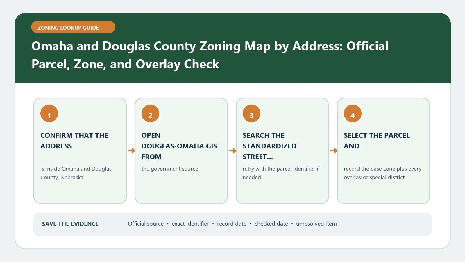
Start an Omaha or Douglas County zoning lookup by determining which government controls the parcel, then select the exact property in the official Douglas-Omaha GIS. Record the parcel identifier, zoning classification, height field, PUD or PUR value, and linked code information separately. The GIS result is evidence for further review, not permission to build or operate a use.
Checked August 25, 2026 against the official Douglas-Omaha GIS and Omaha Planning map directory.
Decide whether Omaha or Douglas County owns the zoning record
A postal address can use Omaha while the parcel lies outside City zoning authority. Begin at the Douglas-Omaha GIS and record municipal boundaries or jurisdiction fields with the selected parcel. If the result identifies County or another municipality, stop before interpreting an Omaha code. Boundary and annexation dates may matter for recently changed properties.
Use the parcel number to confirm the map selection
- Search the full address and inspect all returned candidates.
- Select the parcel polygon and compare its outline with assessor or legal-description information.
- Record the parcel number, situs address, jurisdiction, owner-name clue, and lookup date.
- Search again by parcel number if the pin falls on a road, campus, or neighboring tract.
- Note multiple parcels or a zoning boundary that crosses the proposed work area.
Use the parcel-number lookup guide when the address result is ambiguous. The parcel identifier connects the GIS, assessor, case, and ordinance research without assuming that every database uses the same address spelling.
Keep the Douglas GIS zoning fields in separate columns
| GIS evidence | Record exactly | Question still open |
|---|---|---|
| Jurisdiction | City, County, municipality, and boundary context | Which current ordinance controls after a boundary change |
| Classification | Full base zoning designation | Whether the proposed use is allowed and under what standards |
| Height | Displayed height district or value | How height is measured and whether exceptions apply |
| PUD or PUR | Value, identifier, or mapped boundary | Which adopted plan, amendment, and conditions govern |
| Code link | Exact linked chapter or source route | Whether a parcel-specific case changes the general rule |
The Omaha zoning field guide helps preserve these values without merging them. Always return to the official GIS and ordinance for the live property record.
Open the code link for the proposed use and form
Describe the project before reading the code: dwelling type and unit count, business function, customers, employees, outdoor activity, floor area, height, setbacks, parking, signs, or construction. Find the definition and use table for the classification, then follow dimensional, performance, parking, landscaping, and procedural references. A similar use name in another city is not a substitute for the local definition.
The Omaha Planning GIS tools and maps directory is the City route for current map resources. Pair it with the ordinance and any application or case system. If the parcel is outside Omaha, locate the equivalent source from the controlling government instead.
Separate mapped zoning from existing use and permit history
The GIS classification describes the mapped district, while assessor and permit records may describe a building or activity. Search certificates, building permits, special-use approvals, and enforcement records when the existing condition matters. Record the document number, approved scope, final status, and conditions. A long-running use may be conforming, nonconforming, conditionally approved, or undocumented; age alone does not decide which.
For a tenant or business change, describe the new operation instead of relying on the prior business name. Include floor area, customers, employees, deliveries, outdoor areas, hours, equipment, signs, and construction. Those facts let a reviewer decide whether the use classification or occupancy path changes.
Retrieve PUD, PUR, variance, and rezoning records
A PUD or PUR field signals that a plan or site-specific decision may matter, but the acronym alone is not the rule. Obtain the approved plan, ordinance, exhibits, amendments, and conditions. Search the parcel and case number for rezoning, special-use, conditional-use, variance, or appeal decisions. Distinguish an application, staff report, recommendation, and final action.
When the proposal relies on an older approval, verify that it applies to the same parcel and phase and that required conditions were not superseded. Existing construction or activity does not prove current zoning compliance.
If the parcel result is missing or conflicts
Retry with the parcel number, shortened street name, and direct map selection. Confirm jurisdiction before comparing zoning. For a newly split parcel, annexation, or map amendment, save the GIS result and the recorded action with their dates. Do not select the most favorable classification from competing records. Ask which map and effective ordinance apply to the filing date.
- Mark the intended project area when the site contains several parcels or districts.
- Keep the classification, height, PUD, PUR, and case references as distinct evidence.
- Record the exact discrepancy and the source date for each result.
- Request a written zoning response or determination process when a transaction depends on the answer.
Create a reproducible Omaha-area parcel file
Save the address, parcel number, jurisdiction, selected boundary, zoning fields, code sections, property decisions, proposal facts, and unresolved questions. Recheck official sources before closing, leasing, designing, or applying because datasets and ordinances may change. This map research does not prove lawful use, code compliance, entitlement, or final approval, and it does not address private title restrictions.
When the project spans parcels, add one row for each parcel and show where each structure, parking area, access point, and outdoor activity will sit. Ask whether the parcels must be combined or reviewed together. This prevents one favorable district result from being applied across an entire multi-parcel site.
Keep contact notes precise: office, staff role, date, question, documents provided, answer, and stated limits. If only a phone conversation is available, ask where the controlling map, ordinance, or written determination process can be found. The evidence should survive a change in owner, broker, designer, or reviewer.
Recheck open cases before the decision date. A recommended rezoning, pending plan, or hearing notice can explain future risk, but it should remain separate from the district and approvals that are effective now.
Archive the final map view and ordinance citation together so neither loses its parcel context during later review.