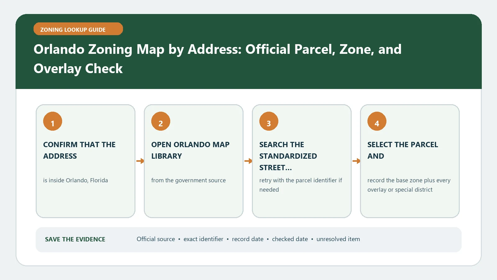
An Orlando mailing address does not establish City of Orlando zoning jurisdiction. Begin in the City Information Locator, search the complete address, and verify that the selected property is within the City before using City zoning and future-land-use records. If the parcel is in unincorporated Orange County or another municipality, stop the City workflow and move to that authority.
Reviewed August 26, 2026 against Orlando's Information Locator, Map Library, and official verification application.
Pass a city-or-county gate
| Locator result | Authority route | Do not do |
|---|---|---|
| Inside City of Orlando | Continue with City zoning, future land use, and planning layers | Assume the mailing city alone proved jurisdiction |
| Unincorporated Orange County | Use Orange County official zoning and parcel sources | Apply an adjacent City district color |
| Other incorporated municipality | Use that city’s official planning source | Treat all of metropolitan Orlando as one zoning system |
| Boundary unclear | Save the parcel and ask for jurisdiction confirmation | Interpret a district before resolving authority |
Build a locator-to-map chain
- Enter the complete street address and choose the exact candidate.
- Select the parcel and copy the parcel identifier and jurisdiction result.
- Open only the City planning layers relevant to zoning, future land use, or a named special geography.
- Use the City Map Library to locate the current official zoning-map series or GIS data route and record the map or data date shown.
- Compare the parcel identifier across the locator, map, and transaction record before interpreting a district.
Keep four Orlando records in separate columns
| Column | Exact capture | Question it answers |
|---|---|---|
| Jurisdiction | City, County, or other municipality | Which government’s rules should be opened? |
| Current zoning | Complete district and overlay label | What current regulatory route starts the review? |
| Future land use | Comprehensive-plan designation | What policy designation must be considered separately? |
| Cases and special geography | Case/ordinance/overlay/plan identifier and status | Which additional document or approval may govern? |
Do not merge zoning and future land use into one answer. A use or development proposal can require consistency with both while still needing a separate case, overlay, historic, downtown, airport, or other specialized review. The map is the index to those records.
Use the map-library date as a version control
If a printable zoning sheet and the live locator appear different, compare their publication or update dates and make sure both cover the same parcel. Preserve the older map only as historical evidence. Do not use its color to override a newer parcel record. If neither source identifies which record is current, send the discrepancy to City Planning with the parcel identifier and both dated captures.
Request verification for a decision-grade answer
The current City Planning Division page links to planning appointments, the Map Library, and Planning & Zoning Approvals, and lists 407.246.2269 and [email protected]. Use that official route to choose the service that fits the parcel question or ask City Planning which current process applies. Prepare the parcel identifier, current map result, proposed use or decision, specific question, and any conflicting record. Do not treat a map result, appointment, or staff response as project approval beyond the issue actually reviewed.
Recover from four Orlando lookup traps
- Address not found: remove unit text, verify street direction and suffix, and search the parcel identifier.
- City map is blank: repeat the jurisdiction gate before changing the search terms.
- Parcel straddles or touches a boundary: preserve the parcel-scale view and request authority confirmation.
- Zoning and future land use seem inconsistent: keep both results and route the conflict to City Planning; do not discard either column.
Return a jurisdiction-safe Orlando finding
Name the governing authority, selected parcel, current zoning, future land use, special records, data dates, and verification status. Use How to Find Your Local Zoning Map when a mailing city and government boundary differ, Land Use Map Check Before Buying Property for the two-column interpretation, and Planning Department Permit and Zoning Search for decision-grade confirmation. The lookup is incomplete whenever jurisdiction remains unresolved.
Package an Orlando jurisdiction handoff without losing the parcel
When the locator shows Orange County or another municipality, save the parcel identifier, selected boundary, jurisdiction result, and checked date before leaving the City tool. Enter that same parcel identifier or legal property description in the next authority’s official source. Do not restart with only the postal address and risk selecting a nearby City parcel.
| Handoff item | City-tool observation | Receiving-authority check |
|---|---|---|
| Parcel identity | Address, parcel ID, polygon | Same land is selected |
| Government boundary | City, County, or municipality label | Office confirms it regulates the parcel |
| Planning context | Visible City-adjacent layer only if relevant | Receiving authority supplies its current zoning and plan records |
| Open question | Boundary or data conflict stated narrowly | Responsible staff gives a parcel-specific route |
For a City parcel, version the evidence. Record the Information Locator checked date, the zoning-map sheet or dataset date, the future-land-use source, and the date of any case or ordinance. If the printable map and live GIS differ, do not blend their labels; send both versions and the parcel identifier to City Planning.
Scope the verification request to one decision
Describe the named use, development standard, current record conflict, or classification question. List the address and parcel, map result, future land use, special geography, and relevant case. A City zoning response does not prove compliance with County rules, private restrictions, building code, licensing, environmental review, or a project not described in the request.
Keep the response with the exact submitted question and source dates. Recheck jurisdiction and the live maps after annexation, parcel changes, rezoning, plan amendment, or a material project revision.
Recheck Orlando authority after a boundary or parcel change
Annexation, subdivision, consolidation, and address reassignment can make an older locator capture misleading. Compare the current parcel identifier and government boundary with the earlier record before reusing its zoning label. If the parcel changed, keep the parent and successor identifiers in the evidence chain.
Ask the City or County which effective action moved the boundary or classification and which map edition reflects it. The older capture remains history; the current authority and adopted record control the new lookup route.