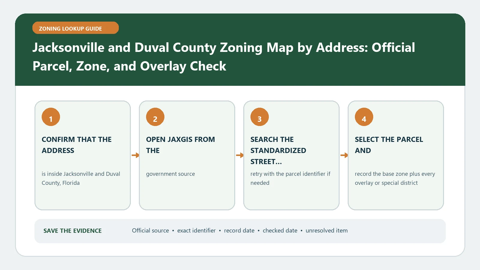
The dependable key for a Jacksonville zoning map lookup is the 10-digit Real Estate Number, not the street address alone. Use the address to find the property in JaxGIS / Duval Maps, then copy and verify the RE number before reading the zoning district, future land use, or linked case information.
Reviewed August 26, 2026 using Jacksonville's parcel map, Chapter 656 guidance, and confirmation-letter instructions.
Assemble a parcel identity pack
| Identity element | Where to obtain it | Mismatch response |
|---|---|---|
| Complete address | Transaction, permit, or map search | Remove unit text and verify direction/suffix |
| 10-digit RE number | Selected JaxGIS parcel or tax record | Stop if it belongs to a different parcel |
| Parcel polygon | Map selection at parcel scale | Repeat for every lot under one address |
| Jurisdiction | Official parcel/map result | Move outside-City questions to the responsible authority |
The City’s zoning FAQ tells users to search by address or the 10-digit RE/tax identification number and explains that the district must be followed into Chapter 656 for uses and dimensional standards. Save the RE number with every later screenshot, question, and confirmation request.
Read three outputs without combining them
Current zoning
Copy the exact district and any overlay or planned-unit label from the selected parcel. This is the starting regulation route.
Future land use
Record the comprehensive-plan designation separately. Future land use and zoning have different roles; one does not silently replace the other.
Case, permit, and exception records
Open the exact case or approval and capture its status, date, scope, conditions, and parcel coverage. A record appearing in the map does not establish that it is final or applicable to the proposed action.
Translate the district through Chapter 656
- State the proposed use in operational terms, including accessory and outdoor components.
- Find the district section and the table or list governing that use.
- Record whether a conditional-use, exception, administrative deviation, or other approval path appears.
- Check lot area, width, yards, height, coverage, parking, signage, and any overlay standard relevant to the physical plan.
- Keep the section citations with the same RE number used in the map lookup.
Escalate with a confirmation-ready question
When the answer affects a transaction or the map and code leave a material issue unresolved, use the City’s zoning confirmation letter request route. The City asks for the exact RE number, property address, addressee information, delivery details, and the parcel-specific question. “Is this property okay?” is not a usable scope. Ask, for example, which current district and recorded approval govern a named use on the parcel identified by the stated RE number.
| Request field | Value to prepare |
|---|---|
| Property | 10-digit RE number and full address |
| Recipient | Exact addressee or organization name |
| Delivery | Requested delivery method and contact details |
| Question | One closed zoning, use, or record-conflict question tied to that parcel |
| Evidence | Map date, district, Chapter 656 section, and conflicting case or approval |
Recover from an identity failure
If the address result and RE number disagree, stop the code analysis. Recheck the parcel polygon, tax record, direction, unit, and legal description. If one project covers multiple RE numbers, make a separate identity pack and rule result for each. A written confirmation request should list every affected RE number rather than treating the mailing address as one legal parcel.
Close the Jacksonville lookup with a traceable record
Record the RE number, address, jurisdiction, current zoning, future land use, relevant case or approval, Chapter 656 sections, and confirmation status. Continue to Parcel Number Zoning Lookup for multi-parcel handling, Planning Department Permit and Zoning Search for request preparation, and Land Use Map Check Before Buying Property for intent separation. That keeps a City of Jacksonville zoning map query tied to the parcel the user actually means.
Handle one Jacksonville project with several RE numbers
Make one row per 10-digit RE number. For each parcel, record the returned address, current zoning, future land use, overlay or planned-unit label, case identifiers, and Chapter 656 route. Add a separate project-boundary sketch or list only after the individual parcel rows are complete.
| Multi-parcel check | Evidence | Stop condition |
|---|---|---|
| Identity | Every RE number and its selected polygon | A lot is missing or belongs to another address |
| Current regulation | District and overlay for each RE number | The project crosses a zoning boundary |
| Plan context | Future land use for each parcel | Zoning and plan paths require a consistency review |
| Site-specific record | Case, exception, deviation, PUD, or condition | Document scope or status is unresolved |
A confirmation letter should list all affected RE numbers and say whether the question concerns each parcel individually or the combined site. Include the exact use, structure, sign, parking, setback, or record conflict being checked. The map result does not prove that a proposed project spanning several parcels can be reviewed as one zoning lot.
Preserve a clean handoff to Jacksonville staff
Attach the identity table, parcel-scale capture, current zoning and future-land-use columns, cited Chapter 656 provisions, and every case document located. Mark missing documents explicitly. Avoid sending private transaction records unless they are necessary and the receiving process is appropriate.
When the City response arrives, record which RE numbers, use description, documents, and date it covers. If the project or parcel configuration changes, rerun the address-to-RE lookup and ask whether the earlier response still addresses the revised scope.
Index the Jacksonville response back to each parcel
When a confirmation response covers several RE numbers, copy its finding into the row for each parcel and preserve any exception or condition that applies only to one. If the City replies using only the street address, ask whether every listed RE number was reviewed.
Keep the application, attachments, payment or tracking reference, response, and checked map together. A later buyer or designer should be able to see the use and parcel configuration the City considered rather than reuse the letter for a changed project.