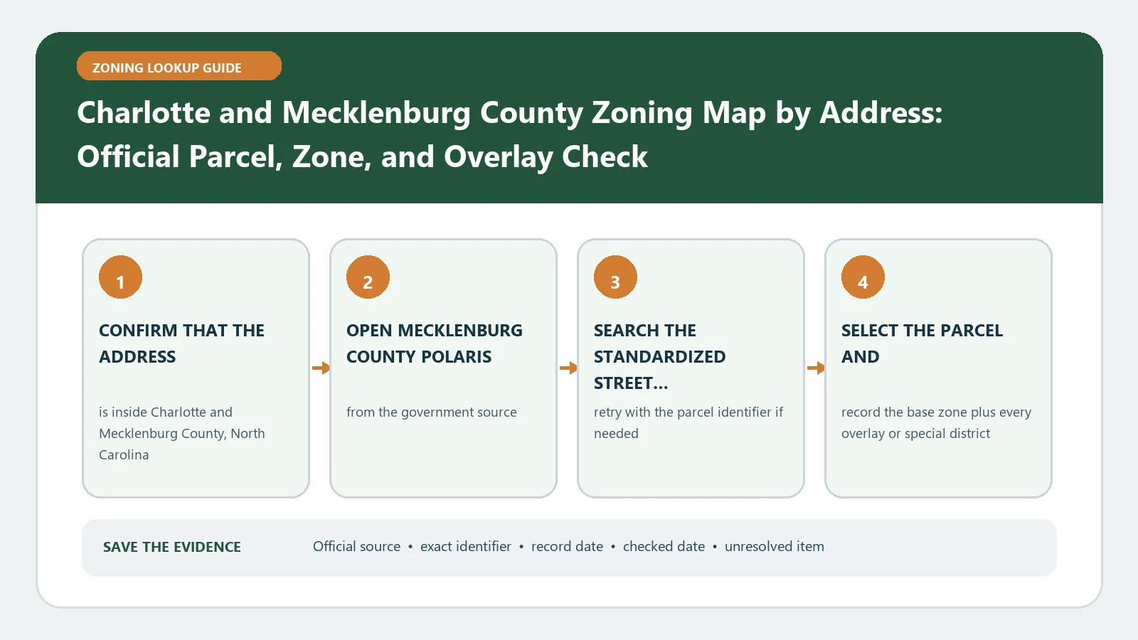
Search the address or parcel in Mecklenburg County POLARIS, but read the municipality field before opening a zoning rulebook. For a City of Charlotte parcel, preserve the tax parcel ID, current zoning classification, and every conditional, optional, overlay, or plan reference shown. Then use the current Charlotte Unified Development Ordinance together with any older approved conditional plan that remains applicable. The map can direct the check; it cannot decide the planned activity on its own.
Official route checked August 26, 2026: City of Charlotte Planning, Design and Development. Recheck POLARIS municipality, the current UDO, any preserved conditional plan, and the appropriate Zoning Administration function before reliance.
The Charlotte-Mecklenburg area requires an early jurisdiction decision because countywide property data can include parcels governed by Charlotte, unincorporated Mecklenburg County, or one of the County’s towns. A technically correct parcel match can still lead to the wrong ordinance if the municipality is ignored.
The municipality field determines which rulebook to open
The City of Charlotte zoning FAQ explains that the governing body for the jurisdiction establishes the parcel’s zoning classification. It directs users to Mecklenburg County’s GIS real-estate system and says the result includes zoning classification, parcel ID, and municipality.
Record all three fields together. If the municipality is Charlotte, continue to Charlotte’s UDO and administration routes. If POLARIS identifies a different town or another jurisdiction, stop and use that government’s current ordinance. Do not assume a Charlotte mailing address establishes City authority.
The jurisdiction decision should be visible at the top of the research record, not buried in notes. It controls the map, code, permit office, and any request for a formal interpretation.
Use POLARIS to anchor the address to one tax parcel
Open Mecklenburg County POLARIS and enter the address, parcel number, owner, or landmark supported by the search interface. Select the exact property and compare the highlighted geometry with the street, building, and neighboring parcels. Save the parcel ID shown in the result.
An address can point to a building entrance while a project involves several tax parcels. Search every parcel included in a development, parking area, access route, or purchase. If the geometry does not look right, do not accept the zoning field merely because the street text matches.
When the address produces no match, remove unit information, try the parcel ID from a tax record, and confirm spelling and jurisdiction. When several results appear, compare parcel shape and owner or situs context. The parcel-number zoning lookup guide explains why the parcel key is often more stable than an address alone.
Charlotte’s current UDO does not erase every older condition
The City’s Unified Development Ordinance page states that the UDO became effective June 1, 2023. That date is a starting point for the current City framework, not a reason to discard parcel-specific history. The City’s ordinance record for the transition states that mapped conditional or optional districts retained their designations and that approved site-plan conditions remained in effect under the zoning rules in place when those districts were adopted.
If POLARIS or another official City record shows a conditional or optional district, petition number, approved site plan, or legacy designation, preserve it. An older approved plan may contain conditions that continue to affect the parcel. Retrieve the plan and the final approval rather than translating the old label into a current conventional district and moving on.
Use the Charlotte zoning field guide to separate current UDO codes from legacy conditional records. The official City ordinance, approved plan, and administration decision remain controlling.
Read the district and every added designation in context
A Charlotte result may require more than one text path. Record the complete district label, then note any overlay, frontage, conditional plan, optional provision, or other site-specific reference displayed by the official sources. Do not shorten the string until each part is understood.
For a conventional current district, locate its use and development standards in the current UDO. For a conditional or optional result, open the approved plan and conditions as well as the relevant ordinance provisions. If an overlay applies, read its standards separately. A planning policy map or neighborhood geography should not be substituted for the official zoning classification.
The zoning overlays and special districts guide offers a general layer checklist. Apply it with Charlotte’s exact official names and documents.
Test the proposed activity against the controlling use rules
The City FAQ says that after finding the zoning classification, a user should view the zoning district table to see whether a use is permitted. That is necessary, but the proposed activity must first be classified correctly. A broad business label may hide multiple uses, accessory activities, outdoor operations, drive-through service, storage, or production.
Write a one-sentence operational description that includes the main use, accessory activity, customer pattern, outdoor area, and significant equipment. Then check:
- Whether the use appears in the controlling district table
- Whether it is permitted, conditional, limited, accessory, or absent
- Which prescribed conditions or supplemental standards apply
- Whether an approved conditional plan is more specific
- Whether a change of use, zoning use permit, sign permit, verification letter, or plan review is required
An allowed-use entry does not establish that the site design, parking, access, signage, landscaping, drainage, or building work complies. Keep use permission and development compliance as separate questions.
Make a jurisdiction-and-history decision sheet
- Search input: Full address and tax parcel ID
- Municipality: Exact jurisdiction returned by POLARIS
- Current classification: Complete district code and displayed description
- Additional designation: Overlay, frontage, optional, conditional, or plan reference
- Rulebook: Current UDO or another jurisdiction’s current ordinance
- Legacy record: Petition, approved site plan, conditions, and approval date
- Proposed activity: Operational description used for the use-table check
- Required route: Permit, plan review, verification letter, or interpretation
- Open issue: Exact conflict, missing record, or classification question
This sheet prevents two common mistakes: using Charlotte rules for a parcel governed elsewhere and treating a modern-looking district field as if it erased a conditional approval.
Route a difficult parcel to the right Charlotte function
The City Zoning Administration page lists responsibilities that include UDO enforcement, zoning use and sign permits, zoning verification letters, interpretations, inspections, and commercial site-plan review. Use that division of responsibility to frame the next step.
If the issue is a blank or contradictory map field, provide the parcel ID and screenshots. If it is the classification of a proposed use, provide the operational description and the district section reviewed. If a legacy plan is involved, attach the petition or plan reference and identify the condition that seems relevant. If substantial money or a contested entitlement depends on the result, ask which formal verification or interpretation process is appropriate.
Avoid asking only whether the project is allowed. A narrow question with the parcel, municipality, current code, legacy document, and proposed activity is more likely to produce a usable answer.
Finish with the answer the official map can actually support
POLARIS can connect an address to a tax parcel and display useful jurisdiction and zoning fields. Charlotte’s official pages can route the reader to the current UDO and the City functions responsible for permits, verification, and interpretation. None of those screens alone proves that a proposed use, building, sign, occupancy, or site plan is approved.
The final research statement should name the municipality, parcel ID, displayed district and added records, documents reviewed, access date, and unresolved official step. That is a defensible zoning check. A bare map color or copied code is not.