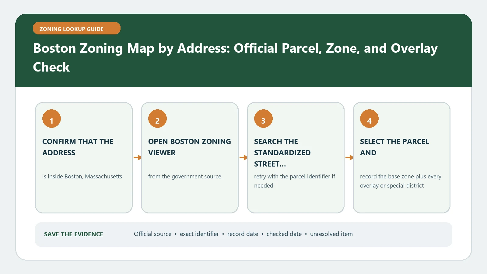
For a Boston zoning lookup, search the official viewer by address or parcel ID, select the correct assessing parcel, and read the subdistrict, map, PDA, and other regulation fields separately. Then open the controlling zoning article and signed map materials. The viewer is a research tool; it does not approve a use or replace the official zoning documents when they conflict.
Checked August 25, 2026 using the current Boston instructions and Planning Department viewer.
Anchor the search to Boston’s parcel ID
Begin with the City of Boston zoning-designation instructions. The City tells users to search by address or parcel ID and explains the information panel. Record the official address and parcel ID from the Assessing section before reading zoning. Large sites, corner properties, condominiums, and recently divided lots can make an address-only match misleading.
- Enter the complete street address and review all suggestions.
- Click the parcel polygon and compare its boundary with the intended building or lot.
- Save the parcel ID, official address, neighborhood, and date of the viewer result.
- Search again by parcel ID if the map chose a nearby feature or only part of the site.
Read each part of the Boston panel for its own purpose
The viewer can place assessing facts, zoning districts, planning areas, PDAs, Article 80 material, and non-zoning context close together. Proximity on the screen does not make every field a zoning rule. The Boston viewer field guide provides a working crosswalk, while the City sources remain controlling.
| Viewer field | Record | Do not conclude yet |
|---|---|---|
| Assessing | Parcel ID, official address, lot and current-use clues | That assessed use is lawful zoning use |
| Subdistrict or district | Exact name and linked zoning article | That the proposed activity is allowed |
| PDA | Plan number, boundary and available plan documents | That general district rules answer the PDA site |
| Other or overlay material | Historic, coastal, state or federal context shown | That every outside approval has been identified |
| Article 80 | Project-review context and linked project record | That Article 80 information changes zoning by itself |
Move from the subdistrict name to the applicable article
Open the zoning article associated with the selected parcel and find the land-use table, dimensional rules, and definitions. Translate the proposal into the terms the article uses: dwelling type, commercial function, gross floor area, height, lot coverage, parking, signs, outdoor use, or change of occupancy. Follow notes and cross-references rather than stopping at the first row that appears favorable.
District names can repeat across neighborhoods while the applicable article or map differs. Record both. Also search for variances, conditional uses, zoning relief, and previous decisions tied to the address or parcel. A prior approval may be narrow, expired, conditioned, or limited to a different layout.
Check occupancy evidence without confusing it with zoning
Assessing data can describe current use, and building records can identify an occupancy or permit history. Neither automatically establishes that the activity is permitted under today’s zoning. Compare the proposed use with the existing certificate, permits, and any zoning relief. If a tenant will change, ask whether a new occupancy, use, or sign review is triggered even when no major construction is planned.
For commercial space, note the exact floor, suite, gross area, customer activity, equipment, deliveries, hours, and exterior work. Boston use categories may not match ordinary business labels. A detailed description lets staff distinguish an allowed use from one that needs zoning relief or another board process.
Treat a PDA and an Article 80 project as different evidence
A Planned Development Area may have a development plan or amendments that establish site-specific controls. Article 80 records document development review and can explain a project’s history, but the viewer itself warns that Article 80 information is context rather than a zoning regulation. Retrieve the actual plan, amendment, zoning commission action, or board decision before relying on a project summary.
Read document dates in sequence. A base plan, later amendment, and project-specific approval may each address a different part of the site. Mark the parcel, building, phase, and condition covered by each document. If the language is unclear, ask which provision governs the current proposal rather than combining several summaries into one conclusion.
Use the zoning change and variance records guide to separate an application from a final decision and to capture approval conditions. Do not assume that a built condition proves the current legal entitlement.
If the viewer selects the wrong property or shows no result
Retry with the parcel ID, remove unit information, and click the parcel directly. Compare the official address and assessing details. If multiple zoning polygons cross the lot, record each boundary and do not collapse them into one district. For a missing or apparently stale layer, compare the Boston Zoning Viewer with the signed maps and amendments identified by the Planning Department. Its warning states that signed zoning maps control when discrepancies exist.
- Save the viewer URL or screenshot, parcel ID, selected district and lookup date.
- Name the signed map, zoning article, amendment, PDA document, or decision reviewed.
- Describe the proposed use and physical work in plain factual terms.
- Ask the appropriate City office to resolve the exact map, article, or parcel conflict.
Build a Boston record another reviewer can reproduce
Keep the parcel match, viewer fields, signed-map reference, current article, property-specific decisions, and unanswered questions together. Recheck the sources before a lease, purchase, license, or permit filing because maps and legislation may change. Neither the viewer nor this guide is a final zoning determination, legal advice, or a guarantee that a proposal will receive relief or permits.
A useful handoff also records negative findings. Note which map, article, PDA, variance, and permit systems were searched, the identifiers used, and the date. That prevents a later reviewer from mistaking a missing document for a completed search or repeating an address query that selected the wrong parcel.
If the project crosses a parcel line, prepare one evidence row for each parcel and show which building, access, parking, and outdoor areas fall on it. Ask whether the parcels are reviewed together or under separate zoning provisions.