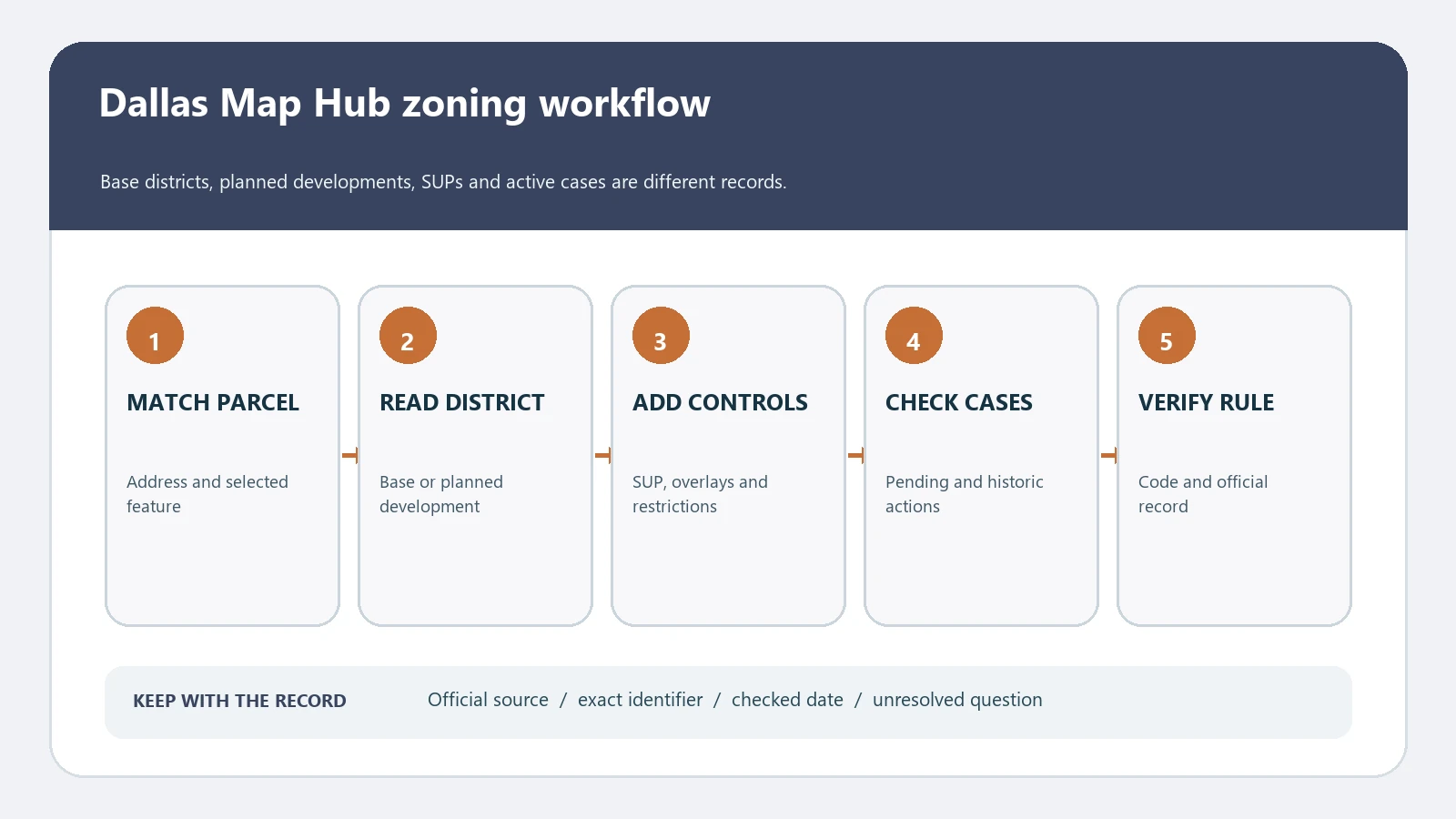
To check Dallas zoning by address, open the City of Dallas Map Hub, search the location, select the correct parcel, and inspect the Dallas Zoning & Cases map for the base district, planned development district, specific use permit, overlays, deed-restriction notation, and nearby zoning cases. Save every identifier, then read the controlling Chapter 51A text and any property-specific ordinance. The interactive map is a research tool; it is not an official zoning verification letter, permit, title report, or assurance that a proposed use is allowed.
The City’s Zoning and Pre-Development Resources page identifies the Map Hub as its primary public map resource. That page says the hub includes an address or location search and a Dallas Zoning & Cases tab with zoning plus layers such as historic areas, airport overlays, deed restrictions, and specific use permits. It also directs users who need an official zoning verification or determination letter to DallasNow. This distinction prevents a colored map result from being overstated as a formal City decision.
Confirm the parcel is inside Dallas city limits
A Dallas postal address can fall in another municipality or an unincorporated area, and county appraisal records do not replace the city’s zoning map. In the Map Hub, compare the selected location with city boundaries and the parcel or site outline. Preserve the complete street direction, unit information when relevant, and any parcel identifier displayed by the connected record. If the site includes several tracts or lots, check all of them rather than treating one point as the whole project area.
Address pins and parcel polygons answer different questions. A pin helps navigate, while the zoning layer applies across mapped geography and can change within a larger tract. If the pin falls near a zoning boundary, zoom in, inspect the selected feature details, and compare the official map with the legal description or survey used for the project. Do not estimate which district controls a strip of land from the screen alone.
| Property control | Record it | Stop if |
|---|---|---|
| City authority | City of Dallas boundary and responsible department | The address is served by a different city or county land-use authority |
| Search identity | Full address, direction, parcel or account key, and selected outline | The map highlights a neighboring lot or only one tract of a multi-tract site |
| Mapped base district | Complete district label exactly as displayed | The point sits on or very near a district boundary |
| Special identifiers | PD, SUP, overlay, historic, airport, conservation, or case number | A visible symbol has no saved legend or feature details |
| Evidence date | Official URL, checked date, and map notes | The only evidence is an undated third-party screenshot |
Use the Dallas Zoning & Cases map, not one layer
Choose the Dallas Zoning & Cases tab and inspect the selected feature details rather than relying only on fill color. Keep the base district separate from every special layer and case record. Dallas has conventional districts such as residential, office, retail, mixed-use, commercial service, and industrial districts, but a property can also sit in a planned development district with customized regulations or be affected by a specific use permit and its conditions.
- Open the City zoning-resources page and follow its current link to the primary Map Hub; this provides a stable official route if the application address changes.
- Search the complete address, choose the correct location, and compare the selected parcel or site with streets, structures, and the project boundary.
- Open Dallas Zoning & Cases and copy the base zoning district exactly, including parentheses, suffixes, numbers, and letter modifiers.
- Turn on or inspect relevant layers for planned development districts, specific use permits, historic or conservation areas, airport overlays, deed-restriction notation, and zoning cases.
- Open the details for each feature and save the ordinance, PD, SUP, or case identifier instead of describing it only by map color.
- Use the current Dallas City Code directory to find Volume III, Chapter 51A and read the district, use, development, parking, sign, landscaping, and procedural provisions relevant to the proposal.
- When the result will support a transaction, filing, or design decision, use the City’s official verification route or consult the responsible Dallas zoning staff.
If the Map Hub opens with many tabs or layers, keep a short research log. Write which tab and layer produced each fact, the exact feature label, and the date. Map pop-ups and layer names can change; a log lets another researcher reproduce the path and distinguishes an adopted zoning district from a proposed case or a contextual layer.
Separate the base district from PD and SUP rules
The City’s zoning-district index provides a useful orientation to district families and directs readers to Section 51A-4.100 for specifics. However, the City warns that its summary materials may have exceptions. The separate Dallas zoning information page says the staff-prepared charts and pages are guides and that the Dallas Development Code controls if they conflict with the adopted text. Use summaries to find the likely chapter, not as the final rule.
A planned development district is especially important because its ordinance may create a property-specific or area-specific regulatory package. Record the PD number, open the applicable ordinance and exhibits, and check later amendments. A specific use permit can authorize a particular use subject to a site plan, time limit, operating conditions, landscape plan, or other restrictions. Its presence does not mean every proposed version of that use is allowed, and an expired, amended, or differently bounded SUP may not cover the site.
| Map finding | What it may establish | Required follow-through |
|---|---|---|
| Base district | The general zoning district mapped for the location | Read the adopted Chapter 51A district provisions, use regulations, definitions, and all table notes |
| PD number | A planned development district affects the site | Open the PD ordinance, exhibits, development plan, conditions, boundaries, and amendments |
| SUP number | A specific use permit record may apply | Confirm the authorized use, exact boundary, conditions, site plan, effective term, expiration, and later action |
| Historic or conservation layer | An additional geographic control may be relevant | Read the current district ordinance, preservation rules, and review requirements |
| Airport or other overlay | Another mapped constraint may affect the property | Identify the controlling provision and the proposal feature it regulates |
| Zoning case | An application or case exists near or on the site | Check status, request, recommendation, hearings, final ordinance, and effective date |
| Deed-restriction notation | The map flags a separate private-record issue | Obtain and review the recorded document; the zoning map does not interpret title enforceability |
Match the proposed use to the Dallas code
Describe the proposed activity before looking for a favorable district. Dallas use classifications can be more specific than everyday labels such as shop, studio, warehouse, clinic, event space, restaurant, or apartment. Record the principal use, accessory uses, indoor and outdoor operations, hours, alcohol or food service, vehicle activity, floor area, number of units, and any construction or change of occupancy. Then find the adopted definition and use regulation that fits those facts.
Continue beyond whether the use appears in a chart. Check yard, lot, space, height, floor area ratio, lot coverage, parking, loading, landscaping, signage, access, residential adjacency, and use-specific provisions. A PD or SUP may replace or add requirements. Building, fire, health, transportation, floodplain, and private deed restrictions can present separate questions even when the zoning use appears permitted.
| Project question | Documents and fields to compare | Do not infer |
|---|---|---|
| Can this business operate here? | Use definition, district status, PD/SUP text, site plan, conditions, and certificates | That a similar nearby business proves present permission |
| Can the building be enlarged? | Setbacks, height, FAR, coverage, parking, landscape, overlay, PD plan, and easements | That unused land on the lot is buildable |
| Can housing be added? | Dwelling type, density, unit limits, parking, PD provisions, occupancy and permit history | That appraisal records establish lawful units or zoning capacity |
| Is a zoning case already approved? | Case status, hearing record, adopted ordinance, mayoral action, effective date, and map update | That an intake log or proposed case changed the law |
| Does an SUP cover the proposal? | Use, operator if relevant, term, conditions, plan, boundary, amendments, and compliance | That the SUP label is transferable to every use or site layout |
Know when a formal Dallas answer is needed
For early research, the map and code help frame the issue. For lender, investor, closing, lease, permit, or legal reliance, use the City’s current formal route. The zoning-resources page directs official zoning verification or determination letter requests to the Building module in DallasNow. Confirm the exact product, supporting documents, fee, response format, and current processing instructions before applying, because portal procedures can change.
A verification letter and a project approval are not necessarily the same thing. Ask what the requested letter will state and whether a separate zoning review, certificate, permit, interpretation, or land-use application is needed for the proposed activity. If a PD ordinance, SUP condition, boundary, deed restriction, or nonconforming-use history is disputed, obtain qualified local advice rather than compressing the issue into a map label.
Build a Dallas zoning evidence packet
Keep the exact address and parcel identity, city jurisdiction, base district, every PD and SUP number, overlay or district, deed-restriction notation, related case identifiers, adopted ordinance links, code provisions, relevant plans, formal correspondence, and date checked. State the project facts beside the rules being tested. Separate adopted law from staff summaries, pending applications, private restrictions, and your own interpretation.
When an address result is uncertain, use the zoning lookup by address workflow and confirm each tract with the parcel-number zoning guide. The overlays and special districts guide helps organize PD, SUP, and other added controls, while the zoning code versus zoning map guide explains why a map label must be traced to adopted text.
Questions Dallas property researchers ask
Is the Dallas Map Hub an official zoning letter?
No. It is the City’s primary public map resource for research. The City provides a separate DallasNow route for an official zoning verification or determination letter. Confirm which formal response your transaction or application requires.
Does a PD number replace the base zoning code?
A PD ordinance can establish customized regulations and may incorporate, modify, or reference base-district rules. Read the complete PD ordinance, exhibits, plans, amendments, and the current code rather than treating the number as a complete answer.
Does an SUP mean the listed use is allowed forever?
Not necessarily. An SUP can have a defined boundary, site plan, conditions, and time period. Check the adopted ordinance and subsequent actions for the exact property and proposal.
Can a pending zoning case be reported as current zoning?
No. Record it as a case and verify its request and status. Current zoning changes only through the applicable adopted and effective action, not because an application or hearing appears on the map.
Dallas maps, ordinances, case records, portal routes, and agency procedures can change. Verify the live official record before relying on a result. Last reviewed August 6, 2026.