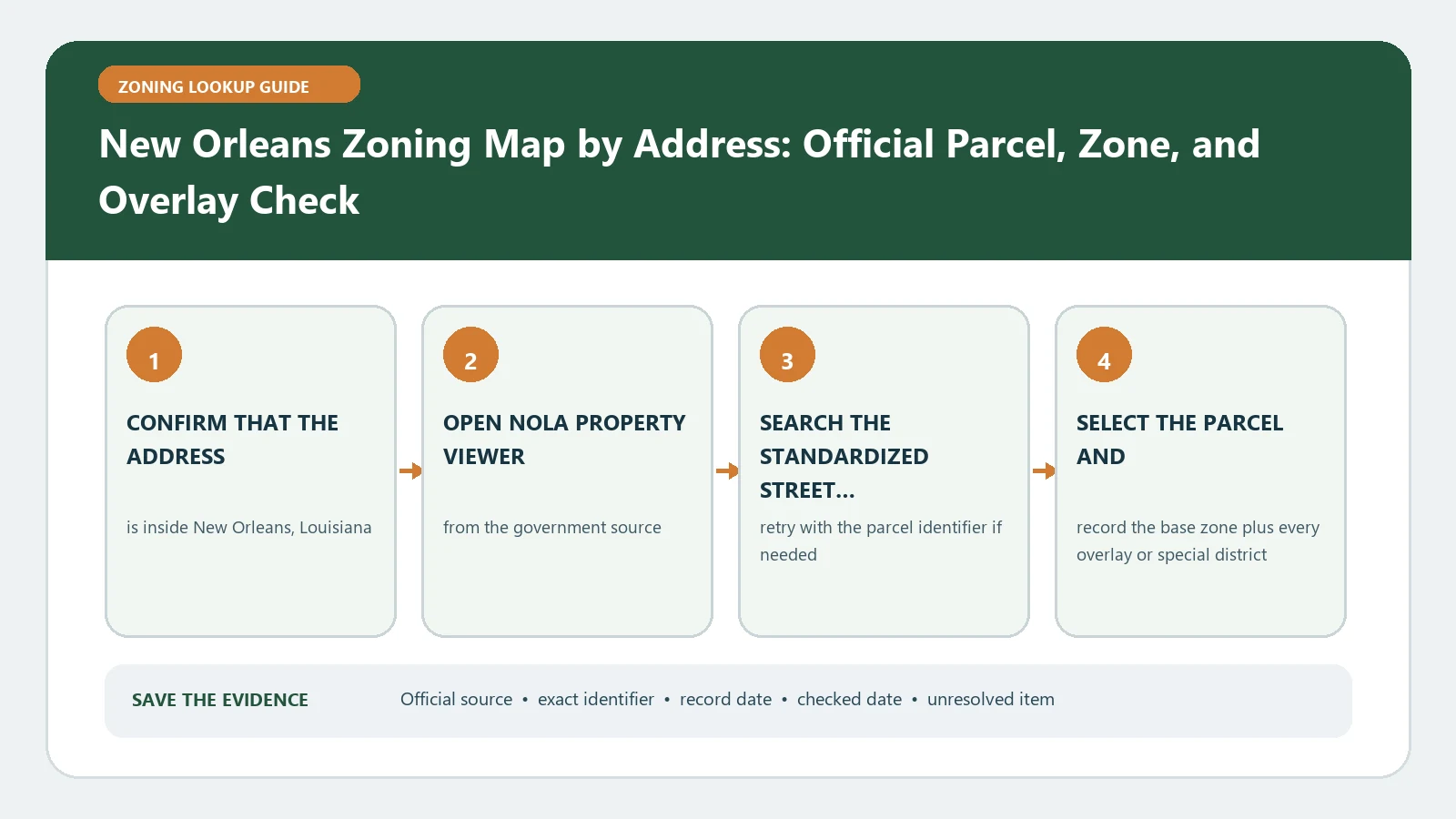
Search the address in the City of New Orleans Property Viewer, select the actual parcel, and record the base zoning district together with every overlay and site-specific zoning action. Then open the matching article in the Comprehensive Zoning Ordinance. The viewer locates rules; it does not approve a proposed use.
New Orleans parcels can carry more than one relevant layer, and nearby historic, riverfront, or mixed-use areas make color-only reading especially risky. Build a layer stack for the parcel before deciding what the property can do. The City Planning Commission explains the official viewer scope on its Property Viewer and Zoning Data page, including zoning boundaries and approved site-specific actions.
First confirm that City zoning owns the address
Use the returned parcel boundary and municipal context, not a mailing city alone. An address that sounds like New Orleans may sit outside the City system, while a large development may include several tax parcels. Save the normalized address, parcel identifier, and the outline of the selected feature. If two parcels highlight, handle them separately even when one building or proposed purchase covers both.
Do not start with the future land-use map or an old neighborhood plan. Those sources can describe policy direction without replacing the current zoning district. The present check owns one question: which adopted zoning and parcel-specific actions the official City tools associate with this parcel now.
Build the parcel layer stack in Property Viewer
- Select the parcel and transcribe the base zoning district exactly as displayed.
- Record every overlay, special district, historic or conservation context exposed for that location.
- Look for conditional uses, exceptional uses, planned development districts, or other site-specific actions.
- Preserve the case or ordinance reference instead of reducing it to a generic approved label.
- Note the viewer access date and any metadata date shown for the layer.
The City states that Property Viewer includes approved site-specific zoning actions. That matters because an action may carry conditions that the base district table never shows. Open the linked material when available and identify the affected property, authorized use, conditions, and adoption date. A symbol near the parcel is not enough; confirm the selected feature actually intersects the lot.
Read the CZO only after the map fields are fixed
Use the recorded district code to navigate the CZO article for that district. Check the permitted and conditional use framework, then follow the standards that apply to the proposed activity. Separate the use question from physical standards such as yards, height, parking, loading, landscape, signs, and use-specific rules. An overlay article may add requirements even when the base district permits the activity.
Write the project in concrete terms before interpreting the ordinance: for example, a two-unit conversion, a restaurant with outdoor service, a short-term rental, a warehouse expansion, or a change in occupancy. Without that description, the code search tends to collect interesting provisions without reaching a decision. If the use name is uncertain, preserve the everyday description and ask the City which defined use applies.
Keep future land use and current zoning in different columns
| Layer or record | What it contributes | What it cannot establish alone |
|---|---|---|
| Base zoning district | Starting district for the parcel | Approval of a particular operation or building plan |
| Overlay or special district | Additional place-specific regulation | The complete set of standards without reading its CZO article |
| Site-specific zoning action | Parcel decision, case, or ordinance trail | That every current proposal fits the earlier approval |
| Future land-use designation | Long-range policy context | The controlling present zoning classification |
| Historic or conservation layer | A route to another review body or standard | Automatic denial or approval of the project |
Recover a parcel when the address search goes empty
If Property Viewer returns nothing, simplify the address, remove the unit, try the parcel identifier, and browse to the location from a known intersection. Confirm that the street name and directional match the City format. A recently assigned address may not yet be the best key. Record each attempt rather than repeating variations from memory, then use the City Planning source page to reach the current viewer again.
When the viewer, CZO, and a parcel-specific ordinance appear inconsistent, compare their functions and dates. The ordinance may describe conditions for one action; the map may show the resulting classification; the CZO supplies generally applicable rules. Keep all three citations and ask which record controls the exact proposal. Never average conflicting official sources into a homemade zoning conclusion.
Hand the next reviewer a parcel question, not a map screenshot
A useful handoff contains the address, parcel, base district, overlays, site-specific actions, relevant CZO articles, map date, and one unresolved question. Attach the proposed use and basic project dimensions. That packet lets a planner, architect, lender, or buyer see where interpretation begins and prevents a screenshot from circulating without the parcel and layer context that made it meaningful.
The lookup does not prove legal establishment of an existing New Orleans use, continuing force of a past approval, or authority to begin new work. Permit history, nonconforming-use evidence, building rules, and another reviewing body may answer those questions. Add them only when the project actually needs them, and keep their records outside the zoning-layer stack. State which separate record remains outstanding.
Before a deadline, compare the saved parcel outline with the current viewer one more time. Street renaming, parcel consolidation, a newly published action, or a corrected layer can alter the evidence even when the building has not moved. Label the older capture as historical rather than overwriting it; a dated difference may explain why two professionals reached different starting points.
Use the internal New Orleans layer field guide when a Property Viewer label is unclear. The address lookup workflow covers identifier discipline, while the code-versus-map guide explains why those records perform different jobs. None of them replaces a City record or interpretation.
This workflow and its New Orleans sources were reviewed August 26, 2026. Check Property Viewer and the live CZO again after a zoning action, map revision, or project change and immediately before relying on the result.