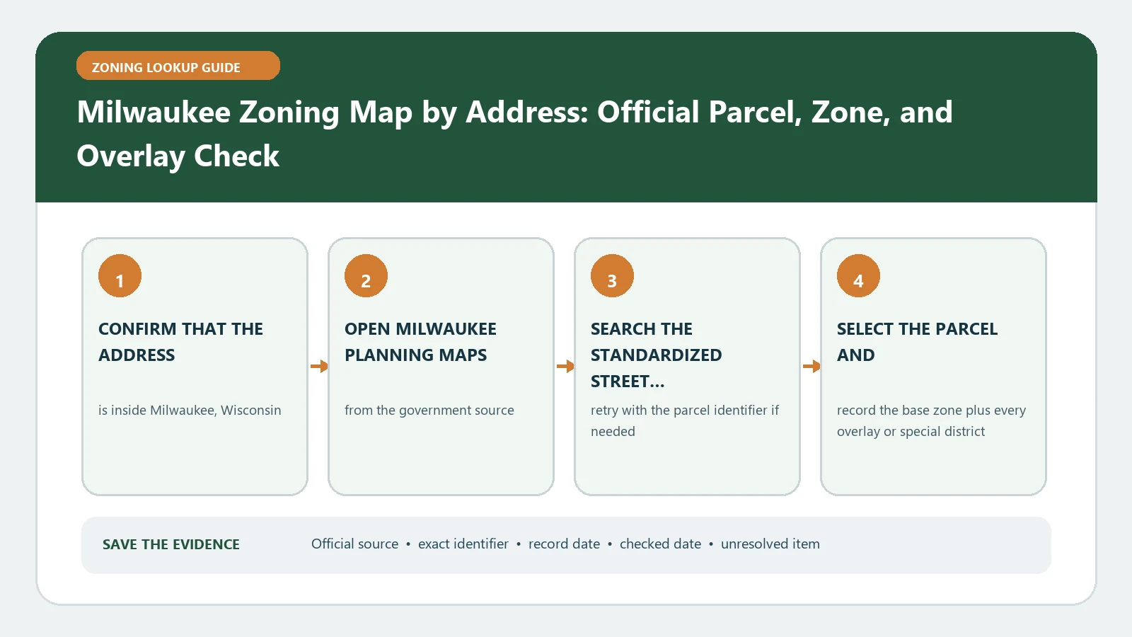
For a Milwaukee address, use two official views for different jobs: the zoning map to inspect district geometry and My Milwaukee Home to retrieve the address-based Special Interest record. The Department of City Development zoning-map page links both routes. Match the parcel and district between them before opening the code; disagreement is a reason to preserve evidence and ask the city, not to choose whichever screen is easier.
Official route checked August 26, 2026: City of Milwaukee Department of City Development. Recheck the current Milwaukee map application, Special Interest result, code chapter, and independent design-review path before project reliance.
Assign one job to each official application
Use the interactive map for spatial questions: which parcel was selected, where the district boundary runs, and which mapped overlay or special area intersects the property. Use My Milwaukee Home for the city’s address-based property report and open its Special Interest tab for zoning-related entries. Save both URLs, the address entered, the parcel identity shown, and the lookup time. One application may expose context that the other does not. Neither should be treated as a substitute for the ordinance text or a parcel-specific determination by the Department of Neighborhood Services.
| Official view | Best use | Evidence to retain |
|---|---|---|
| Interactive zoning map | Parcel geometry, district boundary, neighboring context, mapped special areas | Selected polygon, layer names, district, scale, and screenshot |
| My Milwaukee Home | Address property profile and Special Interest entries | Normalized address, returned property identity, entries, and lookup time |
| Zoning Code page | Current chapter and rule text | Chapter, section, effective update, and interpreted fact |
Confirm the parcel before trusting the district label
Search the complete address in My Milwaukee Home, verify the returned property, and note the identifier available on the report. Then open the current map application from the DCD page and select the same parcel. Compare the polygon with the building footprint and nearby lot lines. If the project covers multiple tax parcels, repeat the check. A search marker on a street or building does not establish that every part of the site lies in the same district, especially near a boundary or special district.
- Enter the address without an apartment or suite unless the official tool requires it.
- Open Special Interest and copy zoning-related entries exactly.
- Select the same property polygon in the zoning map.
- Record the full base district and every visible overlay or special area.
- Save lookup dates, screenshots, layer names, and any mismatch between applications.
Route the district to the correct ordinance chapter
The official Milwaukee Zoning Code page organizes general administration and definitions separately from residential, commercial, downtown, industrial, and special-district chapters. Preserve the entire district designation, identify its family, then open both the district chapter and applicable general provisions. A district table may answer the initial use question while other sections control parking, signs, dimensional standards, or approval procedure. Record the proposed activity in concrete facts rather than searching the code for a broad business label.
| Code route | Question to test | Do not assume |
|---|---|---|
| District-family chapter | How the proposed use is classified and reviewed | A broad category captures every operational detail |
| General provisions | Which citywide standards and procedures also apply | The district table is self-contained |
| Overlay or floodplain chapter | Which supplemental constraints intersect the parcel | Base zoning removes the supplemental review |
| Independent design review | Whether a historic or named design district has its own process | A zoning-map return settles design approval |
Check design review outside the ordinary district chain
Milwaukee identifies design-review contexts that can operate independently from the basic zoning lookup, including local historic review and named design districts. If the property appears in or near one of those areas, open the responsible program page and verify the parcel boundary and proposed work. Exterior alterations, signs, demolition, or new construction can trigger a review that a simple permitted-use reading does not answer. Keep the design body, boundary source, application trigger, and decision record in a separate worksheet row.
Make a cross-application evidence card
The evidence card should show the address, parcel identity, map district, Special Interest entries, ordinance chapters, overlay or design review, and lookup dates in one place. Use the address lookup method to normalize the input and the map-and-code comparison to keep each source in its proper role. Add the proposed use, floor area, occupancy, outdoor activity, parking, signs, and construction so a reviewer can connect records with the actual decision.
- Address and parcel identity agreed across both city applications
- Full district value and selected boundary capture
- Special Interest entries copied with the report date
- District-family and general code chapters opened
- Overlay, floodplain, historic, or design-review branch checked
- Proposed activity and unresolved city question recorded
Resolve an application mismatch without erasing it
If My Milwaukee Home returns no property, simplify the address, remove unit information, and confirm the municipal address through another official city record. If the property report and map show different district information, save both results with timestamps and parcel identifiers. Check whether one source is an address profile and the other a spatial layer, whether a recent map amendment is involved, and whether the selected geometries match. If the map page is being revised or a direct application link changes, return through the DCD landing page rather than relying on an old bookmark.
For this property identity, what is the complete current zoning district, do the map and Special Interest record refer to the same parcel, and which overlay, floodplain, historic, or design-review rules must also be checked?
Provide the address, parcel key, both captures, district text, code sections, lookup dates, and proposed activity with that request. Ask the responsible Milwaukee office to identify the official record and any separate review, not to validate an unsupported conclusion. Preserve the response and the facts submitted because a different use or design can require a different determination.
The map is an index, not a permit
A consistent two-application result is useful evidence of the mapped zoning record. It does not establish survey lines, title, private covenants, environmental compliance, building-code approval, lawful occupancy, license eligibility, or permit issuance. Use the official map and property report to find the ordinance and responsible review body. Obtain written clarification before a purchase, lease, financing commitment, or design depends on an ambiguous boundary or conflicting record.