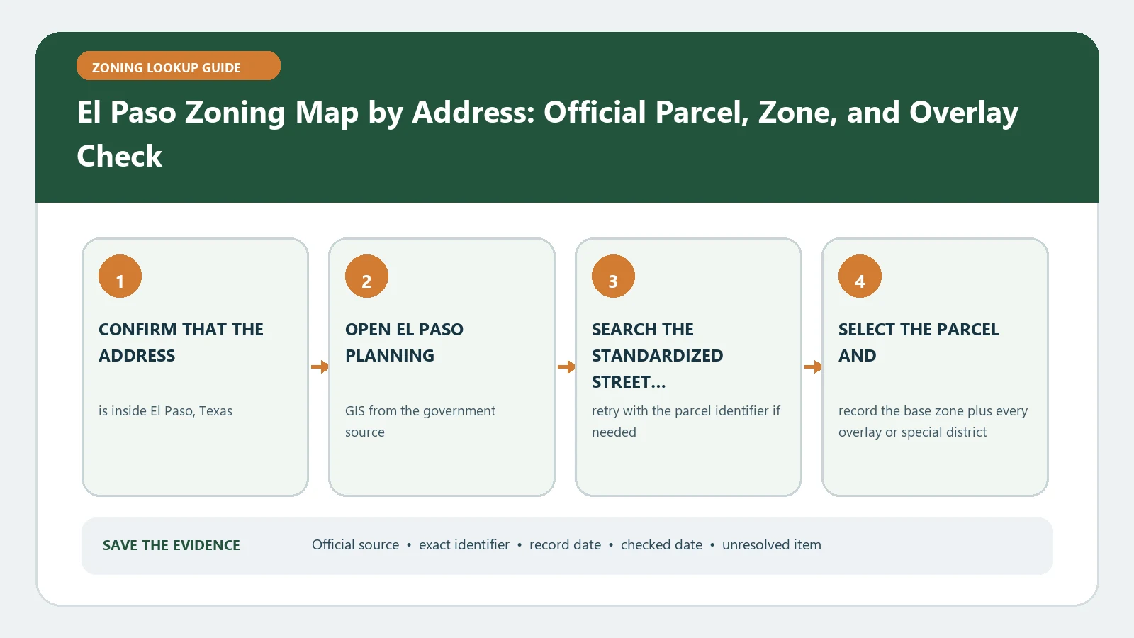
For an El Paso zoning map search, first confirm whether the parcel is inside the City’s zoning jurisdiction; then translate the displayed district through the exact Title 20 appendix that answers the proposed use or physical standard. Start with the full address in the City planning map, select the property, and keep the city-limit or ETJ observation beside the zoning result.
Reviewed August 26, 2026 against El Paso's planning map, Title 20 guidance, and the official planning-layer service.
Create a jurisdiction-and-district ticket
- Full site address and parcel identifier from the selected polygon
- City-limit, extraterritorial, or other boundary observation
- Complete zoning district label and any overlay or NCO label
- Map layer name and checked date
- Exact proposed activity and the physical change being considered
The official Planning Zoning service separates planning and zoning layers, including legal-nonconforming, City/ETJ, neighborhood-conservation overlay, and future-land-use information. Keep those labels in separate fields. A future-land-use designation or ETJ boundary is not a substitute for a current City zoning district.
Send the district to the correct Title 20 question
| Question | Title 20 route | Output to record |
|---|---|---|
| May the activity occur? | Permissible-use table for the exact district/use | Allowed, special/conditional, accessory, prohibited, or unresolved |
| What lot and building limits apply? | Dimensional-standards appendix plus district-specific provisions | Lot area, width, setbacks, height, coverage or other listed standard |
| How much parking or loading is required? | Off-street parking/loading provisions | Use category, calculation inputs, ratio, adjustments, and exceptions |
| Does an overlay modify the result? | NCO or named overlay document | Overlay boundary, added standard, and controlling section |
The City’s Planning and Inspections FAQ points users from the zoning district to Title 20 permissible-use and dimensional tables. Quote the table row and section that match the exact use. Do not answer “commercial,” “residential,” or “industrial” from the district family alone.
Work one example without inventing a conclusion
Suppose the proposed activity combines a retail use, outdoor display, and a new sign. Treat those as three checks: the principal use in the permissible-use table, the outdoor component under its own standards, and the sign under the applicable sign rules. Record a separate result for each. If any activity lacks a clear table match, the combined project remains unresolved even if the main retail use appears permitted.
Do not erase a legal-nonconforming question
A legal-nonconforming layer or an older use at the site is not another district classification. Identify the claimed use or structure, the date it was established, the permits and occupancy evidence, later discontinuance or expansion, and the code provisions governing continuation. The current zoning map cannot by itself establish that historical right.
Repair five lookup failures
- No address match: remove unit text and search the root address or parcel identifier.
- Parcel appears outside City jurisdiction: identify the governing authority before opening Title 20.
- District boundary crosses the lot: save the parcel-scale view and request parcel-specific staff confirmation.
- Use name is absent from the table: test a precise code definition and ask staff to classify the activity.
- Overlay or nonconforming record lacks detail: retain its exact label and obtain the controlling document or case file.
Return an El Paso rule-path answer
The deliverable is a rule path: jurisdiction, selected parcel, current district, proposed activity, Title 20 table row, dimensional and parking sections, overlay document, and open historical-right question. Use Zoning District Meaning only for vocabulary, Setback Rules Source Check for the dimensional calculation, and Legal Nonconforming Use Records for the evidence timeline. A district label without those links is only the first line of the El Paso answer.
Classify the activity before reading a permissible-use row
Describe what happens on the site: the goods or service, customers or residents, indoor and outdoor areas, storage, vehicles, hours, accessory activity, and any production or repair. Then match that description to a Title 20 definition. A marketing label can send the review to the wrong row.
| Activity fact | Code-classification use | Open question |
|---|---|---|
| Principal service or goods | Select the closest defined principal use | Does staff classify a mixed activity differently? |
| Outdoor display/storage | Check separate outdoor standards | Is it accessory, limited, or independently regulated? |
| Vehicles and deliveries | Apply parking, loading, stacking, or fleet provisions | Which calculation inputs control? |
| Existing structure/use | Compare current rules with permit and nonconforming history | Was the claimed right established and maintained? |
For an NCO or other named overlay, capture the exact boundary and adopted text. Read its added design, use, setback, or procedural terms beside the base district. An overlay observation does not mean that every provision applies to every parcel inside the broader neighborhood; use the adopted scope.
If the use table, definition, and staff description do not align, retain the operational facts and ask one classification question. Do not edit the facts to fit an easier row. The response should identify the definition or table entry used and whether another approval, parking calculation, or site-plan review remains.
Make the El Paso dimensional calculation auditable
For a setback, height, lot-area, coverage, or parking question, record the Title 20 section, district, use classification, parcel dimensions used, unit of measure, and every adjustment or exception applied. Keep measured facts from the survey or site plan separate from values estimated on the public map.
| Calculation line | Source | Value to retain |
|---|---|---|
| Rule | Title 20 table or section | Required ratio, distance, maximum, or minimum |
| Property fact | Survey, plat, approved plan, or verified parcel record | Actual dimension or count |
| Adjustment | Named exception, overlay, or approved case | Exact condition and document |
| Result | Arithmetic plus unresolved assumptions | Complies on stated inputs / does not / needs staff interpretation |
A map-measured line can help frame the question but should not be represented as a surveyed distance. If the outcome turns on a few feet, a lot line, or an easement, obtain the appropriate property record and ask the responsible reviewer which measurement controls.