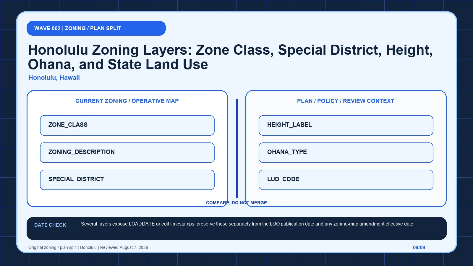
HoLIS starts the Honolulu lookup with the county zone class, while state land-use and community labels provide a different kind of context. Keep the special district, mapped height, and ohana record attached to their own rules before opening the Land Use Ordinance. It is not an approval.
Last checked: August 7, 2026.
Begin the county-zone-to-LUO route at Honolulu Land Information System, which supplies official parcel and GIS entry. Cross-check the selected geometry through Honolulu zoning-regulation feature service, the route used for exact field and layer schema. Before copying ZONE_CLASS, verify honolulugis ArcGIS publisher and Zoning_Reg service; those markers keep the HoLIS layer stack tied to the intended jurisdiction and record period.
ZONE_CLASS answers a different question from LUD_CODE
Honolulu zoning requires a vertical stack of county, state, and plan records. ZONE_CLASS provides the county base class, with examples such as AG-2, I-1, or R-5, and ZONING_DESCRIPTION expands the symbol. SPECIAL_DISTRICT can add Chinatown, Diamond Head, or Haleiwa provisions. HEIGHT_LABEL supplies a separate mapped height expression, including conditional-looking values such as 25 feet (150 feet), which cannot be shortened safely. OHANA_TYPE is a separate program or history layer rather than base zoning. LUD_CODE represents the State Land Use District and must not be reported as the county zone. community_name points to a sustainable-communities plan area such as NORTH SHORE, CENTRAL OAHU, or WAIANAE. Each level answers a different question; the final record must preserve their hierarchy instead of merging all codes into one designation.
Special districts and height labels sit between zoning and design review
| Returned local record | Record to compare | When to stop | Next decision |
|---|---|---|---|
| ZONE_CLASS returns AG-2; I-1; R-5 | Compare with ZONING_DESCRIPTION, which expands the base class | Stop the county-zone-to-LUO route if ZONING_DESCRIPTION is missing, dated differently, or points to another record. | Continue through the HoLIS layer stack: Open the matching LUO district article. Then test whether ZONING_DESCRIPTION changes that route. |
| ZONING_DESCRIPTION returns AG-2 General Agriculture District | Compare with SPECIAL_DISTRICT, which names a special-district overlay | Stop the county-zone-to-LUO route if SPECIAL_DISTRICT is missing, dated differently, or points to another record. | Continue through the HoLIS layer stack: Use it to verify the symbol, not as a complete use determination. Then test whether SPECIAL_DISTRICT changes that route. |
| SPECIAL_DISTRICT returns Chinatown; Diamond Head; Haleiwa Special District | Compare with HEIGHT_LABEL, which returns the mapped height label | Stop the county-zone-to-LUO route if HEIGHT_LABEL is missing, dated differently, or points to another record. | Continue through the HoLIS layer stack: Read the named special-district provisions with the base class. Then test whether HEIGHT_LABEL changes that route. |
| HEIGHT_LABEL returns 40 feet; 25 feet (150 feet); 150 feet | Compare with OHANA_TYPE, which stores the Ohana layer type code | Stop the county-zone-to-LUO route if OHANA_TYPE is missing, dated differently, or points to another record. | Continue through the HoLIS layer stack: Check height-map notes and exceptions before applying the number. Then test whether OHANA_TYPE changes that route. |
| OHANA_TYPE returns 4; 5 | Compare with LUD_CODE, which stores the State Land Use District code | Stop the county-zone-to-LUO route if LUD_CODE is missing, dated differently, or points to another record. | Continue through the HoLIS layer stack: Treat it as a separate mapped program/history layer, not a base zoning code. Then test whether LUD_CODE changes that route. |
| LUD_CODE returns 1; 3; 4 | Compare with community_name, which names the sustainable-communities plan area | Stop the county-zone-to-LUO route if community_name is missing, dated differently, or points to another record. | Continue through the HoLIS layer stack: State land-use classification and county zoning are separate controls. Then test whether community_name changes that route. |
| community_name returns NORTH SHORE; CENTRAL OAHU; WAIANAE | Compare with ZONE_CLASS, which stores the base zoning class | Stop the county-zone-to-LUO route if ZONE_CLASS is missing, dated differently, or points to another record. | Continue through the HoLIS layer stack: Open the linked plan without replacing the LUO district analysis. Then test whether ZONE_CLASS changes that route. |
Test a Honolulu parcel where an ohana type meets a plan designation
Assume a hypothetical Honolulu parcel returns ZONE_CLASS AG-2, ZONING_DESCRIPTION AG-2 General Agriculture District, SPECIAL_DISTRICT Haleiwa Special District, HEIGHT_LABEL 25 feet (150 feet), LUD_CODE 3, and community_name NORTH SHORE. AG-2 is used to open the matching Land Use Ordinance district article, while the Haleiwa provisions are reviewed in addition to that base class. The full height label is copied, including both numbers and parentheses, and the height-map notes and exceptions are opened before either number is applied. LUD_CODE 3 remains a state classification and is not relabeled AG-2. NORTH SHORE directs the user to the linked plan but does not replace the LUO analysis. If OHANA_TYPE also returns 4 or 5, it is recorded in its separate layer role. The hypothetical yields a stack, not a single permission code.
The HoLIS labels that belong to code, plan, and community context
The HoLIS layer stack table keeps each returned label beside its displayed scope and the separate legal record still waiting to be opened. Its first checkpoint is ZONE_CLASS, which may appear as AG-2; I-1; R-5; from there, Open the matching LUO district article. A blank in the county-zone-to-LUO route stays visible so another reader can distinguish an empty official return from an unexamined field.
| Local field, layer, or record | What it does | Displayed value or scope | Next code or record check | Official page |
|---|---|---|---|---|
| ZONE_CLASS field | stores the base zoning class | AG-2; I-1; R-5 | Open the matching LUO district article. | Open exact record |
| ZONING_DESCRIPTION field | expands the base class | AG-2 General Agriculture District | Use it to verify the symbol, not as a complete use determination. | Open exact record |
| SPECIAL_DISTRICT field | names a special-district overlay | Chinatown; Diamond Head; Haleiwa Special District | Read the named special-district provisions with the base class. | Open exact record |
| HEIGHT_LABEL field | returns the mapped height label | 40 feet; 25 feet (150 feet); 150 feet | Check height-map notes and exceptions before applying the number. | Open exact record |
| OHANA_TYPE field | stores the Ohana layer type code | 4; 5 | Treat it as a separate mapped program/history layer, not a base zoning code. | Open exact record |
| LUD_CODE field | stores the State Land Use District code | 1; 3; 4 | State land-use classification and county zoning are separate controls. | Open exact record |
| community_name field | names the sustainable-communities plan area | NORTH SHORE; CENTRAL OAHU; WAIANAE | Open the linked plan without replacing the LUO district analysis. | Open exact record |
Read the zoning-regulation service before opening the LUO
- Open the HoLIS layer stack; fix the parcel, boundary, jurisdiction, and official key before reading thematic records.
- Start the county-zone-to-LUO route by copying ZONE_CLASS exactly as returned, including AG-2; I-1; R-5.
- Keep ZONING_DESCRIPTION in a second HoLIS layer stack worksheet field because it expands the base class.
- Test SPECIAL_DISTRICT independently, then mark its value, service layer, or documented blank in the county-zone-to-LUO route.
- Give HEIGHT_LABEL and every later item a separate row; never compress history, plans, and overlays into the HoLIS layer stack result.
- Attach the HoLIS layer stack lookup time to ZONE_CLASS, while preserving this separate currency clue: Several layers expose LOADDATE or edit timestamps; preserve those separately from the LUO publication date and any zoning-map amendment effective date.
- If ZONE_CLASS and ZONING_DESCRIPTION conflict, send the county-zone-to-LUO route to Honolulu Land Information System and ask which special, height, and state-land-use rules remain separate.
The HoLIS layer stack worksheet is complete only when another reader can reproduce the county-zone-to-LUO route from the same parcel key and official pages. Keep each source's legal role and effective date apart, then record which special, height, and state-land-use rules remain separate as unresolved instead of selecting the most convenient output. The local currency note remains part of that audit trail: Several layers expose LOADDATE or edit timestamps; preserve those separately from the LUO publication date and any zoning-map amendment effective date.
A LOADDATE cannot turn a policy layer into present zoning
| Local situation | What went wrong | What to retain | How to resolve it |
|---|---|---|---|
| Scenario 1 | The State Land Use District code is reported as the Honolulu county zoning class. | Preserve SPECIAL_DISTRICT, the selected geometry, and both timestamps from the HoLIS layer stack check. | Use Honolulu Land Information System to settle which special, height, and state-land-use rules remain separate; then Read the named special-district provisions with the base class. |
| Scenario 2 | A mapped 25-foot (150-foot) height label is shortened to one number without reading the height-map condition. | Preserve HEIGHT_LABEL, the selected geometry, and both timestamps from the HoLIS layer stack check. | Use Honolulu Land Information System to settle which special, height, and state-land-use rules remain separate; then Check height-map notes and exceptions before applying the number. |
When LUD_CODE 1, 3, or 4 was reported as the Honolulu county zoning class, restore the State Land Use District label and retrieve ZONE_CLASS independently. When HEIGHT_LABEL 25 feet (150 feet) was shortened to 25 or 150, restore the complete string and open the height-map notes and exceptions before drawing a conclusion. Also retain SPECIAL_DISTRICT and community_name in separate columns so a plan area or special district cannot disappear behind AG-2, I-1, or R-5. A focused DPP question is: For this parcel, which ZONE_CLASS, SPECIAL_DISTRICT, and full HEIGHT_LABEL are currently mapped, and what ordinance or map note explains the parenthetical height? Include LUD_CODE only as the separate state classification and attach all query and effective dates. That structure asks the agency to resolve the exact vertical stack, not to approve a project.
Honolulu, Hawaii date check: Several layers expose LOADDATE or edit timestamps; preserve those separately from the LUO publication date and any zoning-map amendment effective date.
The Honolulu Land Information System provides the official parcel and GIS entry, the Zoning_Reg feature service defines the exact fields and layers, and the Department of Planning and Permitting's Land Use Ordinance supplies the controlling county text. Several layers can expose LOADDATE or edit timestamps, but those are dataset clues. Keep them separate from the LUO publication date and from the effective date of a zoning-map amendment. The state land-use layer and sustainable-communities plan layer also have different institutional scopes from county zoning. A current service response can accurately report LUD_CODE or community_name without deciding county use permissions. Honolulu currency therefore requires the query date for each layer plus the operative date of the county, state, special-district, height-map, or plan record actually used in the analysis.
HoLIS, the feature service, and the LUO each close a different gap
| Official page | What to check there | Local coverage shown |
|---|---|---|
| Honolulu Land Information System | official parcel and GIS entry | Honolulu GIS portal |
| Honolulu zoning-regulation feature service | exact field and layer schema | honolulugis-published service |
| Honolulu Land Use Ordinance | controlling zoning text | Official Honolulu DPP PDF |
How should ZONE_CLASS be checked in Honolulu, Hawaii?
Open the official ZONE_CLASS record and capture the value inside the HoLIS layer stack. That record shows how ZONE_CLASS stores the base zoning class; one displayed form is AG-2; I-1; R-5. Place the copied value in the county-zone-to-LUO route, then follow its separate rule route: Open the matching LUO district article.
How should ZONING_DESCRIPTION be checked in Honolulu, Hawaii?
Open the official ZONING_DESCRIPTION record and capture the value inside the HoLIS layer stack. That record shows how ZONING_DESCRIPTION expands the base class; one displayed form is AG-2 General Agriculture District. Place the copied value in the county-zone-to-LUO route, then follow its separate rule route: Use it to verify the symbol, not as a complete use determination.
How should SPECIAL_DISTRICT be checked in Honolulu, Hawaii?
Open the official SPECIAL_DISTRICT record and capture the value inside the HoLIS layer stack. That record shows how SPECIAL_DISTRICT names a special-district overlay; one displayed form is Chinatown; Diamond Head; Haleiwa Special District. Place the copied value in the county-zone-to-LUO route, then follow its separate rule route: Read the named special-district provisions with the base class.
Evidence to retain when a special district crosses the parcel
- Selected parcel key, geometry, and responsible jurisdiction
- Every returned value from the local field table
- Page titles, URLs, lookup times, and update clues
- Opened code, plan, case, ordinance, or metadata records
- Unresolved blanks, boundary splits, dates, and competing outputs
- Proposed activity stated in code-relevant facts
- Agency contact, narrow question, reply date, and limits
The HoLIS layer stack does not decide title, survey boundaries, private restrictions, vested rights, building-code compliance, utilities, licensing, or permit issuance. Request a written response when the county-zone-to-LUO route leaves competing official results or when substantial reliance is planned. A useful request to Honolulu Land Information System identifies the parcel, quotes ZONE_CLASS and ZONING_DESCRIPTION, gives their source dates, and asks which special, height, and state-land-use rules remain separate.
Use honolulu zoning map by address, zoning code vs zoning map, zoning overlays special districts only where those methods clarify the county-zone-to-LUO route. The HoLIS layer stack evidence linked for ZONE_CLASS and ZONING_DESCRIPTION remains the local starting point.
Reviewed August 7, 2026. Recheck the HoLIS layer stack, its cited ordinance, and the agency procedure before relying on the saved worksheet.