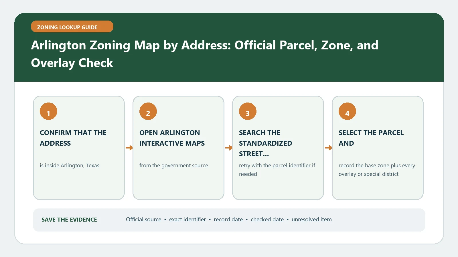
For an Arlington zoning map lookup, select the exact property in Arlington Maps Online, record its zoning detail and parcel identity, then use the current Unified Development Code to test the proposed use. A district label by itself does not authorize construction, occupancy, or a land-use change.
The useful result is not the color under a map pin. It is a matched parcel record that can be traced to the City code and, when present, a zoning case, specific use permit, or planning overlay. Save the street address exactly as entered, the parcel selected, the map date or access date, and the use you are investigating. That makes a later discussion with Planning and Development much narrower.
An Arlington map match does not prove existing-use legality or project approval. It establishes the zoning evidence visible for one selected parcel and date; permits, prior conditions, inspections, and a formal City decision may still be separate.
Pin the Arlington parcel before reading the district
Begin with the address search, zoom to the parcel boundary, and check that the selected geometry covers the intended lot rather than a road segment or an adjacent tract. Corner properties, campuses, and recently platted land deserve a second identifier. Compare the displayed address with the parcel or appraisal reference available in the result. If the project spans more than one polygon, create one row for each parcel instead of assuming the first zone applies everywhere.
- Copy the normalized address returned by the City map, including any directional or street suffix.
- Save the parcel identifier and the shape of the selected lot so a neighboring result is easy to reject.
- Record zoning detail, base district, case number, ordinance reference, and effective date when those fields appear.
- List planning overlays or specific use permit layers separately from the base zoning value.
Treat every map layer as a different kind of evidence
Arlington mapping services can expose more than a base district. A planning overlay describes an additional rule area. A specific use permit identifies a parcel-specific approval path. A zoning case or ordinance may explain why the current label changed. These records should not be collapsed into one sentence. Open any available case or ordinance reference and note whether it applies to the entire parcel, only a mapped portion, or a defined use.
The practical question is also narrower than asking what a zone means in general. Write down the exact activity, building type, floor area, outdoor component, parking demand, and occupancy change being considered. The same district can treat a restaurant, vehicle service use, dwelling, warehouse, and temporary event differently. Keeping the proposal beside the map result stops a broad district summary from becoming an accidental permission claim.
Move from the zone label to the UDC use table
The City describes the UDC as its consolidated source for zoning, land use, subdivision, design standards, and review procedures. Use the district shown on the selected parcel to find the applicable use table, then read the row for the proposed activity. A permitted entry, a specific-use route, and a use with added conditions lead to different next steps. Follow cross-references for accessory and temporary uses rather than treating the main table as the whole code.
After the use row, inspect the standards that can still control the project: setbacks, height, parking, loading, landscaping, signs, screening, and site-plan review. If a case or ordinance is attached to the parcel, compare its conditions with the general UDC. The map answers where the district is; the code and parcel-specific record answer which standards must be checked.
Keep an Arlington parcel decision sheet
| Evidence | Value to save | Reason for saving it |
|---|---|---|
| Property match | Returned address, parcel reference, and selected boundary | Proves the map result belongs to the intended tract |
| Base zoning | Exact district code and map access date | Provides the entry point to the UDC |
| Special layers | Overlay, SUP, plan, or other applicable layer | Prevents a base zone from hiding additional controls |
| Case trail | Case number, ordinance, decision, and effective date | Connects a mapped change to its adopted record |
| Proposed activity | One concrete use and the physical scope | Keeps the code reading tied to the real decision |
| Open question | One field or condition requiring City confirmation | Creates a focused follow-up instead of a vague inquiry |
When the map is missing a parcel or refuses the search
A blank search is a troubleshooting signal, not evidence that land is unzoned. Retry the standardized address without a unit, search the parcel reference if one is available, and confirm the location is inside Arlington city limits. For a new subdivision, compare the legal lot description or appraisal record because the public-facing address may arrive after the parcel. Save the failed query and a screenshot description so staff can reproduce the problem.
If the map and an adopted case appear to disagree, do not choose the newer-looking screen by instinct. Record both dates and ask which ordinance is effective for the parcel. The City notes that its online map is the current map source, but consequential reliance still deserves confirmation when an active case, boundary uncertainty, or publication delay is visible.
Ask for the smallest confirmation that settles the decision
Before signing a lease, buying land, commissioning plans, or applying for a permit, send a concise packet: address, parcel, map capture date, base zone, every special layer, cited UDC use row, parcel-specific case, and the proposed activity. Ask whether that activity is permitted, conditionally reviewed, or routed through another approval. The answer should remain attached to the same project description; changing the use or site plan can change its value.
For adjacent tasks, use the site guides to interpret Arlington zoning fields, compare a zoning code with a zoning map, or review how overlays and special districts change a parcel check. Those pages explain method; Arlington remains the issuing authority for the property record.
Arlington sources were checked August 26, 2026. Reopen the live map and current UDC immediately before a transaction or filing because zoning cases, map layers, and code amendments can change.