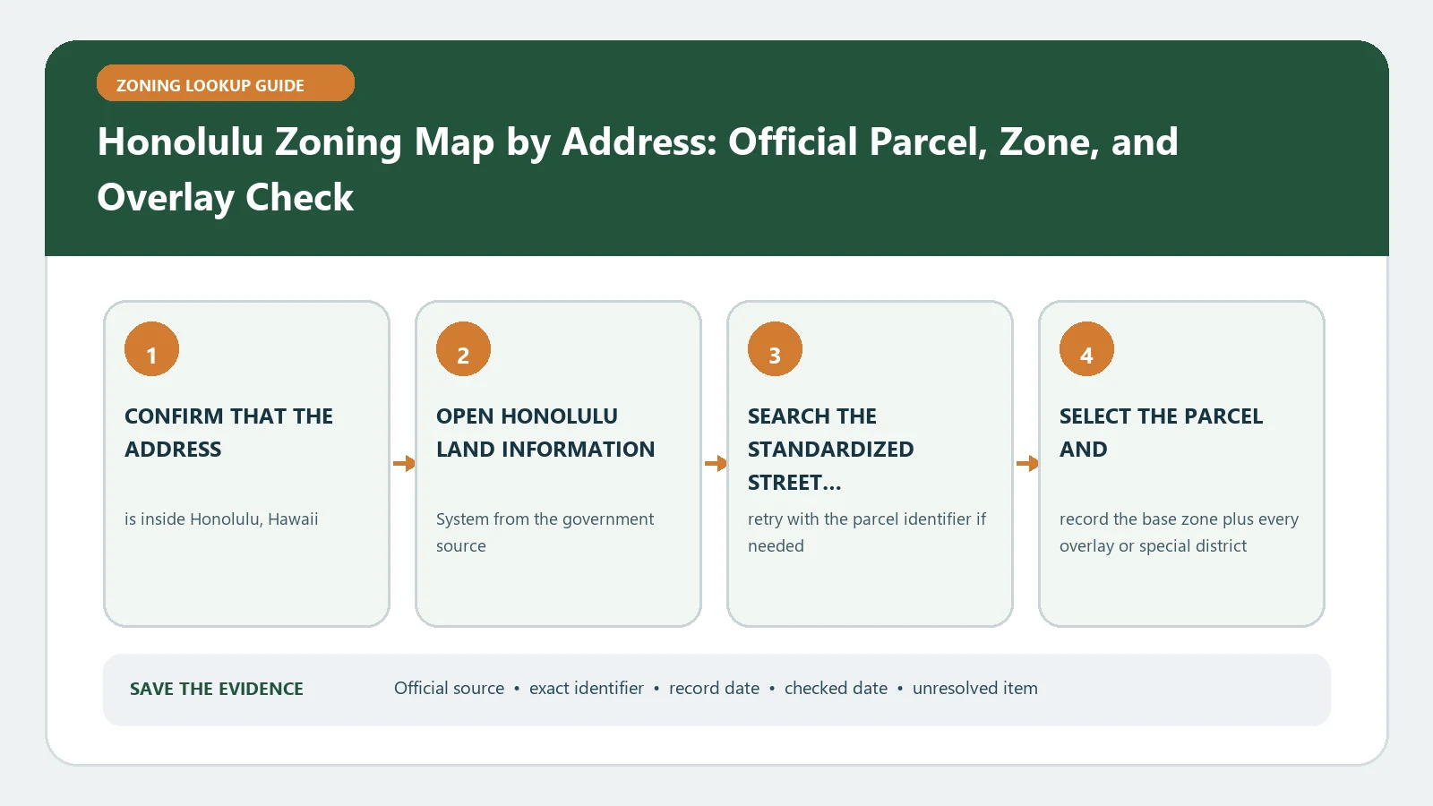
For Honolulu zoning by address, convert the location into its exact Tax Map Key, select that parcel in Honolulu GIS, and read both the parcel Details and Warning information. Then use the Department of Planning and Permitting property and zoning instructions to test the proposed use under the Land Use Ordinance. A TMK match confirms the parcel, not permission for the project.
Address spelling alone is a weak identifier on Oahu, especially for condominiums, shared driveways, and large parcels. DPP explains that a TMK is the tax mapping key and describes the standard zone, sector, plat, and parcel pattern. Preserve punctuation and every digit returned by the official system. A leading island digit or additional condominium division should remain separate from the base land parcel rather than being casually removed.
Turn the street address into a verified TMK
Search the address in the official GIS and compare the selected parcel with the visible building, road access, and lot outline. Copy the full TMK from the result. If a condominium unit is involved, identify which value describes the underlying zoning lot and which value identifies the ownership division. The City notes that condominium property regimes concern ownership and are not themselves recognized by the City as a zoning-lot division.
Create a second check against a current tax or property record when the digits are consequential. If two map features answer to the same address, do not choose by building name. Select each candidate, compare its TMK and geometry, and state why one matches the intended property. This identity work should happen before anyone opens a use table.
A verified TMK and county zoning field do not prove legality or approval for a Honolulu structure, rental, business, or alteration. Those fields establish land identity and a code starting point; permits, prior approvals, inspections, and special-area decisions may require their own evidence.
Read the Details tab and the Warning tab as separate records
DPP directs users to Parcel Information for zoning and property-specific notices. In the Details area, record the zoning field and any Special Management Area indication. In the Warning area, capture advisories or warnings that attach to the parcel. A warning is not the same thing as a zoning district, and an SMA indicator does not explain the complete coastal review by itself.
| Honolulu parcel field | What to transcribe | Why it stays separate |
|---|---|---|
| TMK | Full formatted parcel key and selected map boundary | Anchors every later rule to the correct land parcel |
| County zoning | Exact district code in the Details result | Routes the use to the LUO |
| SMA or special area | Displayed indicator and source date | Signals a distinct place-based review question |
| Warnings and advisories | Each notice as shown in the Warning area | Prevents an added constraint from disappearing into the base zone |
| CPR note | Ownership-unit identifier and its relationship to the base TMK | Keeps condominium ownership from redefining the zoning lot |
| Checked date | Date and time of the live lookup | Makes later map or record changes visible |
Use the LUO table for the actual structure or activity
The DPP guidance points to the Master Use Table in Article 3 for the types of uses and structures allowed in each district. Find the mapped district first, then locate the precise activity. Some entries require another permit or are subject to use standards. Follow the article references rather than translating one table symbol into an unconditional yes.
Continue through the parts relevant to the proposal: district development standards, general standards, parking and loading, special districts, and use-specific provisions. Describe the project with enough detail to choose a row: dwelling count, short-term or long-term occupancy, accessory structure, commercial activity, outdoor component, floor area, and parking effect. A different description can lead to a different LUO route.
Branch early for special-area and shoreline questions
If the parcel shows an SMA, warning, special district, or shoreline-related context, make that a separate workstream before final design. The base zone still matters, but it cannot answer every coastal or place-specific requirement. Record the boundary displayed and ask which application or determination applies to the proposed work. Avoid announcing that an indicator guarantees a permit requirement or exemption without the responsible DPP source.
Likewise, a State land-use designation and a City and County zoning district are not interchangeable labels. Keep them in different rows if both are relevant. The present page is limited to the Honolulu municipal zoning lookup; another authority may control a different layer of the land-use decision.
Resolve a missing address, odd TMK, or CPR mismatch
When an address produces no parcel, search the base TMK from a current property record and browse to the site. When the TMK produces a result but the boundary looks wrong, compare zone, sector, plat, and parcel digits one group at a time. For a CPR, retain the unit-level identifier but return to the underlying land parcel for zoning. Do not shorten the key until two official records point to the same lot.
- Save the failed address and the successful TMK query as two distinct attempts.
- Describe the parcel shape and adjoining street used to confirm the selection.
- Identify whether the mismatch concerns land, ownership unit, map timing, or jurisdiction.
- Ask DPP one focused question when the discrepancy affects a permit, purchase, or rental decision.
Finish with a TMK decision packet
A reusable packet includes the address, base and extended TMK values, selected parcel capture, zoning, SMA field, warnings, proposed activity, cited LUO rows, and remaining DPP question. Keep the lookup date beside the map result. If the project changes from a dwelling to a rental use, adds a structure, or alters the lot, reopen the analysis instead of carrying forward the old answer.
Use the Honolulu zoning field guide for local result labels, the address-to-parcel workflow for identity discipline, and the overlay guide when a special-area layer appears. The City and County sources remain the evidence for the actual TMK.
Honolulu GIS and DPP guidance were checked August 26, 2026. Repeat the live parcel search before a filing or transaction because TMK records, warnings, zoning, and ordinance provisions may change.