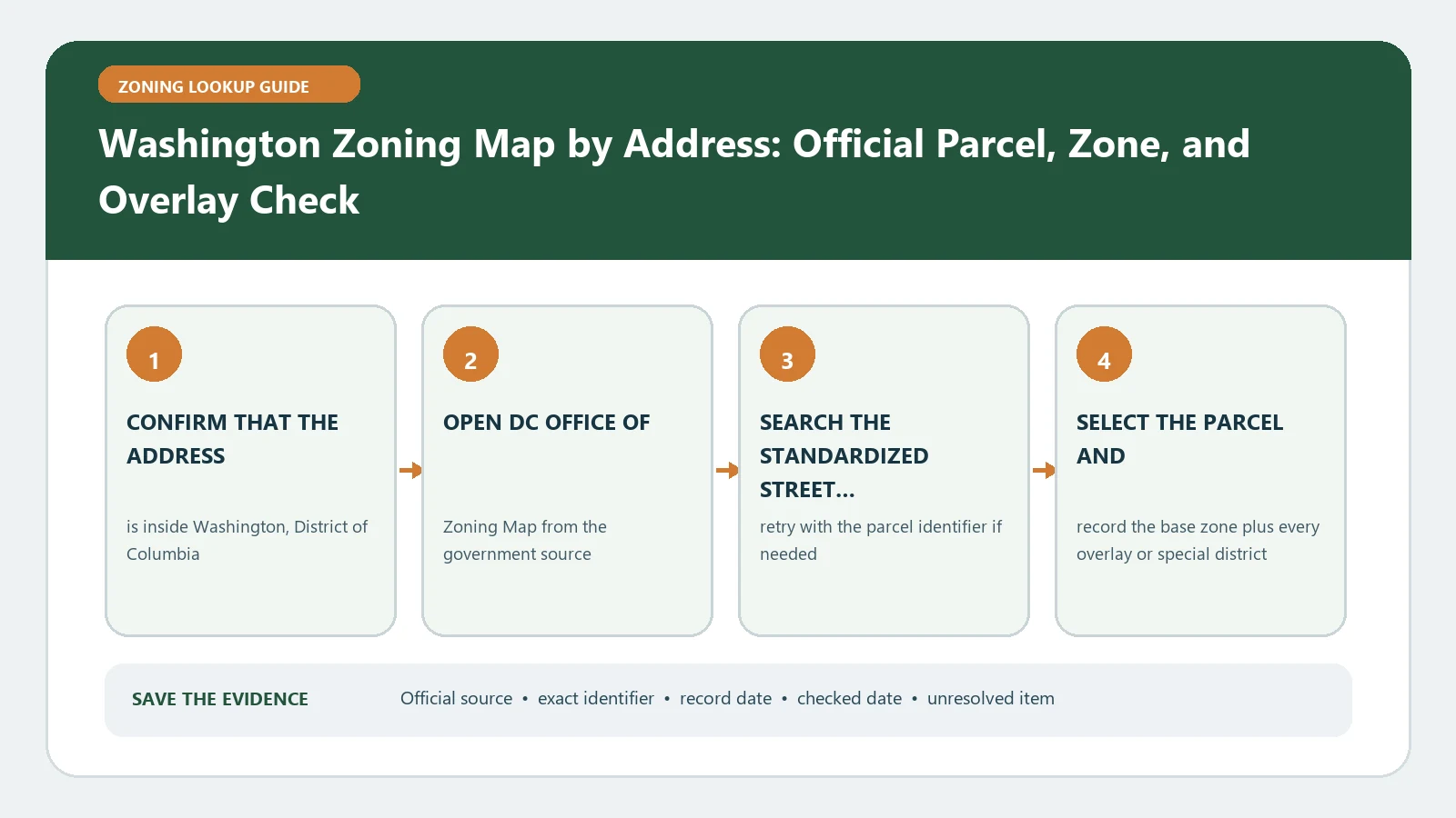
Search the DC Zoning Map by address, then preserve the square and lot, zone, and any Zoning Commission, Board of Zoning Adjustment, or PUD references shown for that property. Use those identifiers to open the current regulations and final case records. The interactive map supports research, while a certification or agency review is needed when formal reliance or project approval is at stake.
Reviewed August 25, 2026 using the DC Zoning Map service page and Office of Zoning FAQ.
Convert the street address into a DC square and lot
Washington property research becomes more reliable after the address is tied to its square and lot. The DC Zoning Map service page says the tool supports searches by address, square and lot, parcel, Zoning Commission case, and PUD. Select the property shape and copy the square and lot exactly. For condominiums, large campuses, alley lots, or multi-lot projects, identify which land area the proposed work actually occupies.
- Save the standardized address, square, lot, parcel boundary, and lookup date.
- Copy the complete zone designation and any mapped suffix or special-purpose label.
- Record ZC, BZA, and PUD case numbers as separate entries with their displayed status.
- Export or print the property report while the selected parcel and active layers are visible.
- Mark the project footprint when more than one lot or zone is involved.
Read zone and case layers as different records
| DC map evidence | Use it for | Next verification |
|---|---|---|
| Square and lot | Stable property identity across map and case systems | Compare with the plat and project site |
| Zone | Route to the relevant subtitle and development standards | Read definitions, use, bulk, and measurement rules |
| ZC case | Commission map amendment, PUD, or other action history | Open the final order and later modifications |
| BZA case | Variance, special exception, or appeal history | Confirm the final order, conditions, and exact lot |
| Pending layer | Notice that a change or application is under review | Keep it separate from the zoning effective today |
The map can display several records at once, but their legal roles differ. A zone is not a case order. A PUD label is not the complete set of conditions. A pending case is not an adopted change. Use the overlay and special-record method to preserve each layer under its own source and date.
Follow the district label into the DC regulations
The DC Office of Zoning FAQ routes district questions to the Zoning Handbook for summaries and to the Zoning Regulations for detailed descriptions. Begin with the mapped zone, then search the regulations for definitions, permitted or conditional uses, density, height, setbacks, lot occupancy, parking, inclusionary requirements, and any area-specific provision relevant to the proposal.
Describe the project before reading: existing and proposed use, dwelling count, floor area, height, additions, demolition, parking, signs, loading, occupancy, and operating facts. A broad district summary cannot decide compliance without these facts. The zoning map and code guide shows how to keep the mapped classification and written standards connected without treating them as interchangeable.
Open final PUD, ZC, and BZA orders
When a case number appears, search the Office of Zoning record system and retrieve the final order, exhibits, approved plans, conditions, and later modifications. Confirm the square and lot listed in the order. A case name may reflect the most recent PUD association, while the controlling project file can contain several actions. Record whether each item is filed, pending, approved, effective, expired, superseded, or unrelated to the planned work.
If a prior approval is being relied on, compare the building, use, operator, phase, and physical plan in that order with current conditions. The existence of built work does not settle whether a future alteration stays within the approval.
Keep permit and occupancy records in a parallel track. A Department of Buildings record may identify approved construction or occupancy, while the Office of Zoning map and orders identify the land-use framework. When the records use different addresses or lot numbers, resolve that identity issue before treating them as one property history. For a multi-lot project, list the improvement and approval attached to each lot.
Know when an online map is not enough
The Office of Zoning FAQ distinguishes an interactive-map lookup, informal verification, and formal zoning certification. Due diligence, a legal requirement, or another party’s demand for authenticated zoning may justify the formal route. A certification recognizes zoning for the identified property; it is still different from a Department of Buildings decision that a particular design conforms or from relief granted by the BZA or Zoning Commission.
If the square and lot are missing or the map disagrees
Retry the normalized address, search by square and lot, and compare a plat or tax record. Check for lot subdivision, assessment-and-taxation lot differences, alley lots, or recent map action. If the interactive map, summary extract, plat, and case order conflict, keep all versions and dates. Ask the Office of Zoning which identifier and map action control rather than choosing one layer in isolation.
Use the parcel identity workflow to document the mismatch. State where the proposed construction or use sits when the site spans multiple lots.
Give the decision owner a reproducible property packet
A complete handoff includes address, square, lot, selected boundary, zone, case numbers, current regulation citations, final orders, proposal facts, and the unresolved question. Ask whether the next owner is the Office of Zoning, Zoning Administrator, Department of Buildings, BZA, or Zoning Commission. Preserve the answer and the facts reviewed.
Recheck the DC map, regulations, and case docket before a transaction or application. This research does not establish title, survey boundaries, lawful occupancy, building-code compliance, or approval of a new project.
The online result is not a final zoning determination or a guarantee of permit approval. It documents what the selected DC sources displayed for a stated square, lot, and date. Formal reliance and project decisions remain with the District process assigned to that question.
Name every attachment by square, lot, source, and date. That convention keeps a later order, map export, plat, and agency reply connected when the street address or project name changes.