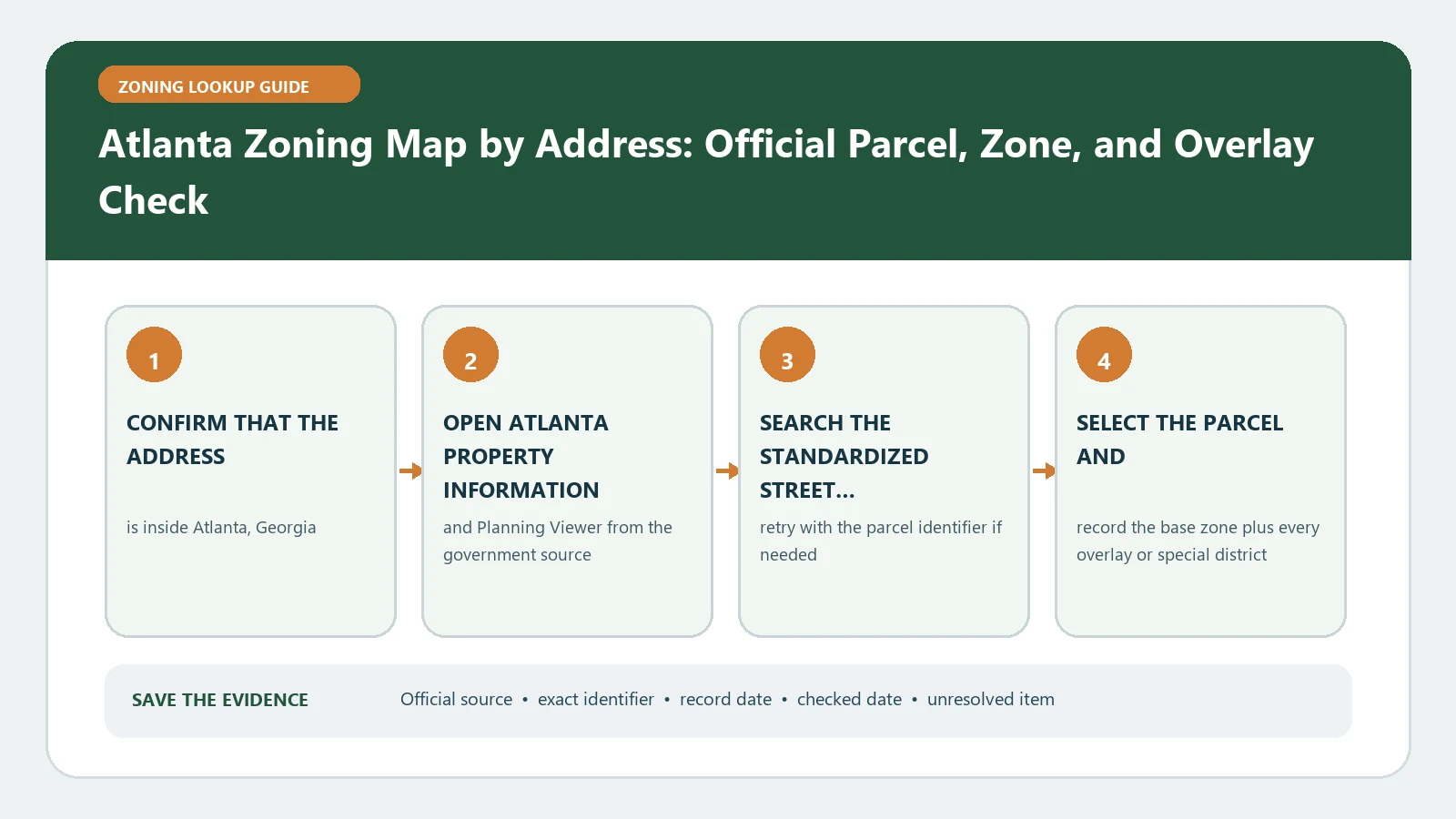
Use the City of Atlanta Property Information tool to locate the address, then confirm that the selected parcel is the land you mean to investigate. Record the zoning district, every overlay or special designation, the inclusionary-zoning field when shown, and the map-index reference. Continue from those identifiers to the current code, map sheet, approved plan, or case record. The screen helps organize research; it does not approve a use, addition, occupancy, subdivision, or permit.
Official route checked August 26, 2026: City of Atlanta Department of City Planning GIS. Reopen Atlanta Property Information, the current layer directory, applicable code, and case or ordinance records before using the parcel packet.
Atlanta provides more than one official GIS route, so a strong lookup does not depend on a single colored parcel. The result should connect one address to one parcel, one complete layer stack, and the dated documents that explain any special condition.
Match the street address to the parcel Atlanta is displaying
Open Atlanta Property Information and search the full address or parcel identifier. Before reading zoning, compare the highlighted shape with the property location, street frontage, neighboring lots, and any parcel information shown. Record the parcel identifier exactly. A building, parking area, or proposed work site can extend across more than one tax parcel even when the everyday address sounds singular.
If the address does not resolve, try the parcel ID, remove a suite or unit, and verify that the property is inside the City of Atlanta rather than another municipality or an unincorporated area. Do not substitute the nearest match. When several results share a street number or complex name, use the parcel geometry and identifier to choose.
The broader zoning lookup by address guide explains how to preserve the address-to-parcel match before interpreting any district code.
Read the Atlanta result as a stack of rule layers
The base district is only one part of an Atlanta lookup. Use the Department of City Planning GIS home and the City Maps and GIS page to identify the current official viewers and map resources. Depending on the parcel and active layers, the research stack may include:
- Base zoning district
- Overlay district or other special zoning geography
- Inclusionary-zoning designation
- Historic or design-related geography
- Zoning map index or map-sheet reference
- Zoning case, special-use permit, or another parcel-specific action
- Planning geography that supplies context but does not replace zoning
Write each result on its own line. Do not collapse a base district and overlay into one invented code, and do not treat a planning area as a zoning approval. The Atlanta zoning-layer field guide can help distinguish the display fields while the City sources remain the authority.
Do not let an assessor boundary settle a permit question
Atlanta map resources may use parcel information originating with a county assessor. Assessor geometry is valuable for locating tax parcels, but a tax boundary shown for reference should not be assumed to resolve every legal lot, right-of-way, lot-line, or permitting question. The City map material itself should be read with its stated source and limitations.
This matters when the zoning line appears to touch an edge, the site consists of several parcels, an alley or right-of-way is involved, or the proposed work sits close to a boundary. Zooming farther does not turn a reference polygon into a survey. Preserve the displayed boundary and ask what legal parcel or survey evidence the reviewing office requires.
A useful description is precise and modest: the City viewer displayed a stated zoning layer over a stated parcel record on the access date. It is not precise to say that the screen certified the permit boundary.
Carry every map label into the controlling text
After recording the district, open the current Atlanta zoning text and locate the section for that exact designation. Read permitted and conditional uses, development standards, and cross-references that matter to the proposed activity. Then repeat that process for each overlay or special layer. An overlay may add requirements without changing the base label.
Use the zoning code and map comparison if the map result is clear but its consequences are not. The code explains the meaning; the map identifies where the rule may apply. If the viewer provides a map-index reference, preserve it and locate the corresponding official sheet or record rather than relying only on the screen color.
Do not infer that a use is allowed merely because the district name sounds compatible. The code may classify the activity differently, impose conditions, or direct the reader to a separate approval path.
Put cases and special approvals in date order
Parcel-specific history can change how a simple district label should be understood. Use the City Research a Property or Project page to locate the official research routes for projects and property records. When a map shows a case number, special-use reference, approved plan, or amendment, collect the final document and effective date.
Build a short chronology:
- The base zoning or prior map state
- The application or case filing
- Staff or board recommendation if relevant
- Final adopted ordinance, signed decision, or approved plan
- Effective date and recorded conditions
- Any later amendment, expiration, withdrawal, or superseding action
An application marker is not the same as an approval. A recommendation is not the same as the final legislative or administrative action. When documents conflict, the later document is not automatically controlling unless it validly amended or replaced the earlier one.
Build an Atlanta evidence card
Keep one compact record for the parcel:
- Search value: Full street address and parcel identifier
- Jurisdiction check: Evidence that the parcel is within the City of Atlanta
- Parcel match: Selected boundary, frontage, and neighboring-lot check
- Base zoning: Exact district code and description shown
- Extra layers: Overlay, inclusionary, historic, design, or other designation
- Map reference: Index, sheet, viewer name, and access date
- Parcel-specific record: Case, ordinance, special-use permit, variance, or approved plan
- Proposed action: Use, occupancy, addition, renovation, subdivision, or other project
- Remaining question: The precise point requiring City confirmation
This card is more useful than a screenshot because it connects the visual result to the source documents and the actual decision the reader needs to make.
Reconcile two official screens without guessing
If Property Information and another Atlanta planning viewer appear to disagree, first confirm that both selected the same parcel. Check active layers, legends, service or update information, and whether one screen is showing a proposal, historic record, or planning designation. Refresh both and repeat the search by parcel ID.
Next, compare the result with the map index and any final ordinance or approved plan. Record both outcomes and their access dates. If the difference remains, send the City planning or zoning office the parcel ID, screenshots, layer names, proposed activity, and the narrow conflict. Ask which adopted record controls and whether a formal verification is appropriate.
Do not erase one official result simply because the other is more favorable. The disagreement is evidence that the lookup has reached a point requiring an authoritative interpretation.
The map identifies research, not project approval
An Atlanta zoning map result does not establish that a proposed use is permitted, that all conditions are satisfied, that a building may be altered, or that an occupancy or permit will be issued. It also does not settle private covenants, title matters, surveys, or non-zoning approvals.
The dependable finish is an evidence chain: confirmed City jurisdiction, matched parcel, complete layer stack, current code, final parcel-specific documents, and a clear official next step. Save that chain before signing a lease, buying property, commissioning plans, or treating the project as cleared.