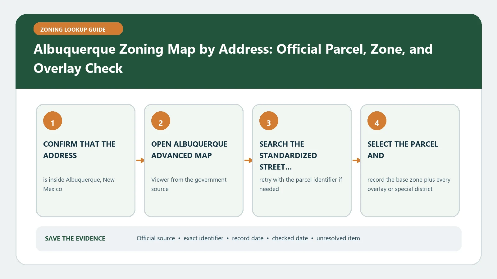
Use the City of Albuquerque Advanced Map Viewer 3.0 to select the exact parcel and display the Integrated Development Ordinance zoning layers. Confirm that the site is in Albuquerque, because the City states that this viewer does not include Bernalillo County zoning. Then match the zone and project date to the current IDO source. The map identifies rules; it does not approve the project.
The City moved the Advanced Map Viewer to version 3.0 in February 2026 and describes more than two hundred available layers, including IDO zoning. That breadth is useful only when the evidence file states which layers were active. Begin with the property identity and City boundary, not with a screenshot showing dozens of unrelated themes.
Resolve Albuquerque versus Bernalillo County first
Search the street address, select the parcel, and verify that the map identifies it within the City. Compare the selected outline with roads and any parcel identifier displayed. If the site lies outside the City or near the municipal edge, switch to the Bernalillo County authority instead of carrying an Albuquerque zone across the line. Keep the boundary finding in the file even when the answer is that this workflow does not apply.
For a multi-parcel development, repeat the check for each legal lot. One project name or mailing address can hide different jurisdictions or zoning layers. A parcel list makes it possible to ask staff about the exact part of the site rather than requesting a general interpretation for a large area.
Open only the IDO layers needed for the parcel
Use the viewer theme or layer controls to display the zoning information tied to the IDO. Select the parcel and transcribe the mapped zone, applicable overlay or small-area layer, parcel identifier, and any linked planning document. Avoid copying labels from a legend without confirming that the selected feature carries them. Turn off unrelated layers when they obscure boundaries, but note every planning layer retained for the final capture.
- Record the address exactly as the viewer returns it.
- Save the selected parcel reference and a description of its boundary.
- Transcribe the IDO zone and each applicable overlay independently.
- Preserve links to cases, plans, or documents exposed for the location.
- Write the viewer access date and active layer set beside the result.
Create a parcel evidence card before opening the ordinance
| Card field | Entry | Interpretation limit |
|---|---|---|
| Authority | City of Albuquerque or a different jurisdiction | A mailing address cannot settle the boundary |
| Property | Address, parcel reference, and selected geometry | A nearby point is not the same lot |
| IDO zoning | Exact mapped district and source date | The label does not authorize a use |
| Added layers | Overlay, center or corridor, small-area, or linked case | Each item needs its own controlling provision |
| Proposal | Use, building work, scale, and submission timing | Changing the project can change the answer |
| Unresolved item | One specific conflict or missing field | Silence is not confirmation |
This card prevents the map and code research from drifting apart. A reader can see which parcel and layer produced the district, while the proposal column shows why a particular IDO section was consulted. It also exposes an unresolved field before it is buried in a longer design memo.
Match the project to the IDO edition that governs it
The Albuquerque IDO page publishes effective documents and explains that an application is reviewed against the regulations in effect when the application was accepted as complete. Record that acceptance date when the project is already in process. For early due diligence, note the current effective document and plan to check again at submission. Do not apply a later consolidated PDF automatically to an older accepted application.
Use the mapped district to find the proposed use, any conditional or specific procedure, and the applicable development standards. Continue through overlays, centers and corridors, site design, height, setbacks, parking, landscaping, and use-specific rules that match the parcel card. If a linked interpretation or declaratory ruling addresses the issue, preserve its date and exact subject rather than generalizing it to unrelated parcels.
Distinguish an online layer from an effective land-use decision
The viewer is a current research interface, while an adopted ordinance, zoning action, or accepted application record can establish dates and procedural status. If a map label changed after a filing, both observations may be correct for different moments. Build a timeline instead of replacing the older value. The controlling question is which official rule set applies to this project and parcel at the relevant stage.
A zone match also does not prove compliance with an existing use or building. Permits, prior approvals, nonconforming status, and enforcement records can be separate. Keep this page focused on the address-to-zone workflow and route those different questions to their own official records.
Recover a missing layer or wrong-jurisdiction result
If the address is not found, remove a unit, verify the street direction, search a parcel identifier, and browse to the site. If the parcel appears but no IDO zone is visible, confirm that the zoning layer is enabled and the selected location is within Albuquerque. If County data is needed, document that handoff. Do not interpret the City viewer’s stated County exclusion as an unzoned parcel.
When a displayed zone conflicts with a recent ordinance or case, save the map selection, active layers, document, and dates. Ask Planning which action is effective and whether the viewer has incorporated it. A precise discrepancy report is more useful than a general request to confirm zoning.
Send staff a question that can be answered
Attach the parcel evidence card, map capture, zone, overlays, IDO edition, application acceptance date if any, and project description. Ask which district and standards control the named use and whether a linked action adds conditions. If the response assumes a fact that later changes, update the packet and ask again rather than applying the old answer to a new design.
Use the internal Albuquerque field dictionary for viewer labels, the address lookup guide for parcel identity, and the map and code comparison for evidence roles. The City source remains controlling for Albuquerque records.
Advanced Map Viewer 3.0 and the Albuquerque IDO page were reviewed August 26, 2026. Recheck the live layers and effective document before relying on the result, especially when an application date or recent zoning action matters.